
Summary
Managed by local government and regulated by the Texas Commission on Environmental Quality (TCEQ), this earth dam serves the primary purpose of water supply, with a storage capacity of 300 acre-feet and a surface area of 64 acres.
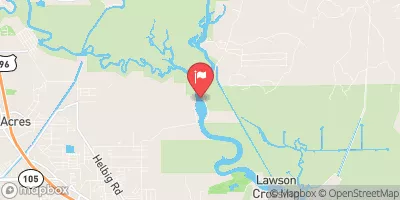
Situated in Jefferson County, the levee overlooks the CH-Sabine Lake and is part of the Fort Worth District. Despite lacking a spillway, the dam is equipped with one outlet gate to manage water levels. While it has not been rated for its condition, the risk assessment categorizes it as high, emphasizing the importance of regular inspections and maintenance to ensure its structural integrity and reliability in providing water resources to the community.
With no documented hazard potential and a lack of available emergency action plan information, there is room for improvement in terms of risk management and preparedness. As water resource and climate enthusiasts, it is imperative to stay informed and engaged in the maintenance and monitoring of vital infrastructure like the Port Arthur Raw Water Reservoir Levee to safeguard against potential risks and ensure sustainable water management practices for the future.
°F
°F
mph
Wind
%
Humidity
15-Day Weather Outlook
Year Completed |
1955 |
Dam Length |
8220 |
Dam Height |
14 |
River Or Stream |
OFF CH-SABINE LAKE |
Primary Dam Type |
Earth |
Surface Area |
64 |
Hydraulic Height |
14 |
Drainage Area |
0.1 |
Nid Storage |
300 |
Structural Height |
14 |
Outlet Gates |
None - 1 |
Hazard Potential |
Not Available |
Foundations |
Unlisted/Unknown |
Nid Height |
14 |
Seasonal Comparison
5-Day Hourly Forecast Detail
Nearby Streamflow Levels
 Neches Rv Saltwater Barrier At Beaumont
|
1950cfs |
 Cow Bayou Nr Mauriceville
|
0cfs |
 Pine Island Bayou Abv Bi Pump Plant
|
266cfs |
 Pine Island Bayou Nr Sour Lake
|
4cfs |
 Sabine Rv Nr Ruliff
|
924cfs |
 Neches Rv At Evadale
|
1460cfs |
Dam Data Reference
Condition Assessment
SatisfactoryNo existing or potential dam safety deficiencies are recognized. Acceptable performance is expected under all loading conditions (static, hydrologic, seismic) in accordance with the minimum applicable state or federal regulatory criteria or tolerable risk guidelines.
Fair
No existing dam safety deficiencies are recognized for normal operating conditions. Rare or extreme hydrologic and/or seismic events may result in a dam safety deficiency. Risk may be in the range to take further action. Note: Rare or extreme event is defined by the regulatory agency based on their minimum
Poor A dam safety deficiency is recognized for normal operating conditions which may realistically occur. Remedial action is necessary. POOR may also be used when uncertainties exist as to critical analysis parameters which identify a potential dam safety deficiency. Investigations and studies are necessary.
Unsatisfactory
A dam safety deficiency is recognized that requires immediate or emergency remedial action for problem resolution.
Not Rated
The dam has not been inspected, is not under state or federal jurisdiction, or has been inspected but, for whatever reason, has not been rated.
Not Available
Dams for which the condition assessment is restricted to approved government users.
Hazard Potential Classification
HighDams assigned the high hazard potential classification are those where failure or mis-operation will probably cause loss of human life.
Significant
Dams assigned the significant hazard potential classification are those dams where failure or mis-operation results in no probable loss of human life but can cause economic loss, environment damage, disruption of lifeline facilities, or impact other concerns. Significant hazard potential classification dams are often located in predominantly rural or agricultural areas but could be in areas with population and significant infrastructure.
Low
Dams assigned the low hazard potential classification are those where failure or mis-operation results in no probable loss of human life and low economic and/or environmental losses. Losses are principally limited to the owner's property.
Undetermined
Dams for which a downstream hazard potential has not been designated or is not provided.
Not Available
Dams for which the downstream hazard potential is restricted to approved government users.
 Port Arthur Raw Water Reservoir Levee
 Lakefront Pier