Saratoga Springs - Pond #6 Reservoir Report
Last Updated: February 12, 2026
Saratoga Springs - Pond #6, located in Utah, is a significant irrigation pond with a hydraulic height of 11 feet and a structural height of 13 feet.
Summary
Completed in 2004, the pond has a storage capacity of 12.2 acre-feet and serves the primary purpose of irrigation. The dam, classified as an earth dam with a core type of rockfill and a foundation of soil, is regulated by the Utah Division of Water Rights and undergoes regular inspections to ensure its safety and compliance with state regulations.
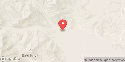
The dam at Saratoga Springs - Pond #6 poses a significant hazard potential, although its condition assessment is currently not rated. Emergency action plans have not been prepared, and there are no inundation maps available. However, the pond meets state permitting requirements and has a maximum discharge capacity of 641 cubic feet per second. The dam is situated in a picturesque location with latitude 40.40740692 and longitude -111.9351241, making it a key feature for water resource enthusiasts and climate advocates interested in the management and protection of water resources in Utah.
Overall, Saratoga Springs - Pond #6 represents a vital water infrastructure project managed by local government authorities in Utah. With a focus on irrigation and a storage capacity of 12.2 acre-feet, this earth dam plays a crucial role in supporting agricultural activities in the region. As climate change continues to impact water resources, the maintenance and regulation of dams like Pond #6 become increasingly important to ensure the sustainable management of water supplies for current and future generations.
°F
°F
mph
Wind
%
Humidity
15-Day Weather Outlook
Year Completed |
2004 |
Primary Dam Type |
Earth |
Hydraulic Height |
11 |
Nid Storage |
12.2 |
Structural Height |
13 |
Hazard Potential |
Significant |
Foundations |
Soil |
Nid Height |
13 |
Seasonal Comparison
5-Day Hourly Forecast Detail
Nearby Streamflow Levels
Dam Data Reference
Condition Assessment
SatisfactoryNo existing or potential dam safety deficiencies are recognized. Acceptable performance is expected under all loading conditions (static, hydrologic, seismic) in accordance with the minimum applicable state or federal regulatory criteria or tolerable risk guidelines.
Fair
No existing dam safety deficiencies are recognized for normal operating conditions. Rare or extreme hydrologic and/or seismic events may result in a dam safety deficiency. Risk may be in the range to take further action. Note: Rare or extreme event is defined by the regulatory agency based on their minimum
Poor A dam safety deficiency is recognized for normal operating conditions which may realistically occur. Remedial action is necessary. POOR may also be used when uncertainties exist as to critical analysis parameters which identify a potential dam safety deficiency. Investigations and studies are necessary.
Unsatisfactory
A dam safety deficiency is recognized that requires immediate or emergency remedial action for problem resolution.
Not Rated
The dam has not been inspected, is not under state or federal jurisdiction, or has been inspected but, for whatever reason, has not been rated.
Not Available
Dams for which the condition assessment is restricted to approved government users.
Hazard Potential Classification
HighDams assigned the high hazard potential classification are those where failure or mis-operation will probably cause loss of human life.
Significant
Dams assigned the significant hazard potential classification are those dams where failure or mis-operation results in no probable loss of human life but can cause economic loss, environment damage, disruption of lifeline facilities, or impact other concerns. Significant hazard potential classification dams are often located in predominantly rural or agricultural areas but could be in areas with population and significant infrastructure.
Low
Dams assigned the low hazard potential classification are those where failure or mis-operation results in no probable loss of human life and low economic and/or environmental losses. Losses are principally limited to the owner's property.
Undetermined
Dams for which a downstream hazard potential has not been designated or is not provided.
Not Available
Dams for which the downstream hazard potential is restricted to approved government users.
Area Campgrounds
| Location | Reservations | Toilets |
|---|---|---|
 Camp Christina Entrance
|
||
 Missionary Point
|
||
 Ponkapoag Camp of Appalachian Mountain Club
|
||
 Spang Camp Site
|
||
 YMCA Camp
|


 Saratoga Springs - Pond #6
 Utah Lake
 Norton Reservoir Launch