

Mauserts Pond Dam Reservoir Report
Nearby: Natural Bridge Dam Eclipse Dam
Last Updated: April 9, 2026
Mauserts Pond Dam, located in Clarksburg, Massachusetts, is a state-regulated structure on the North Branch of the Hoosic River.
Summary
Completed in 1998, this Earth-type dam serves primarily as a Fish and Wildlife Pond, with additional purposes including recreation. The dam stands at a height of 14 feet and has a hydraulic height of 11 feet, providing a storage capacity of 540 acre-feet and a surface area of 44.8 acres.
With a significant hazard potential and a fair condition assessment as of June 2016, Mauserts Pond Dam undergoes inspections every five years to ensure its integrity and safety. The dam's spillway type is listed as uncontrolled, and it has a drainage area of 2.82 square miles. The risk assessment for the dam is moderate, indicating a moderate level of risk associated with its operation and maintenance.
Managed by the Department of Conservation and Recreation, Mauserts Pond Dam plays a crucial role in supporting fish and wildlife habitats in the area. Its location in Berkshire County, Massachusetts, makes it a key feature in the region's water resource management efforts. Climate and water resource enthusiasts will find Mauserts Pond Dam to be a fascinating structure that contributes to both ecological preservation and recreational opportunities in the area.
°F
°F
mph
Wind
%
Humidity
15-Day Weather Outlook
Year Completed |
1998 |
Dam Length |
150 |
Dam Height |
14 |
River Or Stream |
NORTH BRANCH OF HOOSIC RIVER |
Primary Dam Type |
Earth |
Surface Area |
44.8 |
Hydraulic Height |
11 |
Drainage Area |
2.82 |
Nid Storage |
540 |
Hazard Potential |
Significant |
Foundations |
Unlisted/Unknown |
Nid Height |
14 |
Seasonal Comparison
5-Day Hourly Forecast Detail
Nearby Streamflow Levels
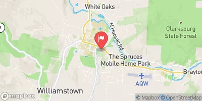
 Hoosic River Near Williamstown
|
368cfs |
 Green River At Williamstown
|
153cfs |
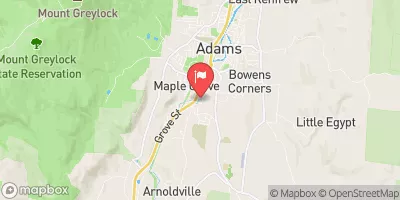 Hoosic River At Adams
|
145cfs |
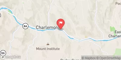 Deerfield River At Charlemont
|
470cfs |
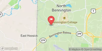 Walloomsac River Near North Bennington
|
288cfs |
 North River At Shattuckville
|
251cfs |
Dam Data Reference
Condition Assessment
SatisfactoryNo existing or potential dam safety deficiencies are recognized. Acceptable performance is expected under all loading conditions (static, hydrologic, seismic) in accordance with the minimum applicable state or federal regulatory criteria or tolerable risk guidelines.
Fair
No existing dam safety deficiencies are recognized for normal operating conditions. Rare or extreme hydrologic and/or seismic events may result in a dam safety deficiency. Risk may be in the range to take further action. Note: Rare or extreme event is defined by the regulatory agency based on their minimum
Poor A dam safety deficiency is recognized for normal operating conditions which may realistically occur. Remedial action is necessary. POOR may also be used when uncertainties exist as to critical analysis parameters which identify a potential dam safety deficiency. Investigations and studies are necessary.
Unsatisfactory
A dam safety deficiency is recognized that requires immediate or emergency remedial action for problem resolution.
Not Rated
The dam has not been inspected, is not under state or federal jurisdiction, or has been inspected but, for whatever reason, has not been rated.
Not Available
Dams for which the condition assessment is restricted to approved government users.
Hazard Potential Classification
HighDams assigned the high hazard potential classification are those where failure or mis-operation will probably cause loss of human life.
Significant
Dams assigned the significant hazard potential classification are those dams where failure or mis-operation results in no probable loss of human life but can cause economic loss, environment damage, disruption of lifeline facilities, or impact other concerns. Significant hazard potential classification dams are often located in predominantly rural or agricultural areas but could be in areas with population and significant infrastructure.
Low
Dams assigned the low hazard potential classification are those where failure or mis-operation results in no probable loss of human life and low economic and/or environmental losses. Losses are principally limited to the owner's property.
Undetermined
Dams for which a downstream hazard potential has not been designated or is not provided.
Not Available
Dams for which the downstream hazard potential is restricted to approved government users.
Area Campgrounds
| Location | Reservations | Toilets |
|---|---|---|
 Clarksburg State Park
|
||
 Historic Valley
|
||
 Sherman Brook Campsite
|
||
 Savoy Mountain State Forest
|
||
 Stoney Ledge Group Site
|
||
 Spruce Group Site
|
 Mauserts Pond Dam
 Stamford Town Line To Confluence With City Stream
 Woodford To Woodford Hollow
 First Bridge To Walloomsac Brook