Miller Pond Reservoir Report
Nearby: Lake Fairlee Middle Brook
Last Updated: February 23, 2026
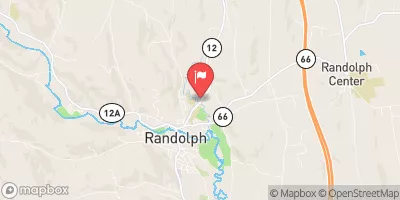
Miller Pond in Strafford, Vermont, is a state-regulated water resource managed by the Department of Environmental Conservation.
Summary
Built in 1960 by Haley & Ward, the 170-foot-long earth dam stands at a height of 8 feet, providing a storage capacity of 590 acre-feet for recreational purposes. With a surface area of 63 acres and a drainage area of 1.04 square miles, Miller Pond is nestled along Abbot Brook, offering a tranquil setting for outdoor enthusiasts to enjoy.
The dam at Miller Pond has a low hazard potential and was last inspected in August 2015, with a satisfactory condition assessment reported. The dam's emergency action plan status and risk management measures are currently not available, indicating a potential area for improvement in the future. Despite these uncertainties, Miller Pond remains a popular destination for boating, fishing, and relaxation, attracting visitors to its scenic shores in Orange County, Vermont.
As climate change continues to impact water resources and ecosystems, the management and maintenance of dams like Miller Pond become increasingly vital. With its strategic location and recreational value, Miller Pond serves as a reminder of the interconnectedness between water resources, climate resilience, and responsible stewardship. As enthusiasts and advocates for sustainable water management, there is an opportunity to support efforts that ensure the long-term viability and safety of places like Miller Pond for future generations to enjoy.
°F
°F
mph
Wind
%
Humidity
15-Day Weather Outlook
Year Completed |
1960 |
Dam Length |
170 |
Dam Height |
8 |
River Or Stream |
ABBOT BROOK-TR |
Primary Dam Type |
Earth |
Surface Area |
63 |
Hydraulic Height |
8 |
Drainage Area |
1.04 |
Nid Storage |
590 |
Structural Height |
11 |
Hazard Potential |
Low |
Foundations |
Soil |
Nid Height |
11 |
Seasonal Comparison
5-Day Hourly Forecast Detail
Nearby Streamflow Levels
Dam Data Reference
Condition Assessment
SatisfactoryNo existing or potential dam safety deficiencies are recognized. Acceptable performance is expected under all loading conditions (static, hydrologic, seismic) in accordance with the minimum applicable state or federal regulatory criteria or tolerable risk guidelines.
Fair
No existing dam safety deficiencies are recognized for normal operating conditions. Rare or extreme hydrologic and/or seismic events may result in a dam safety deficiency. Risk may be in the range to take further action. Note: Rare or extreme event is defined by the regulatory agency based on their minimum
Poor A dam safety deficiency is recognized for normal operating conditions which may realistically occur. Remedial action is necessary. POOR may also be used when uncertainties exist as to critical analysis parameters which identify a potential dam safety deficiency. Investigations and studies are necessary.
Unsatisfactory
A dam safety deficiency is recognized that requires immediate or emergency remedial action for problem resolution.
Not Rated
The dam has not been inspected, is not under state or federal jurisdiction, or has been inspected but, for whatever reason, has not been rated.
Not Available
Dams for which the condition assessment is restricted to approved government users.
Hazard Potential Classification
HighDams assigned the high hazard potential classification are those where failure or mis-operation will probably cause loss of human life.
Significant
Dams assigned the significant hazard potential classification are those dams where failure or mis-operation results in no probable loss of human life but can cause economic loss, environment damage, disruption of lifeline facilities, or impact other concerns. Significant hazard potential classification dams are often located in predominantly rural or agricultural areas but could be in areas with population and significant infrastructure.
Low
Dams assigned the low hazard potential classification are those where failure or mis-operation results in no probable loss of human life and low economic and/or environmental losses. Losses are principally limited to the owner's property.
Undetermined
Dams for which a downstream hazard potential has not been designated or is not provided.
Not Available
Dams for which the downstream hazard potential is restricted to approved government users.
Area Campgrounds
| Location | Reservations | Toilets |
|---|---|---|
 Roaring Brook Campsite
|
||
 Patchen's Point
|
||
 Campsite 15
|
||
 Campsite 14
|
||
 Campsite 16
|
||
 Campsite 12
|


 Miller Pond