Deweys Pond Reservoir Report
Nearby: Deweys Mills Downers Mill
Last Updated: February 26, 2026
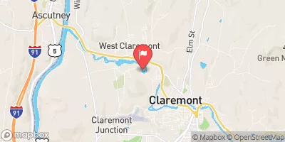
Deweys Pond, located in Hartford, Vermont, is a captivating water resource managed by the federal government with a primary purpose of recreation.
Summary
Built in 1973, this earth dam stands at a height of 7 feet and has a structural height of 10 feet, providing a storage capacity of 325 acre-feet. The pond covers a surface area of 50 acres and is fed by the Ottauquechee River, making it a picturesque location for water and climate enthusiasts to explore.
Despite its low hazard potential, Deweys Pond has not been rated for its condition assessment and has not undergone recent inspections since July 2007. Nonetheless, the dam continues to serve its recreational purpose, offering a tranquil escape for visitors to enjoy the surrounding natural beauty. With a designer named K. A. Leclair, this water resource showcases the harmonious blend of human intervention and environmental preservation, making it an intriguing site for those interested in water management and conservation practices.
For enthusiasts interested in the intersection of water resources and climate change, Deweys Pond serves as a prime example of a man-made structure that coexists with its natural surroundings. As the federal government oversees its operation and maintenance, the pond stands as a testament to the importance of sustainable water management practices in the face of a changing climate. With its serene waters and scenic views, Deweys Pond invites visitors to appreciate the beauty of nature while also recognizing the need for responsible stewardship of our water resources.
°F
°F
mph
Wind
%
Humidity
15-Day Weather Outlook
Year Completed |
1973 |
Dam Length |
2070 |
Dam Height |
7 |
River Or Stream |
OTTAUQUECHEE RIVER |
Primary Dam Type |
Earth |
Surface Area |
50 |
Hydraulic Height |
7 |
Drainage Area |
2 |
Nid Storage |
325 |
Structural Height |
10 |
Hazard Potential |
Low |
Foundations |
Soil |
Nid Height |
10 |
Seasonal Comparison
5-Day Hourly Forecast Detail
Nearby Streamflow Levels
Dam Data Reference
Condition Assessment
SatisfactoryNo existing or potential dam safety deficiencies are recognized. Acceptable performance is expected under all loading conditions (static, hydrologic, seismic) in accordance with the minimum applicable state or federal regulatory criteria or tolerable risk guidelines.
Fair
No existing dam safety deficiencies are recognized for normal operating conditions. Rare or extreme hydrologic and/or seismic events may result in a dam safety deficiency. Risk may be in the range to take further action. Note: Rare or extreme event is defined by the regulatory agency based on their minimum
Poor A dam safety deficiency is recognized for normal operating conditions which may realistically occur. Remedial action is necessary. POOR may also be used when uncertainties exist as to critical analysis parameters which identify a potential dam safety deficiency. Investigations and studies are necessary.
Unsatisfactory
A dam safety deficiency is recognized that requires immediate or emergency remedial action for problem resolution.
Not Rated
The dam has not been inspected, is not under state or federal jurisdiction, or has been inspected but, for whatever reason, has not been rated.
Not Available
Dams for which the condition assessment is restricted to approved government users.
Hazard Potential Classification
HighDams assigned the high hazard potential classification are those where failure or mis-operation will probably cause loss of human life.
Significant
Dams assigned the significant hazard potential classification are those dams where failure or mis-operation results in no probable loss of human life but can cause economic loss, environment damage, disruption of lifeline facilities, or impact other concerns. Significant hazard potential classification dams are often located in predominantly rural or agricultural areas but could be in areas with population and significant infrastructure.
Low
Dams assigned the low hazard potential classification are those where failure or mis-operation results in no probable loss of human life and low economic and/or environmental losses. Losses are principally limited to the owner's property.
Undetermined
Dams for which a downstream hazard potential has not been designated or is not provided.
Not Available
Dams for which the downstream hazard potential is restricted to approved government users.
Area Campgrounds
| Location | Reservations | Toilets |
|---|---|---|
 Quechee State Park
|
||
 Forest campsite with stream & fire ring
|
||
 Velvet Rocks Shelter
|
||
 Storrs Pond Rec Area
|
||
 Campsite 5
|
||
 Campsite 12
|

 Deweys Pond