Pechie Reservoir Report
Nearby: Baldwin Pond Gillett Pond
Last Updated: February 23, 2026
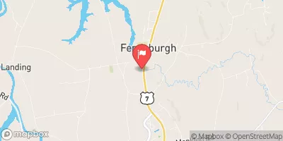
Pechie is a privately owned earth dam located in Starksboro, Vermont, primarily serving the purpose of recreation.
Summary
Built in 1971 by the USDA NRCS, this structure stands at a height of 27 feet with a length of 295 feet, creating a surface area of 3.5 acres and a storage capacity of 31 acre-feet. The dam is regulated by the Vermont Department of Environmental Conservation (DEC) and is subject to regular inspections to ensure its safety and compliance with state regulations.
Despite its low hazard potential, Pechie has been assessed to be in poor condition as of November 2018, prompting the need for potential risk management measures. The dam's spillway type is uncontrolled, and its associated drainage area covers 0.23 square miles. While the dam has not undergone modifications in recent years, its last inspection in July 2005 revealed a need for maintenance and improvement. The risk assessment for Pechie is classified as moderate, indicating a level of concern that warrants attention and proactive measures to mitigate potential hazards and ensure the structure's long-term stability.
Overall, Pechie serves as a valuable recreational resource in Addison County, Vermont, but its condition assessment and risk level highlight the importance of ongoing monitoring and maintenance to safeguard both the dam's integrity and the surrounding community. Enthusiasts of water resources and climate management will find interest in the complex interplay of regulatory oversight, structural design, and risk assessment that shape the management of dams like Pechie and their impact on local ecosystems and public safety.
°F
°F
mph
Wind
%
Humidity
15-Day Weather Outlook
Year Completed |
1971 |
Dam Length |
295 |
Dam Height |
27 |
River Or Stream |
HOLLOW BROOK-TR |
Primary Dam Type |
Earth |
Surface Area |
3.5 |
Hydraulic Height |
27 |
Drainage Area |
0.23 |
Nid Storage |
31 |
Structural Height |
28 |
Hazard Potential |
Low |
Foundations |
Soil |
Nid Height |
28 |
Seasonal Comparison
5-Day Hourly Forecast Detail
Nearby Streamflow Levels
Dam Data Reference
Condition Assessment
SatisfactoryNo existing or potential dam safety deficiencies are recognized. Acceptable performance is expected under all loading conditions (static, hydrologic, seismic) in accordance with the minimum applicable state or federal regulatory criteria or tolerable risk guidelines.
Fair
No existing dam safety deficiencies are recognized for normal operating conditions. Rare or extreme hydrologic and/or seismic events may result in a dam safety deficiency. Risk may be in the range to take further action. Note: Rare or extreme event is defined by the regulatory agency based on their minimum
Poor A dam safety deficiency is recognized for normal operating conditions which may realistically occur. Remedial action is necessary. POOR may also be used when uncertainties exist as to critical analysis parameters which identify a potential dam safety deficiency. Investigations and studies are necessary.
Unsatisfactory
A dam safety deficiency is recognized that requires immediate or emergency remedial action for problem resolution.
Not Rated
The dam has not been inspected, is not under state or federal jurisdiction, or has been inspected but, for whatever reason, has not been rated.
Not Available
Dams for which the condition assessment is restricted to approved government users.
Hazard Potential Classification
HighDams assigned the high hazard potential classification are those where failure or mis-operation will probably cause loss of human life.
Significant
Dams assigned the significant hazard potential classification are those dams where failure or mis-operation results in no probable loss of human life but can cause economic loss, environment damage, disruption of lifeline facilities, or impact other concerns. Significant hazard potential classification dams are often located in predominantly rural or agricultural areas but could be in areas with population and significant infrastructure.
Low
Dams assigned the low hazard potential classification are those where failure or mis-operation results in no probable loss of human life and low economic and/or environmental losses. Losses are principally limited to the owner's property.
Undetermined
Dams for which a downstream hazard potential has not been designated or is not provided.
Not Available
Dams for which the downstream hazard potential is restricted to approved government users.
Area Campgrounds
| Location | Reservations | Toilets |
|---|---|---|
 Hump Brook Campsite
|
||
 Mt. Philo State Park
|
||
 Yestermarrow Camp Ground
|


 Pechie
 Camp Road Monkton