Brown Reservoir Report
Nearby: Loves Marsh Pine Pond
Last Updated: February 7, 2026
Brown is a privately owned recreational dam located in Rutland, Vermont, specifically in the city of Castleton.
Summary
Built in 1971 by the USDA NRCS, this earthen dam stands at a height of 22 feet with a structural height of 24 feet and a length of 287 feet. Serving primarily for recreational purposes, it holds a storage capacity of 52 acre-feet and covers a surface area of 5 acres. The dam is regulated by the Vermont Department of Environmental Conservation (DEC) and is subject to state permitting, inspection, and enforcement.
Despite being designated as having a significant hazard potential, Brown's condition assessment is currently not rated. The dam's spillway is of the uncontrolled type, and it has not undergone any modifications since its construction. The last inspection conducted on Brown dates back to May 1985, with an inspection frequency of 3 years. With a moderate risk assessment rating, the dam's emergency action plan status, inundation maps, and risk management measures are currently not available. Overall, Brown presents an intriguing case study for water resource and climate enthusiasts interested in dam safety and regulation dynamics in Vermont.
°F
°F
mph
Wind
%
Humidity
15-Day Weather Outlook
Year Completed |
1971 |
Dam Length |
287 |
Dam Height |
22 |
River Or Stream |
SUCKER BROOK-TR |
Primary Dam Type |
Earth |
Surface Area |
5 |
Hydraulic Height |
22 |
Drainage Area |
0.29 |
Nid Storage |
52 |
Structural Height |
24 |
Hazard Potential |
Significant |
Foundations |
Soil |
Nid Height |
24 |
Seasonal Comparison
5-Day Hourly Forecast Detail
Nearby Streamflow Levels
Dam Data Reference
Condition Assessment
SatisfactoryNo existing or potential dam safety deficiencies are recognized. Acceptable performance is expected under all loading conditions (static, hydrologic, seismic) in accordance with the minimum applicable state or federal regulatory criteria or tolerable risk guidelines.
Fair
No existing dam safety deficiencies are recognized for normal operating conditions. Rare or extreme hydrologic and/or seismic events may result in a dam safety deficiency. Risk may be in the range to take further action. Note: Rare or extreme event is defined by the regulatory agency based on their minimum
Poor A dam safety deficiency is recognized for normal operating conditions which may realistically occur. Remedial action is necessary. POOR may also be used when uncertainties exist as to critical analysis parameters which identify a potential dam safety deficiency. Investigations and studies are necessary.
Unsatisfactory
A dam safety deficiency is recognized that requires immediate or emergency remedial action for problem resolution.
Not Rated
The dam has not been inspected, is not under state or federal jurisdiction, or has been inspected but, for whatever reason, has not been rated.
Not Available
Dams for which the condition assessment is restricted to approved government users.
Hazard Potential Classification
HighDams assigned the high hazard potential classification are those where failure or mis-operation will probably cause loss of human life.
Significant
Dams assigned the significant hazard potential classification are those dams where failure or mis-operation results in no probable loss of human life but can cause economic loss, environment damage, disruption of lifeline facilities, or impact other concerns. Significant hazard potential classification dams are often located in predominantly rural or agricultural areas but could be in areas with population and significant infrastructure.
Low
Dams assigned the low hazard potential classification are those where failure or mis-operation results in no probable loss of human life and low economic and/or environmental losses. Losses are principally limited to the owner's property.
Undetermined
Dams for which a downstream hazard potential has not been designated or is not provided.
Not Available
Dams for which the downstream hazard potential is restricted to approved government users.

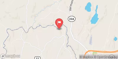

 Brown
Brown
 Lhcs Road Hubbardton