


Lost River #4 Dam Reservoir Report
Last Updated: April 25, 2026
Nearby: Rockcliff Lost River #10 Dam
°F
°F
mph
Wind
%
Humidity
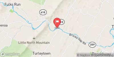
Lost River #4 Dam, also known as Kimsey Run Dam, is a vital piece of infrastructure located in Hardy, West Virginia.
Summary
Constructed in 1996 by the USDA NRCS, this earth dam stands at an impressive height of 90.9 feet and serves primarily for flood risk reduction along Kimsey Run. With a storage capacity of 10,256 acre-feet, this dam plays a crucial role in managing water levels and protecting the surrounding area from flooding.
Managed by the local government and regulated by the West Virginia Department of Environmental Protection, Lost River #4 Dam has been assessed to be in satisfactory condition, with a high hazard potential. The dam's emergency action plan was last revised in 2017, ensuring that proper measures are in place in case of a catastrophic event. Despite the moderate risk assessment, the dam continues to provide essential flood protection for the community of Lost River and the surrounding areas.
Lost River #4 Dam stands as a testament to effective water resource management and climate resilience efforts in West Virginia. With its strategic location and design, this dam not only mitigates flood risks but also contributes to the overall safety and well-being of the local residents. As climate change continues to pose challenges, structures like Lost River #4 Dam play a crucial role in adapting to and mitigating the impacts of a changing environment.
Regional Streamflow Levels
15-Day Long Term Forecast
Year Completed |
1996 |
Dam Length |
1800 |
Dam Height |
90.9 |
River Or Stream |
KIMSEY RUN |
Primary Dam Type |
Earth |
Surface Area |
66 |
Hydraulic Height |
85.9 |
Nid Storage |
10256 |
Outlet Gates |
Uncontrolled |
Hazard Potential |
High |
Foundations |
Rock, Soil |
Nid Height |
91 |
Seasonal Comparison
5-Day Hourly Forecast Detail
Dam Data Reference
Condition Assessment
SatisfactoryNo existing or potential dam safety deficiencies are recognized. Acceptable performance is expected under all loading conditions (static, hydrologic, seismic) in accordance with the minimum applicable state or federal regulatory criteria or tolerable risk guidelines.
Fair
No existing dam safety deficiencies are recognized for normal operating conditions. Rare or extreme hydrologic and/or seismic events may result in a dam safety deficiency. Risk may be in the range to take further action. Note: Rare or extreme event is defined by the regulatory agency based on their minimum
Poor A dam safety deficiency is recognized for normal operating conditions which may realistically occur. Remedial action is necessary. POOR may also be used when uncertainties exist as to critical analysis parameters which identify a potential dam safety deficiency. Investigations and studies are necessary.
Unsatisfactory
A dam safety deficiency is recognized that requires immediate or emergency remedial action for problem resolution.
Not Rated
The dam has not been inspected, is not under state or federal jurisdiction, or has been inspected but, for whatever reason, has not been rated.
Not Available
Dams for which the condition assessment is restricted to approved government users.
Hazard Potential Classification
HighDams assigned the high hazard potential classification are those where failure or mis-operation will probably cause loss of human life.
Significant
Dams assigned the significant hazard potential classification are those dams where failure or mis-operation results in no probable loss of human life but can cause economic loss, environment damage, disruption of lifeline facilities, or impact other concerns. Significant hazard potential classification dams are often located in predominantly rural or agricultural areas but could be in areas with population and significant infrastructure.
Low
Dams assigned the low hazard potential classification are those where failure or mis-operation results in no probable loss of human life and low economic and/or environmental losses. Losses are principally limited to the owner's property.
Undetermined
Dams for which a downstream hazard potential has not been designated or is not provided.
Not Available
Dams for which the downstream hazard potential is restricted to approved government users.
Area Campgrounds
| Location | Reservations | Toilets |
|---|---|---|
 Trout Pond
|
||
 Trout Pond Recreation Area
|
||
 Trout Pond Campground
|
||
 Wolf Gap Recreation Area
|
||
 Wolf Gap
|
 The West Virginia 259 Bridge South Of Wardensville To Ends Where The Lost River Becomes The Cacapon River