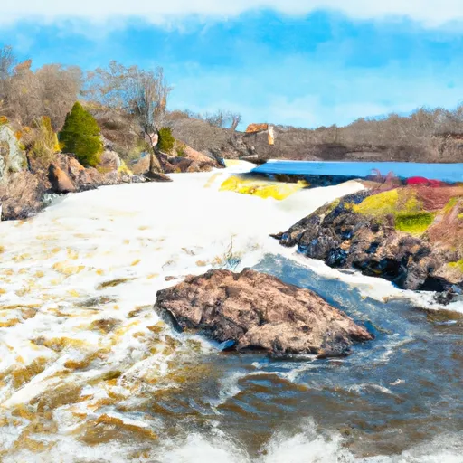
Clam River Dam

Clam River
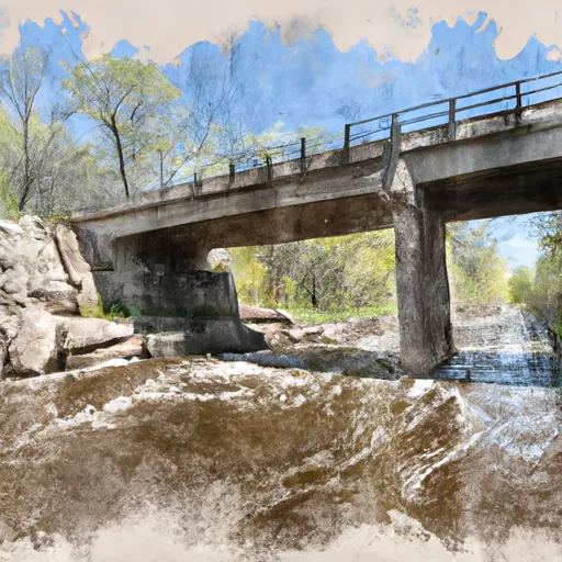
Located in Burnett, Wisconsin, the Clam River dam stands as a testament to the beauty and power of hydroelectric energy. Constructed in 1944, this gravity dam reaches 40 feet in height and spans 1223 feet in length, harnessing the river's flow to generate renewable electricity. With a storage capacity of 3825 acre-feet and a maximum discharge of 4000 cubic feet per second, the dam serves multiple purposes, including flood control, recreation, and habitat enhancement for fish and wildlife.
Managed by the Federal Energy Regulatory Commission, the Clam River dam boasts a controlled spillway and four outlet gates for efficient water release. Despite its low hazard potential, the dam's risk assessment indicates a high level of vulnerability, prompting ongoing monitoring and risk management measures. While the dam's condition assessment is currently unavailable, regular inspections and emergency action plans are in place to ensure the safety and integrity of this vital water resource amidst changing climate conditions.
For water resource and climate enthusiasts, the Clam River dam offers a fascinating example of sustainable energy production and environmental stewardship. As a key player in the region's water management infrastructure, this hydroelectric facility not only provides clean electricity but also supports the local ecosystem and recreational opportunities. With its rich history, impressive engineering, and ongoing commitment to safety and regulatory compliance, the Clam River dam serves as a shining example of responsible water resource management in the face of climate challenges.
Plan around the weather
Same NOAA / yr.no feed Snoflo's iOS app uses. Watch the precipitation column on the meteogram -- rain on the basin upstream typically lifts inflow 24-72 hours later.
Next 5 days, hour by hour
Temperature line with weather symbols on top, snow + rain accumulation as columns, humidity as a dotted line.
5-day forecast table
Every 3 hours, broken out across temperature, snow, rain, humidity, and wind. Each cell is colour-coded relative to the column min/max.
| Time | Condition | Temp (°F) | Snow (in) | Rain (in) | Humidity (%) | Wind (mps) | Wind dir |
|---|---|---|---|---|---|---|---|
| Loading detailed forecast… | |||||||
15-day temperature & precipitation
Daily temperatures, snow, and rain projected over the next two weeks.
Nearby streamflow gauges
USGS streamgauges around Clam River -- inflows here typically show up in storage 24-72 hours later.
| Streamgauge | Discharge | View |
|---|---|---|
| St. Croix River Near Danbury | 700 cfs | → |
| Kettle River Below Sandstone | 138 cfs | → |
| Snake River Near Pine City | 386 cfs | → |
| St. Croix River At St. Croix Falls | 1,870 cfs | → |
| Nemadji River Near South Superior | 58 cfs | → |
| St. Louis River At Scanlon | 525 cfs | → |


About Clam River
Where does the data for Clam River come from?
Structural and regulatory data come from the U.S. Army Corps of Engineers' National Inventory of Dams (NID). Weather forecast comes from NOAA / yr.no -- the same feed Snoflo's iOS app uses.
How often is the report updated?
NID structural data refreshes annually as the Corps publishes updated assessments. The weather forecast refreshes throughout the day.
What does the Low hazard rating mean?
The Corps of Engineers' hazard potential classification grades probable consequences if the dam fails: High = probable loss of human life; Significant = no probable loss of human life but possible economic loss / environmental damage; Low = no probable loss of human life, only minor economic / environmental losses. See the Dam Data Reference card below for the full definitions.
What's "% of normal"?
The current storage value compared to the historical average storage on this calendar day. 100% = right on average; values above 100% mean above-normal storage (wet year); values below mean below-normal (dry year or drought).
Can I get alerts when storage crosses a threshold?
Yes -- alerts are managed in the Snoflo iOS app. Favorite this dam, set a threshold, and you'll get a push the moment conditions cross.
Dam data reference
Condition Assessment
- Satisfactory
- No existing or potential dam safety deficiencies are recognized. Acceptable performance is expected under all loading conditions (static, hydrologic, seismic) in accordance with the minimum applicable state or federal regulatory criteria or tolerable risk guidelines.
- Fair
- No existing dam safety deficiencies are recognized for normal operating conditions. Rare or extreme hydrologic and/or seismic events may result in a dam safety deficiency. Risk may be in the range to take further action.
- Poor
- A dam safety deficiency is recognized for normal operating conditions which may realistically occur. Remedial action is necessary. POOR may also be used when uncertainties exist as to critical analysis parameters which identify a potential dam safety deficiency.
- Unsatisfactory
- A dam safety deficiency is recognized that requires immediate or emergency remedial action for problem resolution.
- Not Rated
- The dam has not been inspected, is not under state or federal jurisdiction, or has been inspected but, for whatever reason, has not been rated.
Hazard Potential Classification
- High
- Dams assigned the high hazard potential classification are those where failure or mis-operation will probably cause loss of human life.
- Significant
- Dams assigned the significant hazard potential classification are those dams where failure or mis-operation results in no probable loss of human life but can cause economic loss, environmental damage, disruption of lifeline facilities, or impact other concerns. Significant hazard potential classification dams are often located in predominantly rural or agricultural areas but could be in areas with population and significant infrastructure.
- Low
- Dams assigned the low hazard potential classification are those where failure or mis-operation results in no probable loss of human life and low economic and/or environmental losses. Losses are principally limited to the owner's property.
- Undetermined
- Dams for which a downstream hazard potential has not been designated or is not provided.