Alma Mill 1 Reservoir Report
Nearby: Alma Mill 2 Alma Mill 3
Last Updated: February 1, 2026
Alma Mill 1, located in Buffalo, Wisconsin, is a vital structure designed by the USDA NRCS in 1963 with the primary purpose of debris control along Riesch Creek.
°F
°F
mph
Wind
%
Humidity
15-Day Weather Outlook
Summary
This earth dam stands at 34 feet in height and spans 560 feet in length, providing a storage capacity of 190 acre-feet to manage flood risk and protect the surrounding area. With a low hazard potential and fair condition assessment as of May 2020, Alma Mill 1 plays a crucial role in mitigating potential risks and ensuring the safety of the community.
Managed by the Wisconsin Department of Natural Resources (WIDNR), Alma Mill 1 is subject to state regulations, permitting, inspection, and enforcement to uphold its operational integrity. The dam's spillway type is uncontrolled, with a maximum discharge capacity of 3,658 cubic feet per second. Despite being last inspected in October 2007, the structure has demonstrated resilience over the years and continues to serve its intended function effectively. With a moderate risk assessment rating of 3, Alma Mill 1 remains a key asset in the region's water resource and climate management efforts.
As a critical infrastructure owned by the local government, Alma Mill 1 exemplifies the collaboration between federal and state agencies in ensuring the safety and sustainability of water resources in Wisconsin. With a designated purpose of debris control and flood risk reduction, this dam stands as a testament to effective engineering and regulatory oversight. As water resource and climate enthusiasts, understanding the significance of structures like Alma Mill 1 is essential in appreciating the complexities of water management and the interconnectedness of environmental stewardship.
Year Completed |
1963 |
Dam Length |
560 |
Dam Height |
34 |
River Or Stream |
RIESCH CREEK |
Primary Dam Type |
Earth |
Surface Area |
8 |
Hydraulic Height |
26 |
Drainage Area |
3.9 |
Nid Storage |
190 |
Structural Height |
34 |
Hazard Potential |
Low |
Nid Height |
34 |
Seasonal Comparison
Hourly Weather Forecast
Nearby Streamflow Levels
 Zumbro River At Kellogg
|
1550cfs |
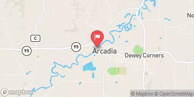
 Trempealeau River At Arcadia
|
400cfs |
 Chippewa River At Durand
|
4160cfs |
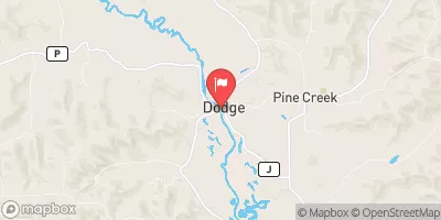
 Trempealeau River At Dodge
|
953cfs |
 Mississippi River At Winona
|
16300cfs |
 South Fork Zumbro River At Rochester
|
85cfs |
Dam Data Reference
Condition Assessment
SatisfactoryNo existing or potential dam safety deficiencies are recognized. Acceptable performance is expected under all loading conditions (static, hydrologic, seismic) in accordance with the minimum applicable state or federal regulatory criteria or tolerable risk guidelines.
Fair
No existing dam safety deficiencies are recognized for normal operating conditions. Rare or extreme hydrologic and/or seismic events may result in a dam safety deficiency. Risk may be in the range to take further action. Note: Rare or extreme event is defined by the regulatory agency based on their minimum
Poor A dam safety deficiency is recognized for normal operating conditions which may realistically occur. Remedial action is necessary. POOR may also be used when uncertainties exist as to critical analysis parameters which identify a potential dam safety deficiency. Investigations and studies are necessary.
Unsatisfactory
A dam safety deficiency is recognized that requires immediate or emergency remedial action for problem resolution.
Not Rated
The dam has not been inspected, is not under state or federal jurisdiction, or has been inspected but, for whatever reason, has not been rated.
Not Available
Dams for which the condition assessment is restricted to approved government users.
Hazard Potential Classification
HighDams assigned the high hazard potential classification are those where failure or mis-operation will probably cause loss of human life.
Significant
Dams assigned the significant hazard potential classification are those dams where failure or mis-operation results in no probable loss of human life but can cause economic loss, environment damage, disruption of lifeline facilities, or impact other concerns. Significant hazard potential classification dams are often located in predominantly rural or agricultural areas but could be in areas with population and significant infrastructure.
Low
Dams assigned the low hazard potential classification are those where failure or mis-operation results in no probable loss of human life and low economic and/or environmental losses. Losses are principally limited to the owner's property.
Undetermined
Dams for which a downstream hazard potential has not been designated or is not provided.
Not Available
Dams for which the downstream hazard potential is restricted to approved government users.

 Reicks Lake Park Campground
 Reicks Lake Park
 Richard J. Dorer SF -Snake Creek
 Richard J. Dorer State Forest- Kruger Campground
 John Latsch State Park
 Richard J. Dorer SF -Zumbro Bottom Horse Camp North
 Alma Mill 1
 Mississippi River -- Dairyland Power Landing (Alma)