Tass Reservoir Report
Nearby: Muffie Muddy Guard No. 2 North Dam
Last Updated: February 5, 2026
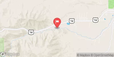
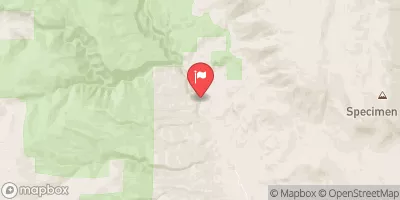
Tass, located in Arvada, Wyoming, is a privately owned earth dam on Burnett Creek completed in 1965 for irrigation purposes.
°F
°F
mph
Wind
%
Humidity
15-Day Weather Outlook
Summary
Standing at 35 feet high with a hydraulic height of 31 feet, Tass has a structural height of 36 feet and a length of 243 feet, providing a storage capacity of 112 acre-feet. The dam has a spillway width of 80 feet and is classified as having a low hazard potential with a poor condition assessment as of the last inspection in August 2018.
Despite its age and condition, Tass remains regulated by the State of Wyoming and is subject to regular inspections, enforcement, and permitting. The dam is situated in Johnson County and falls under the jurisdiction of the SEO regulatory agency. The risk assessment for Tass is moderate, indicating potential hazards that require attention and monitoring. The dam does not have a current Emergency Action Plan (EAP) in place, highlighting the importance of implementing risk management measures to ensure the safety and integrity of the structure for both water resource and climate enthusiasts.
Year Completed |
1965 |
Dam Length |
243 |
Dam Height |
35 |
River Or Stream |
BURNETT CREEK |
Primary Dam Type |
Earth |
Surface Area |
6 |
Hydraulic Height |
31 |
Nid Storage |
112 |
Structural Height |
36 |
Outlet Gates |
Slide (sluice gate) - 0 |
Hazard Potential |
Low |
Foundations |
Soil |
Nid Height |
36 |
Seasonal Comparison
Hourly Weather Forecast
Nearby Streamflow Levels
Dam Data Reference
Condition Assessment
SatisfactoryNo existing or potential dam safety deficiencies are recognized. Acceptable performance is expected under all loading conditions (static, hydrologic, seismic) in accordance with the minimum applicable state or federal regulatory criteria or tolerable risk guidelines.
Fair
No existing dam safety deficiencies are recognized for normal operating conditions. Rare or extreme hydrologic and/or seismic events may result in a dam safety deficiency. Risk may be in the range to take further action. Note: Rare or extreme event is defined by the regulatory agency based on their minimum
Poor A dam safety deficiency is recognized for normal operating conditions which may realistically occur. Remedial action is necessary. POOR may also be used when uncertainties exist as to critical analysis parameters which identify a potential dam safety deficiency. Investigations and studies are necessary.
Unsatisfactory
A dam safety deficiency is recognized that requires immediate or emergency remedial action for problem resolution.
Not Rated
The dam has not been inspected, is not under state or federal jurisdiction, or has been inspected but, for whatever reason, has not been rated.
Not Available
Dams for which the condition assessment is restricted to approved government users.
Hazard Potential Classification
HighDams assigned the high hazard potential classification are those where failure or mis-operation will probably cause loss of human life.
Significant
Dams assigned the significant hazard potential classification are those dams where failure or mis-operation results in no probable loss of human life but can cause economic loss, environment damage, disruption of lifeline facilities, or impact other concerns. Significant hazard potential classification dams are often located in predominantly rural or agricultural areas but could be in areas with population and significant infrastructure.
Low
Dams assigned the low hazard potential classification are those where failure or mis-operation results in no probable loss of human life and low economic and/or environmental losses. Losses are principally limited to the owner's property.
Undetermined
Dams for which a downstream hazard potential has not been designated or is not provided.
Not Available
Dams for which the downstream hazard potential is restricted to approved government users.
Area Campgrounds
| Location | Reservations | Toilets |
|---|---|---|
 Canyon Campground
|
||
 Muddy Guard Cabin
|
||
 Crazy Woman Campground
|
||
 Pole Creek Cabin
|
||
 Tie Hack
|
||
 Lost Cabin Campground
|



 Tass
Tass