Router No. 49 Dam

Router No. 49
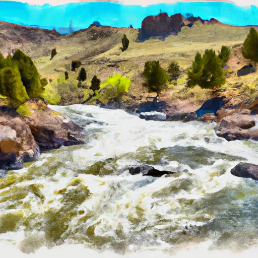
Router No. 49, located in Johnson, Wyoming, along County Road in 31-50-77, serves multiple purposes, including fire protection, stock, and a small fish pond. This private earth dam, designed by Hugh Lowham and completed in 2006, stands at a height of 42 feet with a structural height of 42 feet and a hydraulic height of 37 feet. With a storage capacity of 24.28 acre-feet, the dam covers a surface area of 1.66 acres and has a drainage area of 0.09 square miles, serving as a critical resource in the area.
The dam on Router No. 49 poses a low hazard potential and is currently in fair condition as of the last inspection in August 2021. The spillway, with a width of 40 feet, is uncontrolled, and the dam features a single valve outlet gate. Despite its low risk profile, the dam has a moderate risk assessment of 3, highlighting the importance of ongoing monitoring and maintenance to ensure its continued safety and functionality for fire protection and other uses in the community.
Situated on Flicker Gulch and falling under the jurisdiction of the Wyoming Department of Environmental Quality's Oil and Gas Conservation division, Router No. 49 plays a crucial role in water resource management in the region. With its strategic location and design features, this dam stands as a testament to the collaborative efforts of private owners, regulators, and designers in safeguarding water resources and enhancing climate resilience in Wyoming.
Plan around the weather
Same NOAA / yr.no feed Snoflo's iOS app uses. Watch the precipitation column on the meteogram -- rain on the basin upstream typically lifts inflow 24-72 hours later.
Next 5 days, hour by hour
Temperature line with weather symbols on top, snow + rain accumulation as columns, humidity as a dotted line.
5-day forecast table
Every 3 hours, broken out across temperature, snow, rain, humidity, and wind. Each cell is colour-coded relative to the column min/max.
| Time | Condition | Temp (°F) | Snow (in) | Rain (in) | Humidity (%) | Wind (mps) | Wind dir |
|---|---|---|---|---|---|---|---|
| Loading detailed forecast… | |||||||
15-day temperature & precipitation
Daily temperatures, snow, and rain projected over the next two weeks.
Nearby streamflow gauges
USGS streamgauges around Router No. 49 -- inflows here typically show up in storage 24-72 hours later.
| Streamgauge | Discharge | View |
|---|---|---|
| Wild Horse Creek Near Arvada | 0 cfs | → |
| Powder River At Arvada | 0 cfs | → |
| Clear Creek Near Buffalo | 54 cfs | → |
| Stonepile Creek At Mouth | 3 cfs | → |
| Donkey Creek Near Gillette | 0 cfs | → |
| Rock Creek Near Buffalo | 70 cfs | → |


About Router No. 49
Where does the data for Router No. 49 come from?
Structural and regulatory data come from the U.S. Army Corps of Engineers' National Inventory of Dams (NID). Weather forecast comes from NOAA / yr.no -- the same feed Snoflo's iOS app uses.
How often is the report updated?
NID structural data refreshes annually as the Corps publishes updated assessments. The weather forecast refreshes throughout the day.
What does the Low hazard rating mean?
The Corps of Engineers' hazard potential classification grades probable consequences if the dam fails: High = probable loss of human life; Significant = no probable loss of human life but possible economic loss / environmental damage; Low = no probable loss of human life, only minor economic / environmental losses. See the Dam Data Reference card below for the full definitions.
What's "% of normal"?
The current storage value compared to the historical average storage on this calendar day. 100% = right on average; values above 100% mean above-normal storage (wet year); values below mean below-normal (dry year or drought).
Can I get alerts when storage crosses a threshold?
Yes -- alerts are managed in the Snoflo iOS app. Favorite this dam, set a threshold, and you'll get a push the moment conditions cross.
Dam data reference
Condition Assessment
- Satisfactory
- No existing or potential dam safety deficiencies are recognized. Acceptable performance is expected under all loading conditions (static, hydrologic, seismic) in accordance with the minimum applicable state or federal regulatory criteria or tolerable risk guidelines.
- Fair
- No existing dam safety deficiencies are recognized for normal operating conditions. Rare or extreme hydrologic and/or seismic events may result in a dam safety deficiency. Risk may be in the range to take further action.
- Poor
- A dam safety deficiency is recognized for normal operating conditions which may realistically occur. Remedial action is necessary. POOR may also be used when uncertainties exist as to critical analysis parameters which identify a potential dam safety deficiency.
- Unsatisfactory
- A dam safety deficiency is recognized that requires immediate or emergency remedial action for problem resolution.
- Not Rated
- The dam has not been inspected, is not under state or federal jurisdiction, or has been inspected but, for whatever reason, has not been rated.
Hazard Potential Classification
- High
- Dams assigned the high hazard potential classification are those where failure or mis-operation will probably cause loss of human life.
- Significant
- Dams assigned the significant hazard potential classification are those dams where failure or mis-operation results in no probable loss of human life but can cause economic loss, environmental damage, disruption of lifeline facilities, or impact other concerns. Significant hazard potential classification dams are often located in predominantly rural or agricultural areas but could be in areas with population and significant infrastructure.
- Low
- Dams assigned the low hazard potential classification are those where failure or mis-operation results in no probable loss of human life and low economic and/or environmental losses. Losses are principally limited to the owner's property.
- Undetermined
- Dams for which a downstream hazard potential has not been designated or is not provided.