Northeast 245th Street Road 14526, Fort Mccoy Boat Launch
Community Reviews
Been here? Share the conditions.
Reviews, ratings & photos are added in the free Snoflo iOS app — rate a spot, tag the conditions, and your visit is verified by location. Add or manage your reviews from the app.
Northeast 245th Street Road 14526, Fort Mccoy
The Ocklawaha River is a major tributary of the St. Johns River, running for approximately 74 miles through central Florida. The river is home to a variety of fish species, including largemouth bass, panfish, and catfish, making it a popular spot for anglers. The river is also used for boating, kayaking, and other water-based activities.
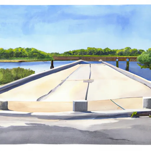
The boat ramp is suitable for launching small to medium-sized boats, canoes, and kayaks. Larger boats may have difficulty launching from this ramp due to its narrow width. However, there is ample parking available for trailers and vehicles.
In summary, Northeast 245th Street Road 14526 boat ramp is a public boat ramp located in Marion County, Florida. It services the Ocklawaha River, is 10 feet wide, and is suitable for small to medium-sized boats, canoes, and kayaks. It is a popular destination for fishing, boating, and other recreational activities.
Plan your launch down to the hour
Same weather feed Snoflo's iOS app uses -- updated continuously from NOAA / yr.no.
Next 5 days, hour by hour
Temperature line with weather symbols on top, snow + rain accumulation as columns, humidity as a dotted line.
5-day forecast table
Every 3 hours, broken out across temperature, snow, rain, humidity, and wind.
| Time | Condition | Temp (°F) | Snow (in) | Rain (in) | Humidity (%) | Wind (mps) | Wind dir |
|---|---|---|---|---|---|---|---|
| Loading detailed forecast… | |||||||
15-day temperature & precipitation
Daily temperatures, snow, and rain projected over the next two weeks.
Area streamflow levels
USGS streamgauges around Northeast 245th Street Road 14526, Fort Mccoy -- the same readings that determine whether your launch is safe and your boat is the right craft.
| Streamgauge | Discharge | View |
|---|---|---|
| Orange Creek At Orange Springs | 3 cfs | → |
| Ocklawaha R At Rodman Dam Nr Orange Springs | 632 cfs | → |
| Ocklawaha River At Eureka | 442 cfs | → |
| St. Johns R At Buffalo Bluff Nr Satsuma | 5,660 cfs | → |
| Dunns Creek Near Satsuma | 596 cfs | → |
| Ocklawaha River Nr Conner | 397 cfs | → |
Plan a longer trip
The closest paddle runs, fishing spots, and other boat launches so you can extend a day on the water.
Boating safety & etiquette
- Check the conditions before you launch
- Use the streamflow numbers, weather, and wind forecast on this page. High-cfs whitewater requires whitewater-specific craft and skill.
- Wear your life jacket
- Statistically the single biggest survival factor in a boating incident. State law often requires one per passenger.
- File a float plan
- Tell someone on shore your put-in, take-out, and expected return time. Especially for multi-day or remote trips.
- Yield at the ramp
- Prep gear in the parking lot, not on the ramp. Launch and clear quickly so others can use the lane.
- Clean, drain, dry
- Inspect, clean, drain and dry your boat between waters to prevent the spread of aquatic invasive species.
Set push alerts in the Snoflo app
Save Northeast 245th Street Road 14526, Fort Mccoy as a favorite, set a discharge threshold or a wind/precipitation alert, and the iOS app will push the moment conditions cross.
About Northeast 245th Street Road 14526, Fort Mccoy
Can I launch a motorboat here?
Most Snoflo-tracked launches support motorboats; check the operator for any horsepower restrictions, paddle-only zones, or seasonal closures.
How fresh is the streamflow data?
USGS streamgauges report continuously (every 15 minutes); the table on this page pulls the latest reading at page load.
Is there a fee?
Many federal and state boat launches charge a day-use fee. Check the operator's site before driving out.
What boat is right for these conditions?
Use the nearby streamflow numbers and river-run panel on this page to gauge current conditions. Wider, slower water is friendly for casual paddling and powerboats; high-cfs whitewater requires whitewater-specific craft and skill.
Can I get alerts when conditions change?
Yes -- alerts are managed in the Snoflo iOS app. Favorite this launch, set a threshold (discharge, wind), and you'll get a push the moment it crosses.
Other launches near here
Snoflo-tracked boat launches within driving distance of Northeast 245th Street Road 14526, Fort Mccoy.