Rodman Dam Road Putnam County boat launch
Community Reviews
Been here? Share the conditions.
Reviews, ratings & photos are added in the free Snoflo iOS app — rate a spot, tag the conditions, and your visit is verified by location. Add or manage your reviews from the app.
Rodman Dam Road Putnam County
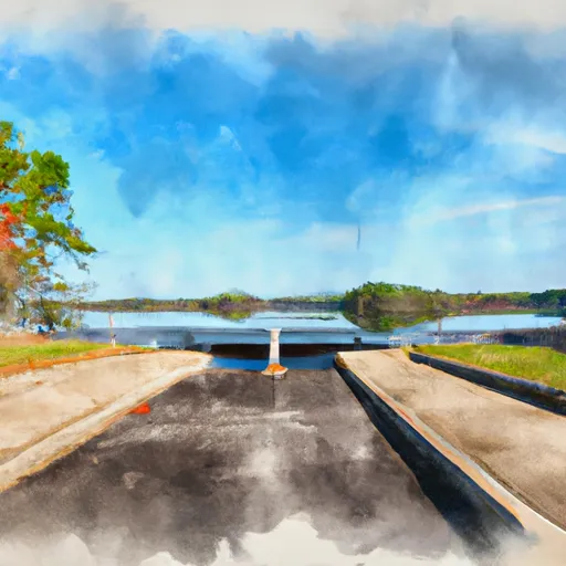
According to the latest information available, the boat ramp is 20 feet wide and has a gradual slope, which makes it suitable for launching and retrieving small to medium-sized boats. The GPS coordinates of the ramp are 29.50794983 latitude and -81.80345154 longitude.
The body of water that the ramp services is the Ocklawaha River, which is a 74-mile-long river that flows through central Florida. The river is home to a variety of fish species, including bass, catfish, and panfish, making it a popular spot for fishing enthusiasts.
As for the kind of craft permitted on the water, the Ocklawaha River is open to all types of boats, including motorized and non-motorized vessels. However, there are some restrictions on boat speed and noise levels in certain areas of the river, so boaters should check with local authorities or signage for any applicable regulations.
Overall, the Rodman Dam Road boat ramp is a popular and well-maintained facility that provides convenient access to a scenic and diverse waterway.
Plan your launch down to the hour
Same weather feed Snoflo's iOS app uses -- updated continuously from NOAA / yr.no.
Next 5 days, hour by hour
Temperature line with weather symbols on top, snow + rain accumulation as columns, humidity as a dotted line.
5-day forecast table
Every 3 hours, broken out across temperature, snow, rain, humidity, and wind.
| Time | Condition | Temp (°F) | Snow (in) | Rain (in) | Humidity (%) | Wind (mps) | Wind dir |
|---|---|---|---|---|---|---|---|
| Loading detailed forecast… | |||||||
15-day temperature & precipitation
Daily temperatures, snow, and rain projected over the next two weeks.
Area streamflow levels
USGS streamgauges around Rodman Dam Road Putnam County -- the same readings that determine whether your launch is safe and your boat is the right craft.
| Streamgauge | Discharge | View |
|---|---|---|
| Ocklawaha R At Rodman Dam Nr Orange Springs | 378 cfs | → |
| Orange Creek At Orange Springs | 3 cfs | → |
| St. Johns R At Buffalo Bluff Nr Satsuma | 4,100 cfs | → |
| Ocklawaha River At Eureka | 448 cfs | → |
| Dunns Creek Near Satsuma | 2,950 cfs | → |
| Ocklawaha River Nr Conner | 366 cfs | → |
Plan a longer trip
The closest paddle runs, fishing spots, and other boat launches so you can extend a day on the water.
River runs
- Segment A--Mouth Of Spring On Ocala Nf (At Juniper Springs Wilderness) To Bridge On Sh 19 (At Wilderness Boundary)
- Segment B--Bridge On Sh 19 To Confluence With Lake George
- Segment A--Mouth Of Spring On Ocala Nf To Alexander Springs Wilderness Boundary
- Segment B--Alexander Springs Wilderness Boundary To Confluence With St. Johns River
Nearby fishing
Boating safety & etiquette
- Check the conditions before you launch
- Use the streamflow numbers, weather, and wind forecast on this page. High-cfs whitewater requires whitewater-specific craft and skill.
- Wear your life jacket
- Statistically the single biggest survival factor in a boating incident. State law often requires one per passenger.
- File a float plan
- Tell someone on shore your put-in, take-out, and expected return time. Especially for multi-day or remote trips.
- Yield at the ramp
- Prep gear in the parking lot, not on the ramp. Launch and clear quickly so others can use the lane.
- Clean, drain, dry
- Inspect, clean, drain and dry your boat between waters to prevent the spread of aquatic invasive species.
Set push alerts in the Snoflo app
Save Rodman Dam Road Putnam County as a favorite, set a discharge threshold or a wind/precipitation alert, and the iOS app will push the moment conditions cross.
About Rodman Dam Road Putnam County
Can I launch a motorboat here?
Most Snoflo-tracked launches support motorboats; check the operator for any horsepower restrictions, paddle-only zones, or seasonal closures.
How fresh is the streamflow data?
USGS streamgauges report continuously (every 15 minutes); the table on this page pulls the latest reading at page load.
Is there a fee?
Many federal and state boat launches charge a day-use fee. Check the operator's site before driving out.
What boat is right for these conditions?
Use the nearby streamflow numbers and river-run panel on this page to gauge current conditions. Wider, slower water is friendly for casual paddling and powerboats; high-cfs whitewater requires whitewater-specific craft and skill.
Can I get alerts when conditions change?
Yes -- alerts are managed in the Snoflo iOS app. Favorite this launch, set a threshold (discharge, wind), and you'll get a push the moment it crosses.
Other launches near here
Snoflo-tracked boat launches within driving distance of Rodman Dam Road Putnam County.