Kings Road Bridge (2 Miles West Of Town Of Luther In T19n, R12w To Slackwater Of The State Fish Weir In T21n, R16w River Run
Community Reviews
Been here? Share the conditions.
Reviews, ratings & photos are added in the free Snoflo iOS app — rate a spot, tag the conditions, and your visit is verified by location. Add or manage your reviews from the app.
Kings Road Bridge (2 Miles West Of Town Of Luther In T19n, R12w To Slackwater Of The State Fish Weir In T21n, R16w
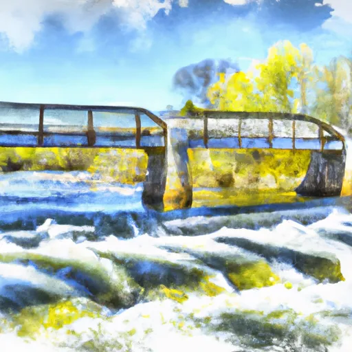
There are specific rapids and obstacles to be aware of on this run, including the "Big Drop," a Class III rapid that requires precise navigation, and the "Punch Bowl," a Class II rapid that can create strong currents. Additionally, there are several low-head dams along the route that can be dangerous if not approached with caution.
The Michigan Department of Natural Resources enforces specific regulations for this area, including a requirement for personal floatation devices for all individuals on the water and a prohibition on alcohol consumption. Additionally, fishing in the area is allowed, but certain regulations must be followed, such as catch and release for certain species of fish.
Overall, the Whitewater River Run offers a thrilling and scenic experience for kayakers and rafters, but caution and careful planning are necessary to ensure a safe trip.
Plan your run down to the hour
Same weather feed Snoflo's iOS app uses -- updated continuously from NOAA / yr.no. Watch the precipitation column on the meteogram; rain ahead of a run typically lifts flows 12-48 hours later depending on the basin.
Next 5 days, hour by hour
Temperature line with weather symbols on top, snow + rain accumulation as columns, humidity as a dotted line.
5-day forecast table
Every 3 hours, broken out across temperature, snow, rain, humidity, and wind. Each cell is colour-coded relative to the column min/max.
| Time | Condition | Temp (°F) | Snow (in) | Rain (in) | Humidity (%) | Wind (mps) | Wind dir |
|---|---|---|---|---|---|---|---|
| Loading detailed forecast… | |||||||
15-day temperature & precipitation
Daily temperatures, snow, and rain projected over the next two weeks -- the upstream story that drives next week's flows.
Regional streamflow levels
USGS streamgauges around Kings Road Bridge (2 Miles West Of Town Of Luther In T19n, R12w To Slackwater Of The State Fish Weir In T21n, R16w -- useful for spotting upstream pulses and gauging which tributary is contributing what.
| Streamgauge | Discharge | View |
|---|---|---|
| Manistee River Near Wellston | 1,630 cfs | → |
| Pere Marquette River At Scottville | 473 cfs | → |
| Pine River At High School Bridge Nr Hoxeyville | 229 cfs | → |
| Manistee River Near Mesick | 1,150 cfs | → |
| Manistee River Near Sherman | 1,150 cfs | → |
| Platte River At Honor | 140 cfs | → |
Plan a longer trip
The closest boat launches, other paddle runs, and campgrounds so a day on the water can grow into a full weekend.
Boat launches
- Us Forest Foot Trail Free Soil Township
- Manistee Lake -S, 930 Acres, Manistee County
- Canfield Lake
- Manistee Lake -E, 930 Acres, Manistee County
- Sengs Marina
- River Road Brown Township
Other river runs
- Southern Boundary Of Sleeping Bear Dunes National Lakeshore To Mouth At Lake Michigan
- South Branch From Forest Boundary East Of Hesperia At West Section Line Of Sec 22, T14n, R14w To Echo Drive In Sec 6, T13n, R12w
- North Branch From Its Confluence With South Branch In Sec 22, T13n, R16 W To Mclaren Lake In Sec 11, T14n, R15w
- Southeastern Boundary Of Sleeping Bear Dunes National Lakeshore To Northwetern Boundary Of Sleeping Bear Dunes National Lakeshore
- Mainstem To Forest Boundary At North Section Line Of Sec 2, T13n, R15w (1.5 Miles West Of Herperia)
Campgrounds
- Coho Bend Campground
- Matson's Big Manistee River Campground
- Bear Track Campground
- Blacksmith Bayou Campground
- Pine Lake Recreation Area
- Pine Lake Campground
Whitewater safety
- Check the flow before you run
- Use the linked-gauge card and Regional Flow panel above. Class ratings change with flow -- a Class III at low water can become Class IV+ at high water.
- Know your skill ceiling
- Pick runs comfortably below your ceiling. Cold-water and big-water runs raise the consequences of any mistake.
- Wear the right gear
- Helmet, PFD, drysuit / wetsuit when water is below 60°F. Throw bag, knife, and whistle on your person, not in the boat.
- Scout, set safety, and run with a team
- Scout new rapids on foot, set safety with throw bags above the consequence pool, and run with at least one other competent paddler.
- Respect the river
- Strainers, undercuts, low-head dams, and wood can kill at any class rating. When in doubt, portage.
Set push alerts in the Snoflo app
Save Kings Road Bridge (2 Miles West Of Town Of Luther In T19n, R12w To Slackwater Of The State Fish Weir In T21n, R16w as a favorite, set a discharge threshold (e.g. "alert me when flow hits 600 cfs"), and the iOS app pushes the moment the linked gauge crosses.
About Kings Road Bridge (2 Miles West Of Town Of Luther In T19n, R12w To Slackwater Of The State Fish Weir In T21n, R16w
What's the optimal flow for Kings Road Bridge (2 Miles West Of Town Of Luther In T19n, R12w To Slackwater Of The State Fish Weir In T21n, R16w?
The optimal flow depends on the section and the craft. Check the Run Details panel for the linked gauge and current status.
How fresh is the cfs reading on this page?
The linked USGS streamgauge reports continuously (every 15 minutes); Snoflo refreshes throughout the day. Hover the streamflow sparkline to read individual datapoints.
What's the whitewater class?
See the Run Details panel for the class rating Snoflo tracks for this run. Class ratings change with flow -- a Class III at low water can become Class IV in high water.
Where do I put in / take out?
Tap Directions in the hero above to open driving directions to the put-in. For shuttle planning, check the Nearby Boat Launches panel and the river run operator's site.
Can I get alerts when flows hit the optimal range?
Yes -- alerts are managed in the Snoflo iOS app. Favorite this run, set a discharge threshold, and you'll get a push the moment the gauge crosses.
Other runs near here
Snoflo-tracked paddle runs within driving distance of Kings Road Bridge (2 Miles West Of Town Of Luther In T19n, R12w To Slackwater Of The State Fish Weir In T21n, R16w.