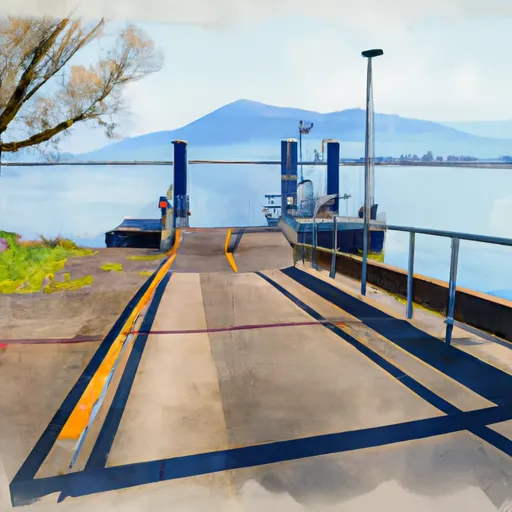
Harrisburg Landing Boat Launch
Community Reviews
Been here? Share the conditions.
Reviews, ratings & photos are added in the free Snoflo iOS app — rate a spot, tag the conditions, and your visit is verified by location. Add or manage your reviews from the app.
Harrisburg Landing
The Harrisburg Landing boat ramp provides access to the Willamette River, which is a major waterway in Oregon. The Willamette River is approximately 187 miles long and runs from the Cascade Mountains to the Columbia River. It is a popular destination for boaters and fishermen, offering a variety of fish species such as Chinook salmon, sturgeon, and steelhead.
The kind of craft permitted on the water at Harrisburg Landing includes recreational boats, kayaks, canoes, and paddleboards. Motorized boats are also allowed, but they must comply with the rules and regulations set by the Oregon State Marine Board, which manages boating activities in the state.
To ensure accuracy, the information about Harrisburg Landing was obtained from the official website of the Oregon State Parks and Recreation Department, which administers the boat ramp. Additionally, the information is regularly updated to reflect any changes or developments that may occur.
Plan your launch down to the hour
Same weather feed Snoflo's iOS app uses -- updated continuously from NOAA / yr.no.
Next 5 days, hour by hour
Temperature line with weather symbols on top, snow + rain accumulation as columns, humidity as a dotted line.
5-day forecast table
Every 3 hours, broken out across temperature, snow, rain, humidity, and wind.
| Time | Condition | Temp (°F) | Snow (in) | Rain (in) | Humidity (%) | Wind (mps) | Wind dir |
|---|---|---|---|---|---|---|---|
| Loading detailed forecast… | |||||||
15-day temperature & precipitation
Daily temperatures, snow, and rain projected over the next two weeks.
Area streamflow levels
USGS streamgauges around Harrisburg Landing -- the same readings that determine whether your launch is safe and your boat is the right craft.
| Streamgauge | Discharge | View |
|---|---|---|
| Willamette River At Harrisburg | 3,740 cfs | → |
| Long Tom River At Monroe | 50 cfs | → |
| Long Tom River Near Alvadore | 63 cfs | → |
| Mckenzie River Near Coburg | 1,820 cfs | → |
| Mohawk River Near Springfield | 29 cfs | → |
| Mckenzie River Abv Hayden Br | 1,710 cfs | → |
Plan a longer trip
The closest paddle runs, fishing spots, and other boat launches so you can extend a day on the water.
Boating safety & etiquette
- Check the conditions before you launch
- Use the streamflow numbers, weather, and wind forecast on this page. High-cfs whitewater requires whitewater-specific craft and skill.
- Wear your life jacket
- Statistically the single biggest survival factor in a boating incident. State law often requires one per passenger.
- File a float plan
- Tell someone on shore your put-in, take-out, and expected return time. Especially for multi-day or remote trips.
- Yield at the ramp
- Prep gear in the parking lot, not on the ramp. Launch and clear quickly so others can use the lane.
- Clean, drain, dry
- Inspect, clean, drain and dry your boat between waters to prevent the spread of aquatic invasive species.
Set push alerts in the Snoflo app
Save Harrisburg Landing as a favorite, set a discharge threshold or a wind/precipitation alert, and the iOS app will push the moment conditions cross.
About Harrisburg Landing
Can I launch a motorboat here?
Most Snoflo-tracked launches support motorboats; check the operator for any horsepower restrictions, paddle-only zones, or seasonal closures.
How fresh is the streamflow data?
USGS streamgauges report continuously (every 15 minutes); the table on this page pulls the latest reading at page load.
Is there a fee?
Many federal and state boat launches charge a day-use fee. Check the operator's site before driving out.
What boat is right for these conditions?
Use the nearby streamflow numbers and river-run panel on this page to gauge current conditions. Wider, slower water is friendly for casual paddling and powerboats; high-cfs whitewater requires whitewater-specific craft and skill.
Can I get alerts when conditions change?
Yes -- alerts are managed in the Snoflo iOS app. Favorite this launch, set a threshold (discharge, wind), and you'll get a push the moment it crosses.
Other launches near here
Snoflo-tracked boat launches within driving distance of Harrisburg Landing.