State Route 314 Wasatch County Boat Launch
Community Reviews
Been here? Share the conditions.
Reviews, ratings & photos are added in the free Snoflo iOS app — rate a spot, tag the conditions, and your visit is verified by location. Add or manage your reviews from the app.
State Route 314 Wasatch County
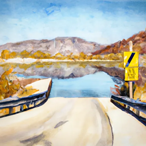
The State Route 314 boat ramp is located on the north side of the Jordanelle Reservoir, near the town of Heber City. It provides easy access to the water for boaters and fishermen, with plenty of parking available for vehicles and boat trailers. The boat ramp is maintained by the Utah Department of Natural Resources, and visitors are encouraged to follow all rules and regulations for safe and responsible boating on the reservoir.
Overall, the State Route 314 boat ramp is a convenient and well-maintained facility for anyone looking to enjoy the recreational opportunities offered by the Jordanelle Reservoir in Wasatch County, Utah.
Plan your launch down to the hour
Same weather feed Snoflo's iOS app uses -- updated continuously from NOAA / yr.no.
Next 5 days, hour by hour
Temperature line with weather symbols on top, snow + rain accumulation as columns, humidity as a dotted line.
5-day forecast table
Every 3 hours, broken out across temperature, snow, rain, humidity, and wind.
| Time | Condition | Temp (°F) | Snow (in) | Rain (in) | Humidity (%) | Wind (mps) | Wind dir |
|---|---|---|---|---|---|---|---|
| Loading detailed forecast… | |||||||
15-day temperature & precipitation
Daily temperatures, snow, and rain projected over the next two weeks.
Area streamflow levels
USGS streamgauges around State Route 314 Wasatch County -- the same readings that determine whether your launch is safe and your boat is the right craft.
| Streamgauge | Discharge | View |
|---|---|---|
| Daniels Creek At Charleston | · | → |
| Snake Creek Near Charleston | 23 cfs | → |
| Provo River Near Charleston | 208 cfs | → |
| American Fk Ab Upper Powerplant Nr American Fk | 20 cfs | → |
| Provo River At River Road Bridge | 183 cfs | → |
| Provo River Near Hailstone | 23 cfs | → |
Plan a longer trip
The closest paddle runs, fishing spots, and other boat launches so you can extend a day on the water.
River runs
- Top Of Cascade Springs To Road Crossing In Section 36
- Mt Timpanogos Wilderness Boundary To Theater-In-The-Pines
- Headwater Spring In Sec 8 To Mt Timpanogos Wilderness Boundary
- Bridal Veil (Bv)
- Mt Timpanogos Wilderenss Boundary To Scout Falls
- Confluence Below Timpooneke To Mt Timpanogos Wilderness Boundary
Nearby fishing
Boating safety & etiquette
- Check the conditions before you launch
- Use the streamflow numbers, weather, and wind forecast on this page. High-cfs whitewater requires whitewater-specific craft and skill.
- Wear your life jacket
- Statistically the single biggest survival factor in a boating incident. State law often requires one per passenger.
- File a float plan
- Tell someone on shore your put-in, take-out, and expected return time. Especially for multi-day or remote trips.
- Yield at the ramp
- Prep gear in the parking lot, not on the ramp. Launch and clear quickly so others can use the lane.
- Clean, drain, dry
- Inspect, clean, drain and dry your boat between waters to prevent the spread of aquatic invasive species.
Set push alerts in the Snoflo app
Save State Route 314 Wasatch County as a favorite, set a discharge threshold or a wind/precipitation alert, and the iOS app will push the moment conditions cross.
About State Route 314 Wasatch County
Can I launch a motorboat here?
Most Snoflo-tracked launches support motorboats; check the operator for any horsepower restrictions, paddle-only zones, or seasonal closures.
How fresh is the streamflow data?
USGS streamgauges report continuously (every 15 minutes); the table on this page pulls the latest reading at page load.
Is there a fee?
Many federal and state boat launches charge a day-use fee. Check the operator's site before driving out.
What boat is right for these conditions?
Use the nearby streamflow numbers and river-run panel on this page to gauge current conditions. Wider, slower water is friendly for casual paddling and powerboats; high-cfs whitewater requires whitewater-specific craft and skill.
Can I get alerts when conditions change?
Yes -- alerts are managed in the Snoflo iOS app. Favorite this launch, set a threshold (discharge, wind), and you'll get a push the moment it crosses.
Other launches near here
Snoflo-tracked boat launches within driving distance of State Route 314 Wasatch County.