International Selkirk Loop, Ione Boat Launch
Community Reviews
Been here? Share the conditions.
Reviews, ratings & photos are added in the free Snoflo iOS app — rate a spot, tag the conditions, and your visit is verified by location. Add or manage your reviews from the app.
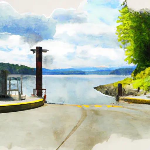
International Selkirk Loop, Ione
The International Selkirk Loop boat ramp is managed by the Washington Department of Fish and Wildlife, which offers additional information on its website. According to the website, the Pend Oreille River is home to a variety of coldwater fish species, including rainbow trout, cutthroat trout, and kokanee salmon. Anglers can also catch warmwater species such as bass, walleye, and northern pike.
It is important to note that regulations and access to this boat ramp may change over time, so it is always best to check with local authorities or visit official websites for the most up-to-date information.
Plan your launch down to the hour
Same weather feed Snoflo's iOS app uses -- updated continuously from NOAA / yr.no.
Next 5 days, hour by hour
Temperature line with weather symbols on top, snow + rain accumulation as columns, humidity as a dotted line.
5-day forecast table
Every 3 hours, broken out across temperature, snow, rain, humidity, and wind.
| Time | Condition | Temp (°F) | Snow (in) | Rain (in) | Humidity (%) | Wind (mps) | Wind dir |
|---|---|---|---|---|---|---|---|
| Loading detailed forecast… | |||||||
15-day temperature & precipitation
Daily temperatures, snow, and rain projected over the next two weeks.
Area streamflow levels
USGS streamgauges around International Selkirk Loop, Ione -- the same readings that determine whether your launch is safe and your boat is the right craft.
| Streamgauge | Discharge | View |
|---|---|---|
| Pend Oreille River Below Box Canyon Near Ione | 21,000 cfs | → |
| Outlet Creek Near Metaline Falls | 19 cfs | → |
| Columbia River At International Boundary | 97,500 cfs | → |
| Priest R Outflow Nr Coolin | 218 cfs | → |
Plan a longer trip
The closest paddle runs, fishing spots, and other boat launches so you can extend a day on the water.
River runs
- Ne1/4 Of Sec 13, T40n, R46e To Nw1/4 Of Sec 5, T40n, R46e
- Segment 2 Flows For Almost 10 Miles From The Intersection With Trail 312 To Its Confluence With The Upper Priest River To Segment 2 Flows For Almost 10 Miles From The Intersection With Trail 312 To Its Confluence With The Upper Priest River
- Segment 1 Is Classified As Wild And Flows From Its Source For Almost Five Miles To The Intersection With Trail 312 To Segment 1 Is Classified As Wild And Flows From Its Source For Almost To The Intersection With Trail 312
- Upper Priest River
Boating safety & etiquette
- Check the conditions before you launch
- Use the streamflow numbers, weather, and wind forecast on this page. High-cfs whitewater requires whitewater-specific craft and skill.
- Wear your life jacket
- Statistically the single biggest survival factor in a boating incident. State law often requires one per passenger.
- File a float plan
- Tell someone on shore your put-in, take-out, and expected return time. Especially for multi-day or remote trips.
- Yield at the ramp
- Prep gear in the parking lot, not on the ramp. Launch and clear quickly so others can use the lane.
- Clean, drain, dry
- Inspect, clean, drain and dry your boat between waters to prevent the spread of aquatic invasive species.
Set push alerts in the Snoflo app
Save International Selkirk Loop, Ione as a favorite, set a discharge threshold or a wind/precipitation alert, and the iOS app will push the moment conditions cross.
About International Selkirk Loop, Ione
Can I launch a motorboat here?
Most Snoflo-tracked launches support motorboats; check the operator for any horsepower restrictions, paddle-only zones, or seasonal closures.
How fresh is the streamflow data?
USGS streamgauges report continuously (every 15 minutes); the table on this page pulls the latest reading at page load.
Is there a fee?
Many federal and state boat launches charge a day-use fee. Check the operator's site before driving out.
What boat is right for these conditions?
Use the nearby streamflow numbers and river-run panel on this page to gauge current conditions. Wider, slower water is friendly for casual paddling and powerboats; high-cfs whitewater requires whitewater-specific craft and skill.
Can I get alerts when conditions change?
Yes -- alerts are managed in the Snoflo iOS app. Favorite this launch, set a threshold (discharge, wind), and you'll get a push the moment it crosses.
Other launches near here
Snoflo-tracked boat launches within driving distance of International Selkirk Loop, Ione.