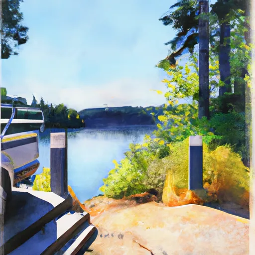
3041 E Mason Lake Dr E, Grapeview, Wa 98546 Boat Launch
Community Reviews
Been here? Share the conditions.
Reviews, ratings & photos are added in the free Snoflo iOS app — rate a spot, tag the conditions, and your visit is verified by location. Add or manage your reviews from the app.
3041 E Mason Lake Dr E, Grapeview, Wa 98546
As per the regulations posted by the Washington Department of Fish and Wildlife, motorized and non-motorized boats are allowed on the lake. However, they should comply with the state boating laws and regulations, including carrying appropriate safety equipment, having valid registration, and not exceeding the maximum horsepower limit. The fish species that can be caught in the lake include rainbow trout, largemouth bass, smallmouth bass, yellow perch, and black crappie, among others.
It is important to note that the accuracy of this information may vary over time, and it is advisable to check with the relevant authorities before planning a trip to the boat ramp.
Plan your launch down to the hour
Same weather feed Snoflo's iOS app uses -- updated continuously from NOAA / yr.no.
Next 5 days, hour by hour
Temperature line with weather symbols on top, snow + rain accumulation as columns, humidity as a dotted line.
5-day forecast table
Every 3 hours, broken out across temperature, snow, rain, humidity, and wind.
| Time | Condition | Temp (°F) | Snow (in) | Rain (in) | Humidity (%) | Wind (mps) | Wind dir |
|---|---|---|---|---|---|---|---|
| Loading detailed forecast… | |||||||
15-day temperature & precipitation
Daily temperatures, snow, and rain projected over the next two weeks.
Area streamflow levels
USGS streamgauges around 3041 E Mason Lake Dr E, Grapeview, Wa 98546 -- the same readings that determine whether your launch is safe and your boat is the right craft.
| Streamgauge | Discharge | View |
|---|---|---|
| Huge Creek Near Wauna | 5 cfs | → |
| Skokomish River Near Potlatch | 223 cfs | → |
| North Fork Skokomish River Near Potlatch | 157 cfs | → |
| South Fork Skokomish River Near Union | 126 cfs | → |
| Chambers Creek Bl Leach Creek Near Steilacoom | 54 cfs | → |
| Leach Creek Near Fircrest | 1 cfs | → |
Plan a longer trip
The closest paddle runs, fishing spots, and other boat launches so you can extend a day on the water.
River runs
- Headwaters- Includes All Tributaries To Confluence With North Fork Skokomish River
- Brothers Wilderness Boundary To Olympic Nf Boundary
- Headwaters To Confluence With North Fork Skokomish River
- Olympic Nf/Olympic Np Bounary To Brothers Wilderness Boundary
- Headwaters To Southern Boundary Of Olympic National Park
Boating safety & etiquette
- Check the conditions before you launch
- Use the streamflow numbers, weather, and wind forecast on this page. High-cfs whitewater requires whitewater-specific craft and skill.
- Wear your life jacket
- Statistically the single biggest survival factor in a boating incident. State law often requires one per passenger.
- File a float plan
- Tell someone on shore your put-in, take-out, and expected return time. Especially for multi-day or remote trips.
- Yield at the ramp
- Prep gear in the parking lot, not on the ramp. Launch and clear quickly so others can use the lane.
- Clean, drain, dry
- Inspect, clean, drain and dry your boat between waters to prevent the spread of aquatic invasive species.
Set push alerts in the Snoflo app
Save 3041 E Mason Lake Dr E, Grapeview, Wa 98546 as a favorite, set a discharge threshold or a wind/precipitation alert, and the iOS app will push the moment conditions cross.
About 3041 E Mason Lake Dr E, Grapeview, Wa 98546
Can I launch a motorboat here?
Most Snoflo-tracked launches support motorboats; check the operator for any horsepower restrictions, paddle-only zones, or seasonal closures.
How fresh is the streamflow data?
USGS streamgauges report continuously (every 15 minutes); the table on this page pulls the latest reading at page load.
Is there a fee?
Many federal and state boat launches charge a day-use fee. Check the operator's site before driving out.
What boat is right for these conditions?
Use the nearby streamflow numbers and river-run panel on this page to gauge current conditions. Wider, slower water is friendly for casual paddling and powerboats; high-cfs whitewater requires whitewater-specific craft and skill.
Can I get alerts when conditions change?
Yes -- alerts are managed in the Snoflo iOS app. Favorite this launch, set a threshold (discharge, wind), and you'll get a push the moment it crosses.
Other launches near here
Snoflo-tracked boat launches within driving distance of 3041 E Mason Lake Dr E, Grapeview, Wa 98546.