CHICO FLAT
Amenities
•
Weather
•
Recreation
CAMPING
•
CALIFORNIA
Chico Flat
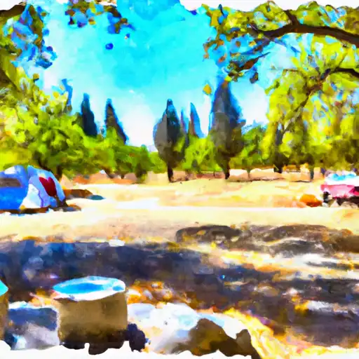
Chico Flat Camping Area is located in California's Mendocino National Forest and offers stunning views of the surrounding mountains and river. Nearby activities include hiking, fishing, and swimming in the nearby river. The campground has 32 first-come-first-serve campsites, each with a fire pit and picnic table. Amenities include vault toilets and potable water, but no showers. The best time to visit is during the summer months when temperatures range from 80-90 degrees Fahrenheit during the day and drop to 50-60 degrees at night. Overall, Chico Flat is a great spot for a rustic camping experience in a beautiful setting.
Weather Outlook
16 Day Long Term Forecast
Regional Streamflow Levels
Rafting & Kayaking
MAINSTREAM - HEADWATERS TO CONFLUENCE WITH COOPER CANYON
Antelope-Fremont Valleys Watershed, California
MIDDLE FORK - COMMANCHE CAMPSITE TO MIDDLE FORK TRAILHEAD
Santa Ana Watershed, California
WEST FORK - HEADWATERS (SE 1/4, NE 1/4, SEC 14, T2N, R12W) TO COGSWELL RESERVOIR (NE 1/4, SW 1/4, SEC 24, T2N, R9W
Los Angeles Watershed, California
NORTH FORK - CONFLUENCE OF SOLDIER AND COLDBROOK CREEKS (SE1/4,SW1/4, SEC) 5, T2N,,R9W TO CONFLLUENCE WITH WEST FORK OF SAN GABRIEL (SW 1/4,SW1/4, SEC 17, T2N, R8W)
San Gabriel Watershed, California
LAUREL GULCH TO CONFLUENCE WITH MINEO CANYON (SE 1/4, SW 1/4, SEC 17, T2N, R8W)
San Gabriel Watershed, California
HEADWATERS IN THE SANTA MONICA MOUNTAINS TO MOUTH AT PACIFIC OCEAN
Santa Monica Bay Watershed, California
MAINSTREAM - CONFLUENCE WITH COOPER CANYON TO CONFLUENCE WIT SOUTH FORK LITTLE ROCK CREEK
Antelope-Fremont Valleys Watershed, California
COOPER CANYON- NEAR STATE HIGHWAY 2 (SW 1/4, NE 1/4, SEC 16, T3N, R10W TO CONFLUENCE WITH LITTLE ROCK CREEK
Antelope-Fremont Valleys Watershed, California
EAST FORK - CONFLUENCE OF VINCENT GULCH AND PRAIRIE FORK (NW 1/4, SW 1/4 SEC 16 ) TO LAUREL GULCH (NW 1/4, SW 1/4, SEC 17, T2N, R8W)
San Gabriel Watershed, California
GAGING STATION BELOW SPILLWAY OF COGSWELL DAM (NE 1/4, SE 1/4, SEC 19, T2N, R10W) TO CONFLUENCE WITH NF SAN GABRIEL RIVER (SW 1/4.SW 1/4, SEC 15, T2N, R9W)
San Gabriel Watershed, California
Leave A Review
Chico Flat
Submit
×
Delete User Account
Deleting your account will permanently remove all your data including preferences, favorites, alerts, and any subscriptions.
I am sure I want to delete my account
×
We recently sent an account verification email to
.
Please follow the instructions in the email to verify your account.
×
Favorite Limit Reached
Your free user account comes with 3 free favorites.
Manage Your Favorites
×