Dirt Flat
April 28, 2024
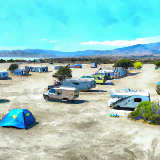
Located in the state of California, Dirt Flat camping area offers a serene and picturesque camping experience. This campground boasts several amenities to ensure a comfortable stay for campers. It provides clean restrooms and shower facilities, picnic tables, and fire rings for cooking and campfires. Additionally, potable water is available on-site, which is a great convenience for campers. The campground does not accept reservations and operates on a first-come, first-served basis. Therefore, it is advisable to arrive early, especially during peak seasons, to secure a campsite.
The best time to visit Dirt Flat camping area is during the spring and fall seasons when the weather is pleasant, and the campground is less crowded. It is important to note that during the summer months, the area can experience high temperatures, so it is recommended to plan accordingly and bring ample water and sun protection. While visiting, campers can enjoy various outdoor activities such as hiking, fishing, and wildlife viewing. The nearby trails offer stunning views of the surrounding landscape, making it an ideal destination for nature enthusiasts. However, it is crucial to be cautious of wildlife encounters and to properly store food and garbage to avoid attracting animals to the camping area.
In conclusion, Dirt Flat camping area in California provides campers with a range of amenities including restrooms, picnic tables, fire rings, and potable water. As reservations are not accepted, it is recommended to arrive early for a campsite. Spring and fall are the optimal seasons to visit, while summer months can be hot. Visitors can enjoy outdoor activities such as hiking and fishing, but should also be mindful of wildlife and properly store food and garbage.