Cholla Campground Campground
Community Reviews
Been here? Share the conditions.
Reviews, ratings & photos are added in the free Snoflo iOS app — rate a spot, tag the conditions, and your visit is verified by location. Add or manage your reviews from the app.
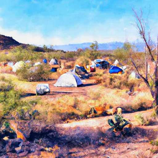
Cholla Campground
Reservations are accepted at Cholla Campground, ensuring campers can secure a spot in advance. However, it is important to note that the campground operates on a first-come, first-served basis during the off-peak season. The peak season typically runs from October to April, offering cooler temperatures and pleasant weather. During this time, Cholla Campground tends to be more crowded, so advanced reservations are recommended.
Visitors to Cholla Campground can partake in a variety of activities, such as hiking, fishing, and wildlife viewing. The nearby Saguaro Lake offers opportunities for boating and water sports. However, it is important to be cautious of the area's wildlife, particularly the presence of rattlesnakes and scorpions. Following safety guidelines and being aware of surroundings is crucial when exploring the camping area.
In summary, Cholla Campground in Arizona's Tonto National Forest provides a range of amenities, accepts reservations, and is best visited during the cooler months. Campers can enjoy activities such as hiking, fishing, and boating, while remaining cautious of local wildlife.
What's on-site at Cholla Campground
Key facilities Snoflo tracks for this campground. Confirm with the operator before booking -- amenities can change seasonally.
Plan your trip down to the hour
Same weather feed Snoflo's iOS app uses -- updated continuously from NOAA / yr.no.
Next 5 days, hour by hour
Temperature line with weather symbols on top, snow + rain accumulation as columns, humidity as a dotted line.
5-day forecast table
Every 3 hours, broken out across temperature, snow, rain, humidity, and wind. Each cell is colour-coded relative to the column min/max so trends jump out at a glance.
| Time | Condition | Temp (°F) | Snow (in) | Rain (in) | Humidity (%) | Wind (mps) | Wind dir |
|---|---|---|---|---|---|---|---|
| Loading detailed forecast… | |||||||
15-day temperature & precipitation
Daily temperatures, snow, and rain projected over the next two weeks. Hover any point for the full breakdown.
Other campgrounds in the area
Snoflo-tracked campsites within driving distance of Cholla Campground, with reservations status.
| Campground | Reservations | Toilets | View |
|---|---|---|---|
| Cholla | ✗ | ✗ | → |
| Cholla Bay Dispersed | ✗ | ✗ | → |
| Cholla Bay | ✗ | ✓ | → |
| Bachelors Cove | ✗ | ✓ | → |
| Bachelor Cove Dispersed | ✗ | ✗ | → |
Nearby streamflow
USGS streamgauges within reach of Cholla Campground -- pulled live from the National Water Information System.
| Streamgauge | Discharge | View |
|---|---|---|
| South Fork Parker Creek Near Roosevelt | · | → |
| Salt River Near Roosevelt | 669 cfs | → |
| Tonto Creek Abv Gun Creek | 432 cfs | → |
| Sycamore Creek Near Fort Mcdowell | 11 cfs | → |
| Pinal Creek At Inspiration Dam | 13 cfs | → |
| Pinto Creek Near Miami | 252 cfs | → |
Nearby snow depths
NRCS SNOTEL stations within reach of Cholla Campground -- relevant when planning a shoulder-season or alpine trip.
| SNOTEL station | Snowpack | 24h Snowfall | View |
|---|---|---|---|
| Workman Creek | 0.0 in | 0.0 in | → |
| Fountain Hills 1.2 Nne | 0.0 in | 0.0 in | → |
| Promontory | 0.0 in | 0.0 in | → |
| Heber | 1.0 in | 0.0 in | → |
Plan a longer trip
The closest parks, lakes, boat launches, and paddle runs so a camping night can grow into a full weekend.
Parks
- Tonto National Monument
- Wilderness Salome
- Wilderness Four Peaks
- Wilderness Salt River Canyon
- Wilderness Sierra Ancha
- Wilderness Mazatzal
Boat launches
- Roosevelt Lake - 3
- Roosevelt Lake - 2
- Roosevelt Lake - 1
- Roosevelt Lake - 4
- Roosevelt Lake - 5
- Service Road 183 Maricopa County
Fishing spots
- Theodore Roosevelt Lake
- Cherry Creek
- Bartlett Reservoir
- South Fork Deadman Creek
- Deadman Creek
- Queen Creek
Points of interest
- Lower Cliff Dwelling
- Upper Cliff Dwelling
- Black Rock
- Circlestone
- Kvit-Fm (Apache Junction)
- Peephole And Little Arch
Paddle runs
- Salome Wilderness Boundary To Confluence With Salome Creek
- Confluence With Turkey Creek To Forest Road 60 Just Above Tin Hat Ranch
- Rock Springs To Confluence With Cottonwood Wash
- Workman Falls To Salome Wilderness Boundary
- Southwest Boundary Of Salt River Canyon Wilderness To State Highway 288 Bridge
- West Boundary Of Fort Apache Indian Reservation To Southwest Boundary Of Salt River Canyon Wilderness
Camping essentials & Leave No Trace
- Pack it in, pack it out
- Take all trash, food scraps, and gear back with you to keep campsites clean and protect wildlife.
- Respect wildlife
- Observe animals from a distance, store food securely, and never feed wildlife to maintain natural behavior and safety.
- Know before you go
- Check weather, fire restrictions, trail conditions, and permit requirements to ensure a safe and well-planned trip.
- Minimize campfire impact
- Use established fire rings, keep fires small, fully extinguish them, or opt for a camp stove when fires are restricted.
- Leave what you find
- Preserve natural and cultural features by avoiding removal of plants, rocks, artifacts, or other elements of the environment.
Set push alerts in the Snoflo app
Save Cholla Campground as a favorite, set a custom threshold (precipitation, snowpack, freezing temperatures), and the iOS app will push the moment conditions cross.
About Cholla Campground
Can I make reservations at Cholla Campground?
Yes -- this campground accepts reservations. Snoflo recommends booking early for peak season; check the operator (Recreation.gov / state park system / private operator) for the booking window and cancellation policy.
How fresh is the weather data on this page?
The hourly forecast updates throughout the day from the NOAA / yr.no public feeds. Streamflow data is pulled live from USGS streamgauges and snowpack from the NRCS SNOTEL network.
What's the best time of year to visit?
Use the 15-day temperature & precipitation outlook on this page to plan -- pick a window with comfortable temperatures and low precipitation. For longer trips, the 5-day hourly meteogram shows snow + rain accumulation hour-by-hour.
How do I get to Cholla Campground?
Tap Directions in the hero above to open driving directions in Google Maps, or Open in map to center the Snoflo interactive map on the campground.
Can I get alerts when conditions change?
Yes -- alerts are managed through the Snoflo iOS app. Favorite this campground, set a threshold (temperature, snowpack, precipitation), and you'll get a push the moment it crosses.
Other campgrounds near here
Snoflo-tracked campgrounds within driving distance of Cholla Campground.