Crossroads Campground
Community Reviews
Been here? Share the conditions.
Reviews, ratings & photos are added in the free Snoflo iOS app — rate a spot, tag the conditions, and your visit is verified by location. Add or manage your reviews from the app.
Crossroads
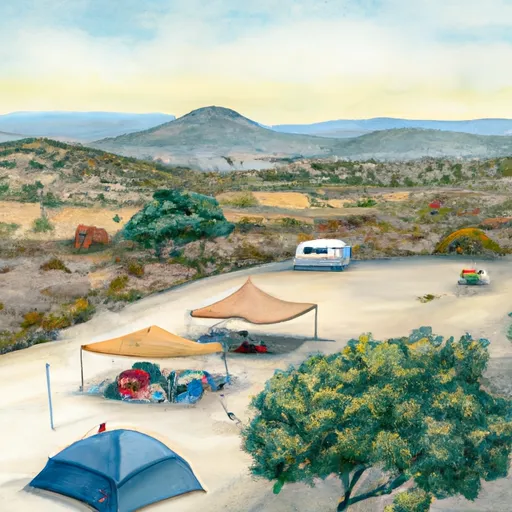
Reservations are accepted at Crossroads Camping Area, allowing campers to secure their desired dates in advance. This is particularly important during peak seasons when the campground can get crowded. It is recommended to make reservations well in advance to ensure availability.
The best time to visit Crossroads Camping Area is during the spring and fall seasons when the weather is mild and pleasant. Summers can be hot and dry, while winters can be cold and rainy, making these seasons less ideal for camping.
While visiting Crossroads Camping Area, campers can enjoy exploring the surrounding area, which offers stunning natural landscapes and opportunities for hiking, fishing, and wildlife viewing. However, it is important to be cautious of wildlife and take necessary precautions to ensure a safe camping experience. Additionally, campers should be mindful of any fire regulations in place and practice proper fire safety protocols.
In conclusion, Crossroads Camping Area in California provides campers with various amenities, accepts reservations, and is best visited during the spring and fall seasons. With its picturesque surroundings and recreational activities, it is an excellent destination for nature enthusiasts.
What's on-site at Crossroads
Key facilities Snoflo tracks for this campground. Confirm with the operator before booking -- amenities can change seasonally.
Plan your trip down to the hour
Same weather feed Snoflo's iOS app uses -- updated continuously from NOAA / yr.no.
Next 5 days, hour by hour
Temperature line with weather symbols on top, snow + rain accumulation as columns, humidity as a dotted line.
5-day forecast table
Every 3 hours, broken out across temperature, snow, rain, humidity, and wind. Each cell is colour-coded relative to the column min/max so trends jump out at a glance.
| Time | Condition | Temp (°F) | Snow (in) | Rain (in) | Humidity (%) | Wind (mps) | Wind dir |
|---|---|---|---|---|---|---|---|
| Loading detailed forecast… | |||||||
15-day temperature & precipitation
Daily temperatures, snow, and rain projected over the next two weeks. Hover any point for the full breakdown.
Other campgrounds in the area
Snoflo-tracked campsites within driving distance of Crossroads, with reservations status.
| Campground | Reservations | Toilets | View |
|---|---|---|---|
| Crossroads Campsite 26 | ✗ | ✗ | → |
| Crossroads Campsite 25 | ✗ | ✗ | → |
| Crossroads Campsite 24 | ✗ | ✗ | → |
| Crossroads Campsite 8 | ✗ | ✗ | → |
| Crossroads Campsite 23 | ✗ | ✗ | → |
Nearby streamflow
USGS streamgauges within reach of Crossroads -- pulled live from the National Water Information System.
| Streamgauge | Discharge | View |
|---|---|---|
| C.R.I.R. Main Canal Nr Parker | 1,290 cfs | → |
| Colorado River Below Parker Dam | 2,300 cfs | → |
| Bill Williams River Near Parker | · | → |
| Gardner Lateral Spill Near Parker | 8 cfs | → |
| Poston Wasteway Near Poston | 30 cfs | → |
| Bill Williams River Below Alamo Dam | 34 cfs | → |
Plan a longer trip
The closest parks, lakes, boat launches, and paddle runs so a camping night can grow into a full weekend.
Parks
- Buckskin Mountain State Park
- Cattail Cove State Park
- Gibraltar Mountain Wilderness
- Lake Havasu State Park
- Bill Williams River National Wildlife Refuge
- Whipple Mountains Wilderness
Boat launches
- Rio Del Colorado
- Rock House Recreation Area Boat Launch
- Parker Dam Road 52650-52900, Earp
- River Land Resort
- Emerald Cove Resort/Colorado River Adventures
- Echo Lodge Resort
Points of interest
- Parker Dam Road Backcountry Byway Cross Roads
- Parker Dam Road Backcountry Byway Burro Flats
- Parker Dam Road Backcountry Byway Bullfrog
- Parker Dam Road Backcountry Byway Bristoll Springs
- Parker Dam Road Backcountry Byway Quail Hollow
- Monkeyhead Flat Wildlife Viewing Area
Camping essentials & Leave No Trace
- Pack it in, pack it out
- Take all trash, food scraps, and gear back with you to keep campsites clean and protect wildlife.
- Respect wildlife
- Observe animals from a distance, store food securely, and never feed wildlife to maintain natural behavior and safety.
- Know before you go
- Check weather, fire restrictions, trail conditions, and permit requirements to ensure a safe and well-planned trip.
- Minimize campfire impact
- Use established fire rings, keep fires small, fully extinguish them, or opt for a camp stove when fires are restricted.
- Leave what you find
- Preserve natural and cultural features by avoiding removal of plants, rocks, artifacts, or other elements of the environment.
Set push alerts in the Snoflo app
Save Crossroads as a favorite, set a custom threshold (precipitation, snowpack, freezing temperatures), and the iOS app will push the moment conditions cross.
About Crossroads
Can I make reservations at Crossroads?
This campground does not appear to accept reservations -- it's typically first-come, first-served. Arrive early on summer weekends.
How fresh is the weather data on this page?
The hourly forecast updates throughout the day from the NOAA / yr.no public feeds. Streamflow data is pulled live from USGS streamgauges and snowpack from the NRCS SNOTEL network.
What's the best time of year to visit?
Use the 15-day temperature & precipitation outlook on this page to plan -- pick a window with comfortable temperatures and low precipitation. For longer trips, the 5-day hourly meteogram shows snow + rain accumulation hour-by-hour.
How do I get to Crossroads?
Tap Directions in the hero above to open driving directions in Google Maps, or Open in map to center the Snoflo interactive map on the campground.
Can I get alerts when conditions change?
Yes -- alerts are managed through the Snoflo iOS app. Favorite this campground, set a threshold (temperature, snowpack, precipitation), and you'll get a push the moment it crosses.
Other campgrounds near here
Snoflo-tracked campgrounds within driving distance of Crossroads.