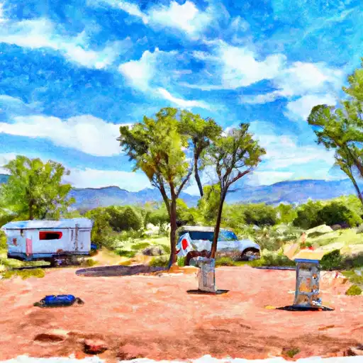
Dead Horse Ranch State Park campground
Community Reviews
Been here? Share the conditions.
Reviews, ratings & photos are added in the free Snoflo iOS app — rate a spot, tag the conditions, and your visit is verified by location. Add or manage your reviews from the app.
Dead Horse Ranch State Park
Reservations are accepted at Dead Horse Ranch State Park, allowing visitors to secure their preferred campsite in advance. This is particularly recommended during peak seasons and weekends when the campground tends to fill up quickly. The best time to visit the park is during the spring and fall months when the weather is mild and pleasant. Summers can be extremely hot, so it is advisable to plan outdoor activities accordingly and stay hydrated.
Dead Horse Ranch State Park offers several attractions for campers to explore. The park features over 20 miles of trails that are suitable for hiking, mountain biking, and horseback riding. The nearby Verde River provides opportunities for canoeing and kayaking. Wildlife enthusiasts will appreciate the chance to observe various species of birds and mammals in their natural habitat. However, it is important to be cautious of rattlesnakes, as they can occasionally be encountered in the area. Overall, Dead Horse Ranch State Park offers a scenic and well-equipped camping experience for nature lovers in Arizona.
What's on-site at Dead Horse Ranch State Park
Key facilities Snoflo tracks for this campground. Confirm with the operator before booking -- amenities can change seasonally.
Plan your trip down to the hour
Same weather feed Snoflo's iOS app uses -- updated continuously from NOAA / yr.no.
Next 5 days, hour by hour
Temperature line with weather symbols on top, snow + rain accumulation as columns, humidity as a dotted line.
5-day forecast table
Every 3 hours, broken out across temperature, snow, rain, humidity, and wind. Each cell is colour-coded relative to the column min/max so trends jump out at a glance.
| Time | Condition | Temp (°F) | Snow (in) | Rain (in) | Humidity (%) | Wind (mps) | Wind dir |
|---|---|---|---|---|---|---|---|
| Loading detailed forecast… | |||||||
15-day temperature & precipitation
Daily temperatures, snow, and rain projected over the next two weeks. Hover any point for the full breakdown.
Other campgrounds in the area
Snoflo-tracked campsites within driving distance of Dead Horse Ranch State Park, with reservations status.
| Campground | Reservations | Toilets | View |
|---|---|---|---|
| Mingus Mountain Campground | ✗ | ✗ | → |
| Thousand Trails Rd Dispersed | ✗ | ✗ | → |
| Mingus Mountain | ✗ | ✓ | → |
| Playground Group Campground | ✗ | ✗ | → |
| Coconino National Forest | ✗ | ✗ | → |
Nearby streamflow
USGS streamgauges within reach of Dead Horse Ranch State Park -- pulled live from the National Water Information System.
| Streamgauge | Discharge | View |
|---|---|---|
| Verde River Near Clarkdale | 55 cfs | → |
| Oak Creek Near Cornville | 23 cfs | → |
| Dry Beaver Creek Near Rimrock | · | → |
| Oak Creek Near Sedona | 35 cfs | → |
| Wet Beaver Creek Near Rimrock | 8 cfs | → |
| Verde River Near Paulden | 20 cfs | → |
Nearby snow depths
NRCS SNOTEL stations within reach of Dead Horse Ranch State Park -- relevant when planning a shoulder-season or alpine trip.
| SNOTEL station | Snowpack | 24h Snowfall | View |
|---|---|---|---|
| Nohrsc Prescott Valley 4.0 Nnw | 0.0 in | 0.0 in | → |
| Nohrsc Prescott Valley 2.4 Nw | 0.0 in | 0.0 in | → |
| Nohrsc Prescott Valley 1.0 W | 0.5 in | 0.5 in | → |
| Nohrsc Fry | 0.0 in | 0.0 in | → |
| Fry | 0.0 in | 0.0 in | → |
| Bar M | 1.0 in | 1.0 in | → |
Plan a longer trip
The closest parks, lakes, boat launches, and paddle runs so a camping night can grow into a full weekend.
Parks
- Dead Horse Ranch State Park
- Tuzigoot National Monument
- Cottonwood Kids Park
- Jerome State Historic Park
- Windmill Park
- Wilderness Sycamore Canyon
Boat launches
- Pheasant Road Cottonwood
- East Lagoon Loop Trail Cottonwood
- White Bridge Picnic Site And Boat Launch
- Clear Creek Fishing Site
- J.D. Dam Lake
- Beasley Flat Picnic Site
Fishing spots
- Prairie Lane Fishing Site
- Skidmore Day Use Fishing Site
- Black Canyon Fishing Site
- Bignotti Picnic Site
- Sheeps Crossing Fishing Site
- Mingus Lake Day Use / Fishing Site
Points of interest
- Lakes Of The Valley
- Life And Death At Tuzigoot
- Inside Living
- Rooftop Living
- Late Pueblo Architecture
- Trade
Paddle runs
- White Bridge To Beasley Flat
- Indian Gardens
- Wet Beaver Creek Wilderness Boundary To Private Land In Sec 32, T15n, R6e
- Headwaters In Sec 14, T19n, R5e To Confluence With Oak Creek
- Prescott National Forest Boundary To North Edge Of Private Land In Sec 33, T17n, R3e, Near Clarkdale
- Clear Creek Wilderness Boundary To Dispersed Camping Area At Clear Creek Campground
Camping essentials & Leave No Trace
- Pack it in, pack it out
- Take all trash, food scraps, and gear back with you to keep campsites clean and protect wildlife.
- Respect wildlife
- Observe animals from a distance, store food securely, and never feed wildlife to maintain natural behavior and safety.
- Know before you go
- Check weather, fire restrictions, trail conditions, and permit requirements to ensure a safe and well-planned trip.
- Minimize campfire impact
- Use established fire rings, keep fires small, fully extinguish them, or opt for a camp stove when fires are restricted.
- Leave what you find
- Preserve natural and cultural features by avoiding removal of plants, rocks, artifacts, or other elements of the environment.
Set push alerts in the Snoflo app
Save Dead Horse Ranch State Park as a favorite, set a custom threshold (precipitation, snowpack, freezing temperatures), and the iOS app will push the moment conditions cross.
About Dead Horse Ranch State Park
Can I make reservations at Dead Horse Ranch State Park?
Yes -- this campground accepts reservations. Snoflo recommends booking early for peak season; check the operator (Recreation.gov / state park system / private operator) for the booking window and cancellation policy.
How fresh is the weather data on this page?
The hourly forecast updates throughout the day from the NOAA / yr.no public feeds. Streamflow data is pulled live from USGS streamgauges and snowpack from the NRCS SNOTEL network.
What's the best time of year to visit?
Use the 15-day temperature & precipitation outlook on this page to plan -- pick a window with comfortable temperatures and low precipitation. For longer trips, the 5-day hourly meteogram shows snow + rain accumulation hour-by-hour.
How do I get to Dead Horse Ranch State Park?
Tap Directions in the hero above to open driving directions in Google Maps, or Open in map to center the Snoflo interactive map on the campground.
Can I get alerts when conditions change?
Yes -- alerts are managed through the Snoflo iOS app. Favorite this campground, set a threshold (temperature, snowpack, precipitation), and you'll get a push the moment it crosses.
Other campgrounds near here
Snoflo-tracked campgrounds within driving distance of Dead Horse Ranch State Park.