Grapevine Canyon Ohv Road 4n16 Campground
Community Reviews
Been here? Share the conditions.
Reviews, ratings & photos are added in the free Snoflo iOS app — rate a spot, tag the conditions, and your visit is verified by location. Add or manage your reviews from the app.
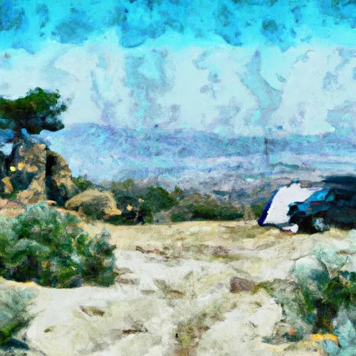
Grapevine Canyon Ohv Road 4n16
Reservations are not required at Grapevine Canyon OHV Road 4N16 camping area. The campground operates on a first-come, first-served basis, so visitors can choose their preferred camping spot upon arrival. However, it is advisable to arrive early, especially during peak seasons, as the campground can fill up quickly.
The best time to visit Grapevine Canyon OHV Road 4N16 camping area is during the spring and fall months when the weather is mild and pleasant. Summers can get extremely hot, so it is recommended to plan accordingly and bring plenty of water and sunscreen. Additionally, campers should be cautious of the rugged terrain and ensure they have proper navigation tools and equipment. It is also essential to respect the environment and follow all OHV regulations to preserve the natural beauty of the area.
What's on-site at Grapevine Canyon Ohv Road 4n16
Key facilities Snoflo tracks for this campground. Confirm with the operator before booking -- amenities can change seasonally.
Plan your trip down to the hour
Same weather feed Snoflo's iOS app uses -- updated continuously from NOAA / yr.no.
Next 5 days, hour by hour
Temperature line with weather symbols on top, snow + rain accumulation as columns, humidity as a dotted line.
5-day forecast table
Every 3 hours, broken out across temperature, snow, rain, humidity, and wind. Each cell is colour-coded relative to the column min/max so trends jump out at a glance.
| Time | Condition | Temp (°F) | Snow (in) | Rain (in) | Humidity (%) | Wind (mps) | Wind dir |
|---|---|---|---|---|---|---|---|
| Loading detailed forecast… | |||||||
15-day temperature & precipitation
Daily temperatures, snow, and rain projected over the next two weeks. Hover any point for the full breakdown.
Other campgrounds in the area
Snoflo-tracked campsites within driving distance of Grapevine Canyon Ohv Road 4n16, with reservations status.
| Campground | Reservations | Toilets | View |
|---|---|---|---|
| Horse Springs | ✗ | ✓ | → |
| Big Pine Flat Family Campground | ✗ | ✗ | → |
| Big Pine Flat | ✗ | ✓ | → |
| Big Pine Flat Campground | ✗ | ✗ | → |
| Big Pine Flat Equestrian Group Campground | ✓ | ✗ | → |
Nearby streamflow
USGS streamgauges within reach of Grapevine Canyon Ohv Road 4n16 -- pulled live from the National Water Information System.
| Streamgauge | Discharge | View |
|---|---|---|
| Deep C Nr Hesperia Ca | 2 cfs | → |
| Wf Mojave R Ab Mojave R Forks Res Nr Hesperia Ca | · | → |
| City C Nr Highland Ca | 0 cfs | → |
| Waterman Cyn C Nr Arrowhead Spgs Ca | 0 cfs | → |
| Sand Canyon C Nr Highland Ca | 1 cfs | → |
| Plunge C Nr East Highlands Ca | 1 cfs | → |
Nearby snow depths
NRCS SNOTEL stations within reach of Grapevine Canyon Ohv Road 4n16 -- relevant when planning a shoulder-season or alpine trip.
| SNOTEL station | Snowpack | 24h Snowfall | View |
|---|---|---|---|
| Lake Arrowhead 1.5 Se | 0.0 in | 0.0 in | → |
| Hesperia 1ene | 0.0 in | 0.0 in | → |
| Johnson Valley | 0.0 in | 0.0 in | → |
| Barstow Fire Station | 0.0 in | 0.0 in | → |
Plan a longer trip
The closest parks, lakes, boat launches, and paddle runs so a camping night can grow into a full weekend.
Parks
- Dana Point Park
- Mendel Park
- Grout Bay Park
- Horsemen's Center Park
- Arrowbear Park Ball Field
- Don Ferrarese Park
Boat launches
- Duane Boyer (West)
- Holloway's Marina, Inc.
- Pleasure Point Landing
- Lake Arrowhead Yacht Club
- Big Bear Marina
- Pine Knot Landing
Fishing spots
Camping essentials & Leave No Trace
- Pack it in, pack it out
- Take all trash, food scraps, and gear back with you to keep campsites clean and protect wildlife.
- Respect wildlife
- Observe animals from a distance, store food securely, and never feed wildlife to maintain natural behavior and safety.
- Know before you go
- Check weather, fire restrictions, trail conditions, and permit requirements to ensure a safe and well-planned trip.
- Minimize campfire impact
- Use established fire rings, keep fires small, fully extinguish them, or opt for a camp stove when fires are restricted.
- Leave what you find
- Preserve natural and cultural features by avoiding removal of plants, rocks, artifacts, or other elements of the environment.
Set push alerts in the Snoflo app
Save Grapevine Canyon Ohv Road 4n16 as a favorite, set a custom threshold (precipitation, snowpack, freezing temperatures), and the iOS app will push the moment conditions cross.
About Grapevine Canyon Ohv Road 4n16
Can I make reservations at Grapevine Canyon Ohv Road 4n16?
This campground does not appear to accept reservations -- it's typically first-come, first-served. Arrive early on summer weekends.
How fresh is the weather data on this page?
The hourly forecast updates throughout the day from the NOAA / yr.no public feeds. Streamflow data is pulled live from USGS streamgauges and snowpack from the NRCS SNOTEL network.
What's the best time of year to visit?
Use the 15-day temperature & precipitation outlook on this page to plan -- pick a window with comfortable temperatures and low precipitation. For longer trips, the 5-day hourly meteogram shows snow + rain accumulation hour-by-hour.
How do I get to Grapevine Canyon Ohv Road 4n16?
Tap Directions in the hero above to open driving directions in Google Maps, or Open in map to center the Snoflo interactive map on the campground.
Can I get alerts when conditions change?
Yes -- alerts are managed through the Snoflo iOS app. Favorite this campground, set a threshold (temperature, snowpack, precipitation), and you'll get a push the moment it crosses.
Other campgrounds near here
Snoflo-tracked campgrounds within driving distance of Grapevine Canyon Ohv Road 4n16.