Below 2w01 Crossing To Mojave Reservoir River Run
Community Reviews
Been here? Share the conditions.
Reviews, ratings & photos are added in the free Snoflo iOS app — rate a spot, tag the conditions, and your visit is verified by location. Add or manage your reviews from the app.
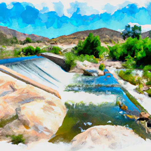
Below 2w01 Crossing To Mojave Reservoir
Some of the specific river rapids and obstacles that paddlers will encounter on this section of the river include "Sledgehammer," a Class IV rapid with a steep drop and powerful hydraulics, and "The Chute," a Class V rapid with a narrow channel and steep drops. Paddlers should also be prepared for numerous boulder gardens and technical rapids throughout the run.
It is important to note that the Whitewater River Run is located in the San Bernardino National Forest, and specific regulations apply to the area. Permits are required for all overnight camping, and all visitors must abide by Leave No Trace principles. Additionally, there are restrictions on campfires, and all food and trash must be stored in bear-resistant containers.
Plan your run down to the hour
Same weather feed Snoflo's iOS app uses -- updated continuously from NOAA / yr.no. Watch the precipitation column on the meteogram; rain ahead of a run typically lifts flows 12-48 hours later depending on the basin.
Next 5 days, hour by hour
Temperature line with weather symbols on top, snow + rain accumulation as columns, humidity as a dotted line.
5-day forecast table
Every 3 hours, broken out across temperature, snow, rain, humidity, and wind. Each cell is colour-coded relative to the column min/max.
| Time | Condition | Temp (°F) | Snow (in) | Rain (in) | Humidity (%) | Wind (mps) | Wind dir |
|---|---|---|---|---|---|---|---|
| Loading detailed forecast… | |||||||
15-day temperature & precipitation
Daily temperatures, snow, and rain projected over the next two weeks -- the upstream story that drives next week's flows.
Regional streamflow levels
USGS streamgauges around Below 2w01 Crossing To Mojave Reservoir -- useful for spotting upstream pulses and gauging which tributary is contributing what.
| Streamgauge | Discharge | View |
|---|---|---|
| Deep C Nr Hesperia Ca | 1 cfs | → |
| Wf Mojave R Ab Mojave R Forks Res Nr Hesperia Ca | · | → |
| Waterman Cyn C Nr Arrowhead Spgs Ca | 0 cfs | → |
| Devil Cyn C Nr San Bernardino Ca | 1 cfs | → |
| E Twin C Nr Arrowhead Springs Ca | 0 cfs | → |
| Sand Canyon C Nr Highland Ca | 1 cfs | → |
Plan a longer trip
The closest boat launches, other paddle runs, and campgrounds so a day on the water can grow into a full weekend.
Boat launches
- Lake Arrowhead Yacht Club
- Silverwood Lake Marina
- Pacific Crest Trail, Hesperia
- Duane Boyer (West)
- Pleasure Point Landing
- Holloway's Marina, Inc.
Other river runs
- Below Deep Creek Lake To Below 2w01 Crossing
- Nfsr 3n16 To Confluence With Deep Creek
- Big Bear Dam To Private Land In Sec 19, T1n, R1w
- Bluff Lake To Confluence With Bear Creek
- Filaree Flat To Confluence With Bear Creek
Campgrounds
- Coyote Bluff Group Camping Area
- Juniper Flats Group Camping Area
- Camping Area
- Mesa Group Camping Area
- Mojave River Forks Regional Park
- Trailer & Rv Area
Fishing spots
- Silverwood Lake
- Lake Gregory
- Lake Gregory County Regional Park
- Silverwood Lake State Recreation Area
- Deep Creek
- Green Valley Lake
Whitewater safety
- Check the flow before you run
- Use the linked-gauge card and Regional Flow panel above. Class ratings change with flow -- a Class III at low water can become Class IV+ at high water.
- Know your skill ceiling
- Pick runs comfortably below your ceiling. Cold-water and big-water runs raise the consequences of any mistake.
- Wear the right gear
- Helmet, PFD, drysuit / wetsuit when water is below 60°F. Throw bag, knife, and whistle on your person, not in the boat.
- Scout, set safety, and run with a team
- Scout new rapids on foot, set safety with throw bags above the consequence pool, and run with at least one other competent paddler.
- Respect the river
- Strainers, undercuts, low-head dams, and wood can kill at any class rating. When in doubt, portage.
Set push alerts in the Snoflo app
Save Below 2w01 Crossing To Mojave Reservoir as a favorite, set a discharge threshold (e.g. "alert me when flow hits 600 cfs"), and the iOS app pushes the moment the linked gauge crosses.
About Below 2w01 Crossing To Mojave Reservoir
What's the optimal flow for Below 2w01 Crossing To Mojave Reservoir?
The optimal flow depends on the section and the craft. Check the Run Details panel for the linked gauge and current status.
How fresh is the cfs reading on this page?
The linked USGS streamgauge reports continuously (every 15 minutes); Snoflo refreshes throughout the day. Hover the streamflow sparkline to read individual datapoints.
What's the whitewater class?
See the Run Details panel for the class rating Snoflo tracks for this run. Class ratings change with flow -- a Class III at low water can become Class IV in high water.
Where do I put in / take out?
Tap Directions in the hero above to open driving directions to the put-in. For shuttle planning, check the Nearby Boat Launches panel and the river run operator's site.
Can I get alerts when flows hit the optimal range?
Yes -- alerts are managed in the Snoflo iOS app. Favorite this run, set a discharge threshold, and you'll get a push the moment the gauge crosses.
Other runs near here
Snoflo-tracked paddle runs within driving distance of Below 2w01 Crossing To Mojave Reservoir.