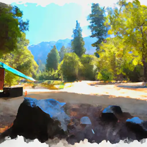
Sly Creek Campground
Community Reviews
Been here? Share the conditions.
Reviews, ratings & photos are added in the free Snoflo iOS app — rate a spot, tag the conditions, and your visit is verified by location. Add or manage your reviews from the app.
Sly Creek
Reservations are required at Sly Creek camping area and can be made in advance through the official website or by contacting the managing agency. It is advisable to book early, especially during popular seasons, to secure a spot at this sought-after campground.
The best time to visit Sly Creek camping area is during the summer months, from June to September, when the weather is warm and ideal for outdoor activities. During this time, campers can enjoy swimming, fishing, and boating in the nearby reservoir. It is worth noting that the campground tends to get crowded on weekends, so arriving early is recommended to secure a good campsite.
While exploring the camping area, visitors should be cautious of wildlife encounters, such as bears and snakes. It is crucial to store food properly and keep all campsites clean to prevent attracting animals. Additionally, it is essential to follow all campground rules and regulations to ensure a safe and enjoyable experience for everyone.
What's on-site at Sly Creek
Key facilities Snoflo tracks for this campground. Confirm with the operator before booking -- amenities can change seasonally.
Plan your trip down to the hour
Same weather feed Snoflo's iOS app uses -- updated continuously from NOAA / yr.no.
Next 5 days, hour by hour
Temperature line with weather symbols on top, snow + rain accumulation as columns, humidity as a dotted line.
5-day forecast table
Every 3 hours, broken out across temperature, snow, rain, humidity, and wind. Each cell is colour-coded relative to the column min/max so trends jump out at a glance.
| Time | Condition | Temp (°F) | Snow (in) | Rain (in) | Humidity (%) | Wind (mps) | Wind dir |
|---|---|---|---|---|---|---|---|
| Loading detailed forecast… | |||||||
15-day temperature & precipitation
Daily temperatures, snow, and rain projected over the next two weeks. Hover any point for the full breakdown.
Other campgrounds in the area
Snoflo-tracked campsites within driving distance of Sly Creek, with reservations status.
| Campground | Reservations | Toilets | View |
|---|---|---|---|
| Sly Creek Campground | ✗ | ✗ | → |
| Sly Creek Recreation Area | ✗ | ✗ | → |
| Golden Trout | ✓ | ✗ | → |
| Golden Trout Crossing | ✗ | ✓ | → |
| Carlton Flat Campground | ✓ | ✗ | → |
Nearby streamflow
USGS streamgauges within reach of Sly Creek -- pulled live from the National Water Information System.
| Streamgauge | Discharge | View |
|---|---|---|
| N Yuba R Bl Goodyears Bar Ca | 157 cfs | → |
| Deer C Nr Smartville Ca | 3 cfs | → |
| Spanish C A Quincy Ca | 15 cfs | → |
| Spanish C Ab Blackhawk C At Keddie Ca | 28 cfs | → |
| Butte C Nr Chico Ca | 170 cfs | → |
| Yuba R Nr Marysville Ca | 528 cfs | → |
Nearby snow depths
NRCS SNOTEL stations within reach of Sly Creek -- relevant when planning a shoulder-season or alpine trip.
| SNOTEL station | Snowpack | 24h Snowfall | View |
|---|---|---|---|
| Grass Valley No. 2 | 0.0 in | 0.0 in | → |
| Blue Canyon | 21.0 in | 3.0 in | → |
| Blue Canyon Alert | 0.0 in | 0.0 in | → |
| Nohrsc Meadow Lk Snow Course | 21.2 in | 0.2 in | → |
| Css Lab | 0.0 in | 0.0 in | → |
| Soda Springs 1.5 Ssw | 0.0 in | 0.0 in | → |
Plan a longer trip
The closest parks, lakes, boat launches, and paddle runs so a camping night can grow into a full weekend.
Parks
- National Wild And Scenic River Feather, California
- Plumas National Forest
- Lake Oroville State Recreation Area
- Malakoff Diggins State Historic Park
- Wilderness Bucks Lake
- South Yuba River State Park
Boat launches
- Mooreville
- Bullards Bar Reservoir (Dark Day )
- Little Grass Valley (Black Rock Tent Camp)
- Peninsula Road, Strawberry Valley
- Plumas County
- Lake Oroville State Recreation Area (Enterprise Area)
Fishing spots
- Bullards Bar Reservoir
- Oroville Lake
- Merle Collins Reservoir
- Bucks Lake
- Scotts Flat Lake
- Englebright Lake
Points of interest
- Frank C. Reilly Museum
- Alleghany Road
- Sierra County Sheriff's Gallows
- Downieville Museum
- Mount. Ararat
- Bidwell Bar Bridge
Paddle runs
- Slate Reservoir To North Yuba River
- One-Quarter Mile Upstream From Confluence With Slate Creek To Bullards Bar Reservoir Spillway (Elevation 1902 Feet)
- One-Eighth Mile Downstream From Confluence With Cherokee Creek To One-Quarter Mile Upstream From Confluence With Slate Creek
- Confluence With South Fork Canyon Creek To Confluence With North Yuba River
- Headwaters To Slate Reservoir
- Headwaters Of North Yuba River (Sec 10, T20n, R13 E) To One-Eighth Mile Downstream Of Confluence With Cherokee Creek
Camping essentials & Leave No Trace
- Pack it in, pack it out
- Take all trash, food scraps, and gear back with you to keep campsites clean and protect wildlife.
- Respect wildlife
- Observe animals from a distance, store food securely, and never feed wildlife to maintain natural behavior and safety.
- Know before you go
- Check weather, fire restrictions, trail conditions, and permit requirements to ensure a safe and well-planned trip.
- Minimize campfire impact
- Use established fire rings, keep fires small, fully extinguish them, or opt for a camp stove when fires are restricted.
- Leave what you find
- Preserve natural and cultural features by avoiding removal of plants, rocks, artifacts, or other elements of the environment.
Set push alerts in the Snoflo app
Save Sly Creek as a favorite, set a custom threshold (precipitation, snowpack, freezing temperatures), and the iOS app will push the moment conditions cross.
About Sly Creek
Can I make reservations at Sly Creek?
This campground does not appear to accept reservations -- it's typically first-come, first-served. Arrive early on summer weekends.
How fresh is the weather data on this page?
The hourly forecast updates throughout the day from the NOAA / yr.no public feeds. Streamflow data is pulled live from USGS streamgauges and snowpack from the NRCS SNOTEL network.
What's the best time of year to visit?
Use the 15-day temperature & precipitation outlook on this page to plan -- pick a window with comfortable temperatures and low precipitation. For longer trips, the 5-day hourly meteogram shows snow + rain accumulation hour-by-hour.
How do I get to Sly Creek?
Tap Directions in the hero above to open driving directions in Google Maps, or Open in map to center the Snoflo interactive map on the campground.
Can I get alerts when conditions change?
Yes -- alerts are managed through the Snoflo iOS app. Favorite this campground, set a threshold (temperature, snowpack, precipitation), and you'll get a push the moment it crosses.
Other campgrounds near here
Snoflo-tracked campgrounds within driving distance of Sly Creek.