Tinnemaha Campground
Community Reviews
Been here? Share the conditions.
Reviews, ratings & photos are added in the free Snoflo iOS app — rate a spot, tag the conditions, and your visit is verified by location. Add or manage your reviews from the app.
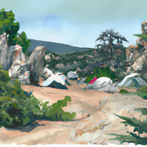
Tinnemaha
The campground provides basic amenities such as picnic tables, fire rings, and drinking water. There is also a boat ramp for easy access to the reservoir. The camping area is first-come, first-serve with 12 campsites available.
For those interested in exploring the area, there are several nearby points of interest, including the Ancient Bristlecone Pine Forest, the John Muir Wilderness, and the Eastern Sierra Interagency Visitor Center. The town of Big Pine also offers dining options and a grocery store for any necessary supplies.
One interesting fact about the area is that the Tinnemaha Reservoir was created in the early 1900s to provide irrigation water for nearby farms. It is now a popular spot for fishing and water sports.
The best time of year to visit the Tinnemaha camping area is during the summer months, from June to September, when temperatures range from 65-80°F during the day and 40-50°F at night. It’s important to note that the campground is at a high elevation of 4,400 feet, so visitors should be prepared for cooler temperatures even in the summer.
What's on-site at Tinnemaha
Key facilities Snoflo tracks for this campground. Confirm with the operator before booking -- amenities can change seasonally.
Plan your trip down to the hour
Same weather feed Snoflo's iOS app uses -- updated continuously from NOAA / yr.no.
Next 5 days, hour by hour
Temperature line with weather symbols on top, snow + rain accumulation as columns, humidity as a dotted line.
5-day forecast table
Every 3 hours, broken out across temperature, snow, rain, humidity, and wind. Each cell is colour-coded relative to the column min/max so trends jump out at a glance.
| Time | Condition | Temp (°F) | Snow (in) | Rain (in) | Humidity (%) | Wind (mps) | Wind dir |
|---|---|---|---|---|---|---|---|
| Loading detailed forecast… | |||||||
15-day temperature & precipitation
Daily temperatures, snow, and rain projected over the next two weeks. Hover any point for the full breakdown.
Other campgrounds in the area
Snoflo-tracked campsites within driving distance of Tinnemaha, with reservations status.
| Campground | Reservations | Toilets | View |
|---|---|---|---|
| Tinemaha Campground | ✗ | ✗ | → |
| Taboose Creek County Park | ✗ | ✗ | → |
| Goodale Creek | ✗ | ✓ | → |
| Goodale Creek Campground | ✗ | ✗ | → |
| Baker Creek | ✗ | ✓ | → |
Nearby streamflow
USGS streamgauges within reach of Tinnemaha -- pulled live from the National Water Information System.
| Streamgauge | Discharge | View |
|---|---|---|
| Marble Fork Kaweah R Ab Horse C Nr Lodgepole Ca | 1 cfs | → |
| Hot C A Flume Nr Mammoth Lakes Ca | 46 cfs | → |
| Mf San Joaquin R Nr Mammoth Lakes Ca | 81 cfs | → |
| Deadman C A Big Springs Nr Crestview Ca | 20 cfs | → |
Nearby snow depths
NRCS SNOTEL stations within reach of Tinnemaha -- relevant when planning a shoulder-season or alpine trip.
| SNOTEL station | Snowpack | 24h Snowfall | View |
|---|---|---|---|
| Charlotte Lake | 11.3 in | 0.0 in | → |
| Blackcap Basin Goes | 0.0 in | 0.0 in | → |
| Upper Burnt Corral Meadow | 0.0 in | 0.0 in | → |
| Nohrsc Rock Creek | 2.6 in | 0.0 in | → |
| Cottonwood Lakes | 0.0 in | 0.0 in | → |
| Mammoth Lakes 16.3 Ese | 1.0 in | 0.3 in | → |
Plan a longer trip
The closest parks, lakes, boat launches, and paddle runs so a camping night can grow into a full weekend.
Parks
- Piper Mountain Wilderness
- Bishop City Park
- Manzanar National Historic Site
- Sierra National Forest
- Wilderness Monarch
Fishing spots
Points of interest
- Big Pine Area
- Owens Valley Radio Observatory
- Saline Valley Road Ohv Trailhead
- Rock Monster
- Sierra View Observation Site
- John Muir Memorial Shelter
Paddle runs
- Wilderness Boundary To Private Property
- Headwaters To Wilderness Boundary
- Headwaters To Inlet At South Lake
- Independence Creek
- Dam Outlet At South Lake To Habeggers Rv Park
- Outlet Of Martha Lake (Boundary Extend 0.25 Mile On Each Side Of River) To Northwestern Boundary Of Kings Canyon National Park
Camping essentials & Leave No Trace
- Pack it in, pack it out
- Take all trash, food scraps, and gear back with you to keep campsites clean and protect wildlife.
- Respect wildlife
- Observe animals from a distance, store food securely, and never feed wildlife to maintain natural behavior and safety.
- Know before you go
- Check weather, fire restrictions, trail conditions, and permit requirements to ensure a safe and well-planned trip.
- Minimize campfire impact
- Use established fire rings, keep fires small, fully extinguish them, or opt for a camp stove when fires are restricted.
- Leave what you find
- Preserve natural and cultural features by avoiding removal of plants, rocks, artifacts, or other elements of the environment.
Set push alerts in the Snoflo app
Save Tinnemaha as a favorite, set a custom threshold (precipitation, snowpack, freezing temperatures), and the iOS app will push the moment conditions cross.
About Tinnemaha
Can I make reservations at Tinnemaha?
This campground does not appear to accept reservations -- it's typically first-come, first-served. Arrive early on summer weekends.
How fresh is the weather data on this page?
The hourly forecast updates throughout the day from the NOAA / yr.no public feeds. Streamflow data is pulled live from USGS streamgauges and snowpack from the NRCS SNOTEL network.
What's the best time of year to visit?
Use the 15-day temperature & precipitation outlook on this page to plan -- pick a window with comfortable temperatures and low precipitation. For longer trips, the 5-day hourly meteogram shows snow + rain accumulation hour-by-hour.
How do I get to Tinnemaha?
Tap Directions in the hero above to open driving directions in Google Maps, or Open in map to center the Snoflo interactive map on the campground.
Can I get alerts when conditions change?
Yes -- alerts are managed through the Snoflo iOS app. Favorite this campground, set a threshold (temperature, snowpack, precipitation), and you'll get a push the moment it crosses.
Other campgrounds near here
Snoflo-tracked campgrounds within driving distance of Tinnemaha.