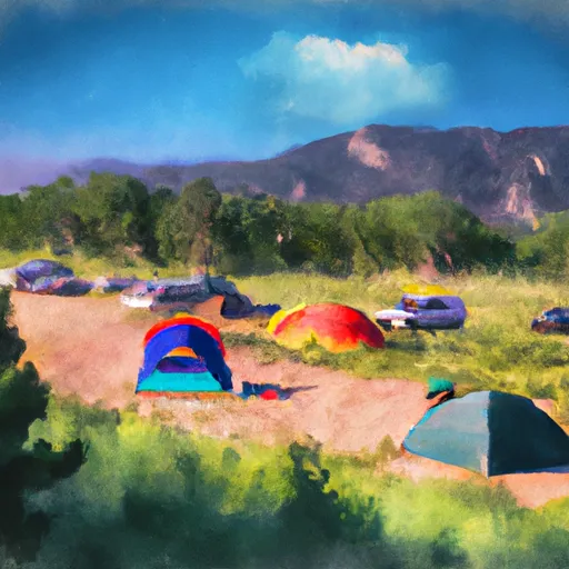
Alamosa Campground
Community Reviews
Been here? Share the conditions.
Reviews, ratings & photos are added in the free Snoflo iOS app — rate a spot, tag the conditions, and your visit is verified by location. Add or manage your reviews from the app.
Alamosa
The best time to visit this camping area is during the summer months, from June to August, when the weather is pleasant and ideal for outdoor activities. Alamosa Campground is situated near the Great Sand Dunes National Park and Preserve, which offers breathtaking sand dunes and diverse ecosystems. Exploring this unique natural wonder should not be missed during your visit. Furthermore, nearby attractions include the Rio Grande National Forest, where visitors can enjoy hiking, fishing, and wildlife viewing.
While enjoying your time at Alamosa Camping Area, it is essential to be cautious of the local wildlife. Bears are known to inhabit the area, so campers are advised to properly store food and dispose of trash in bear-proof containers. It is also wise to bring bear spray and educate yourself on bear safety. Additionally, mosquitoes can be quite prevalent in this region, especially near water sources, so packing insect repellent is recommended. By considering these factors and planning accordingly, campers can have an unforgettable and safe experience at Alamosa Camping Area.
What's on-site at Alamosa
Key facilities Snoflo tracks for this campground. Confirm with the operator before booking -- amenities can change seasonally.
Plan your trip down to the hour
Same weather feed Snoflo's iOS app uses -- updated continuously from NOAA / yr.no.
Next 5 days, hour by hour
Temperature line with weather symbols on top, snow + rain accumulation as columns, humidity as a dotted line.
5-day forecast table
Every 3 hours, broken out across temperature, snow, rain, humidity, and wind. Each cell is colour-coded relative to the column min/max so trends jump out at a glance.
| Time | Condition | Temp (°F) | Snow (in) | Rain (in) | Humidity (%) | Wind (mps) | Wind dir |
|---|---|---|---|---|---|---|---|
| Loading detailed forecast… | |||||||
15-day temperature & precipitation
Daily temperatures, snow, and rain projected over the next two weeks. Hover any point for the full breakdown.
Other campgrounds in the area
Snoflo-tracked campsites within driving distance of Alamosa, with reservations status.
| Campground | Reservations | Toilets | View |
|---|---|---|---|
| Alamosa Campground | ✗ | ✗ | → |
| Comstock | ✗ | ✓ | → |
| Comstock Campground | ✓ | ✗ | → |
| Rock Creek - Monte Vista | ✗ | ✓ | → |
| Lake Fork | ✓ | ✓ | → |
Nearby streamflow
USGS streamgauges within reach of Alamosa -- pulled live from the National Water Information System.
| Streamgauge | Discharge | View |
|---|---|---|
| Alamosa River Above Terrace Reservoir | 15 cfs | → |
| Alamosa River Below Terrace Reservoir | 57 cfs | → |
| Wightman Fork At Mouth Near Jasper | 3 cfs | → |
| Alamosa River Above Wightman Fork Near Jasper | -999 cfs | → |
| Conejos River Below Platoro Reservoir | 19 cfs | → |
| Wightman Fork Bel Cropsy Creek At Summitville | 3 cfs | → |
Nearby snow depths
NRCS SNOTEL stations within reach of Alamosa -- relevant when planning a shoulder-season or alpine trip.
| SNOTEL station | Snowpack | 24h Snowfall | View |
|---|---|---|---|
| Lily Pond | 0.0 in | 0.0 in | → |
| Nohrsc Lily Pond | 0.0 in | 0.0 in | → |
| Nohrsc Grayback | 0.0 in | 0.0 in | → |
| Grayback | 0.0 in | 0.0 in | → |
| Del Norte | 0.0 in | 0.0 in | → |
| Del Norte 3.3 E | 0.0 in | 0.0 in | → |
Plan a longer trip
The closest parks, lakes, boat launches, and paddle runs so a camping night can grow into a full weekend.
Parks
- Monte Vista National Wildlife Refuge
- Fullenweider Park
- Wilderness South San Juan
- Rio Grande National Forest
- Alamosa National Wildlife Refuge
- Wilderness Cruces Basin
Boat launches
- Trujillo Meadows State Wildlife Area
- Platoro Reservoir Boating Site
- Sherman Lake Circle 94, Rio Grande County
- Beaver Creek Reservoir State Wildlife Area
- Rio Grande River State Wildlife Area (Del Norte Fishing Easements)
- Coller State Wildlife Area-Trujillo Meadows
Fishing spots
- La Jara Reservoir
- Kerr Lake Fishing Site
- Lost Lake
- Platoro Reservoir
- Spectacle Lake Fishing Site
- La Manga Creek (Beaver Ponds)
Points of interest
- Mix Lake Observation
- Marilyn Tank
- Howitzer
- Airplane Af69 6193
- Elephant Rocks
- Ancient Valley Interp Site
Paddle runs
- South Fork--Sec 19, T35n, R4e To Sec 36, T35n, R4 1/2e
- Lake Fork--Confluence With South Fork To 1 Mile Below Town Of Platoro
- Sec 17, T35n, R4e To Sec 36, T35n, R4e
- El Rito Azul--Blue Lake (Sec 26, T35n, R3e) And Portion Of Conejos Above Platoro Reservoir To Upper Reach Of Platoro Reservoir--Sec 6, T35n, R4e
- Middle Fork--Sec 13, T35n, R2e To Confluence Of Three Forks--Sec 14, T35n, R3e
- North Fork--Sec 8, T35n, R2e To Confluence With Middle Fork
Camping essentials & Leave No Trace
- Pack it in, pack it out
- Take all trash, food scraps, and gear back with you to keep campsites clean and protect wildlife.
- Respect wildlife
- Observe animals from a distance, store food securely, and never feed wildlife to maintain natural behavior and safety.
- Know before you go
- Check weather, fire restrictions, trail conditions, and permit requirements to ensure a safe and well-planned trip.
- Minimize campfire impact
- Use established fire rings, keep fires small, fully extinguish them, or opt for a camp stove when fires are restricted.
- Leave what you find
- Preserve natural and cultural features by avoiding removal of plants, rocks, artifacts, or other elements of the environment.
Set push alerts in the Snoflo app
Save Alamosa as a favorite, set a custom threshold (precipitation, snowpack, freezing temperatures), and the iOS app will push the moment conditions cross.
About Alamosa
Can I make reservations at Alamosa?
This campground does not appear to accept reservations -- it's typically first-come, first-served. Arrive early on summer weekends.
How fresh is the weather data on this page?
The hourly forecast updates throughout the day from the NOAA / yr.no public feeds. Streamflow data is pulled live from USGS streamgauges and snowpack from the NRCS SNOTEL network.
What's the best time of year to visit?
Use the 15-day temperature & precipitation outlook on this page to plan -- pick a window with comfortable temperatures and low precipitation. For longer trips, the 5-day hourly meteogram shows snow + rain accumulation hour-by-hour.
How do I get to Alamosa?
Tap Directions in the hero above to open driving directions in Google Maps, or Open in map to center the Snoflo interactive map on the campground.
Can I get alerts when conditions change?
Yes -- alerts are managed through the Snoflo iOS app. Favorite this campground, set a threshold (temperature, snowpack, precipitation), and you'll get a push the moment it crosses.
Other campgrounds near here
Snoflo-tracked campgrounds within driving distance of Alamosa.