Cedar Mountain Camp Campground
Community Reviews
Been here? Share the conditions.
Reviews, ratings & photos are added in the free Snoflo iOS app — rate a spot, tag the conditions, and your visit is verified by location. Add or manage your reviews from the app.
Cedar Mountain Camp
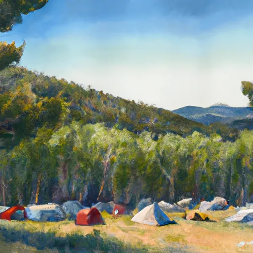
The campground amenities include several fire pits, picnic tables, and vault toilets. There is no potable water available at the campground, so visitors must bring their own water supply.
The area is rich in history, with evidence of Ute Indian habitation dating back over 8,000 years. The nearby town of Kremmling was a center of cattle ranching in the early 20th century and has a fascinating history.
The best time of year to visit Cedar Mountain Camp Campsite is in the summer months, from June to September, with average temperatures ranging from the low 50s to the mid-70s. Visitors can enjoy hiking, fishing, and birdwatching during this time.
Overall, Cedar Mountain Camp Campsite offers a unique camping experience with breathtaking views and a rich history to explore. It is a perfect spot for those who want to get away from the crowds and enjoy the beauty of nature.
What's on-site at Cedar Mountain Camp
Key facilities Snoflo tracks for this campground. Confirm with the operator before booking -- amenities can change seasonally.
Plan your trip down to the hour
Same weather feed Snoflo's iOS app uses -- updated continuously from NOAA / yr.no.
Next 5 days, hour by hour
Temperature line with weather symbols on top, snow + rain accumulation as columns, humidity as a dotted line.
5-day forecast table
Every 3 hours, broken out across temperature, snow, rain, humidity, and wind. Each cell is colour-coded relative to the column min/max so trends jump out at a glance.
| Time | Condition | Temp (°F) | Snow (in) | Rain (in) | Humidity (%) | Wind (mps) | Wind dir |
|---|---|---|---|---|---|---|---|
| Loading detailed forecast… | |||||||
15-day temperature & precipitation
Daily temperatures, snow, and rain projected over the next two weeks. Hover any point for the full breakdown.
Other campgrounds in the area
Snoflo-tracked campsites within driving distance of Cedar Mountain Camp, with reservations status.
| Campground | Reservations | Toilets | View |
|---|---|---|---|
| Lakeview Campground | ✗ | ✗ | → |
| Sage Campground | ✗ | ✗ | → |
| Cedar Campground | ✗ | ✗ | → |
| Rifle Gap State Park | ✓ | ✓ | → |
| Rifle Falls State Park | ✓ | ✓ | → |
Nearby streamflow
USGS streamgauges within reach of Cedar Mountain Camp -- pulled live from the National Water Information System.
| Streamgauge | Discharge | View |
|---|---|---|
| White River Below North Elk Creek Near Buford | 217 cfs | → |
| Colorado River Below Glenwood Springs | 1,820 cfs | → |
| Roaring Fork River At Glenwood Springs | 449 cfs | → |
| West Divide Creek Near Raven | 0 cfs | → |
| White River Above Coal Creek | 89 cfs | → |
| White River Near Meeker | 112 cfs | → |
Nearby snow depths
NRCS SNOTEL stations within reach of Cedar Mountain Camp -- relevant when planning a shoulder-season or alpine trip.
| SNOTEL station | Snowpack | 24h Snowfall | View |
|---|---|---|---|
| Rifle 3.2 Ene | 0.0 in | 0.0 in | → |
| Nohrsc Burro Mountain | 3.0 in | 0.0 in | → |
| Glenwood Springs 7.0 Nw | 0.0 in | 0.0 in | → |
| Burro Mountain | 3.0 in | 0.0 in | → |
| Bison Lake | 1.0 in | 0.0 in | → |
| Bison Lake | 0.0 in | 0.0 in | → |
Plan a longer trip
The closest parks, lakes, boat launches, and paddle runs so a camping night can grow into a full weekend.
Parks
- Rifle Gap State Park
- Rifle Falls State Park
- Harvey Gap State Park
- Sister Lucy Downey Park
- Wilderness Flat Tops
- Two Rivers Park
Boat launches
- Rifle Gap State Park
- Harvey Gap State Park
- New Castle
- South Canyon Boat Ramp
- I 70 Garfield County
- Oak Ridge State Wildlife Area
Fishing spots
- Rifle Gap Reservoir
- Harvey Gap Reservoir
- Meadow Creek Lake
- Meadow Lake Picnic Area
- Lake Avery
- Deep Lake Fishing/Picnic Area Fishing Site
Camping essentials & Leave No Trace
- Pack it in, pack it out
- Take all trash, food scraps, and gear back with you to keep campsites clean and protect wildlife.
- Respect wildlife
- Observe animals from a distance, store food securely, and never feed wildlife to maintain natural behavior and safety.
- Know before you go
- Check weather, fire restrictions, trail conditions, and permit requirements to ensure a safe and well-planned trip.
- Minimize campfire impact
- Use established fire rings, keep fires small, fully extinguish them, or opt for a camp stove when fires are restricted.
- Leave what you find
- Preserve natural and cultural features by avoiding removal of plants, rocks, artifacts, or other elements of the environment.
Set push alerts in the Snoflo app
Save Cedar Mountain Camp as a favorite, set a custom threshold (precipitation, snowpack, freezing temperatures), and the iOS app will push the moment conditions cross.
About Cedar Mountain Camp
Can I make reservations at Cedar Mountain Camp?
This campground does not appear to accept reservations -- it's typically first-come, first-served. Arrive early on summer weekends.
How fresh is the weather data on this page?
The hourly forecast updates throughout the day from the NOAA / yr.no public feeds. Streamflow data is pulled live from USGS streamgauges and snowpack from the NRCS SNOTEL network.
What's the best time of year to visit?
Use the 15-day temperature & precipitation outlook on this page to plan -- pick a window with comfortable temperatures and low precipitation. For longer trips, the 5-day hourly meteogram shows snow + rain accumulation hour-by-hour.
How do I get to Cedar Mountain Camp?
Tap Directions in the hero above to open driving directions in Google Maps, or Open in map to center the Snoflo interactive map on the campground.
Can I get alerts when conditions change?
Yes -- alerts are managed through the Snoflo iOS app. Favorite this campground, set a threshold (temperature, snowpack, precipitation), and you'll get a push the moment it crosses.
Other campgrounds near here
Snoflo-tracked campgrounds within driving distance of Cedar Mountain Camp.