Nellie Creek Site 1 Campground
Community Reviews
Been here? Share the conditions.
Reviews, ratings & photos are added in the free Snoflo iOS app — rate a spot, tag the conditions, and your visit is verified by location. Add or manage your reviews from the app.
Nellie Creek Site 1
Reservations are not accepted at Nellie Creek Site 1, and campsites are available on a first-come, first-served basis. It is advisable to arrive early, especially during peak seasons, to secure a spot. The best time to visit this camping area is during the summer months when the weather is pleasant, and the wildflowers are in full bloom. However, it is important to note that the campground is only accessible by a high-clearance vehicle or 4x4 due to the rough and rocky road leading to the site.
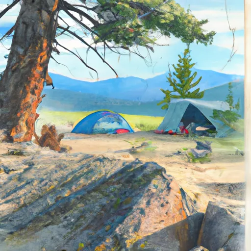
Nellie Creek Site 1 is surrounded by breathtaking landscapes, making it an ideal spot for outdoor enthusiasts. Nearby, there are numerous opportunities for hiking, fishing, and wildlife viewing. Hikers can explore the beautiful Uncompahgre National Forest, while anglers can try their luck in the nearby Nellie Creek. Additionally, the picturesque Wetterhorn Peak is a popular destination for climbers. It is essential for campers to be cautious of wildlife, such as bears and mountain lions, and to properly store food to prevent any potential encounters with these animals.
What's on-site at Nellie Creek Site 1
Key facilities Snoflo tracks for this campground. Confirm with the operator before booking -- amenities can change seasonally.
Plan your trip down to the hour
Same weather feed Snoflo's iOS app uses -- updated continuously from NOAA / yr.no.
Next 5 days, hour by hour
Temperature line with weather symbols on top, snow + rain accumulation as columns, humidity as a dotted line.
5-day forecast table
Every 3 hours, broken out across temperature, snow, rain, humidity, and wind. Each cell is colour-coded relative to the column min/max so trends jump out at a glance.
| Time | Condition | Temp (°F) | Snow (in) | Rain (in) | Humidity (%) | Wind (mps) | Wind dir |
|---|---|---|---|---|---|---|---|
| Loading detailed forecast… | |||||||
15-day temperature & precipitation
Daily temperatures, snow, and rain projected over the next two weeks. Hover any point for the full breakdown.
Other campgrounds in the area
Snoflo-tracked campsites within driving distance of Nellie Creek Site 1, with reservations status.
| Campground | Reservations | Toilets | View |
|---|---|---|---|
| Nellie Creek | ✗ | ✗ | → |
| Argentum Site 3 | ✗ | ✗ | → |
| Argentum Site 2 | ✗ | ✗ | → |
| Argentum Site 5 | ✗ | ✗ | → |
| Argentum Site 1 | ✗ | ✗ | → |
Nearby streamflow
USGS streamgauges within reach of Nellie Creek Site 1 -- pulled live from the National Water Information System.
| Streamgauge | Discharge | View |
|---|---|---|
| Lake Fork Blw Lake San Cristobal Nr Lake City | 30 cfs | → |
| North Clear Creek Bl Continental Reservoir | 6 cfs | → |
| Uncompahgre River Near Ouray | 51 cfs | → |
| Animas River At Howardsville | 39 cfs | → |
| Cimarron River Near Cimarron | 73 cfs | → |
| Cement Creek At Silverton | 17 cfs | → |
Nearby snow depths
NRCS SNOTEL stations within reach of Nellie Creek Site 1 -- relevant when planning a shoulder-season or alpine trip.
| SNOTEL station | Snowpack | 24h Snowfall | View |
|---|---|---|---|
| Nohrsc Wager Gulch | 0.0 in | 0.0 in | → |
| Wager Gulch | 0.0 in | 0.0 in | → |
| Nohrsc Slumgullion | 1.0 in | 0.0 in | → |
| Slumgullion | 1.0 in | 1.0 in | → |
| Monument | 0.1 in | 0.0 in | → |
| Ouray .23 Nnw | 0.0 in | 0.0 in | → |
Plan a longer trip
The closest parks, lakes, boat launches, and paddle runs so a camping night can grow into a full weekend.
Parks
- Wilderness Uncompahgre
- Gunnison National Forest
- Wilderness Powderhorn
- Ridgway State Park
- Telluride Town Park
- Wilderness Mount Sneffels
Boat launches
- Devil's Creek Bridge Boat Ramp
- Cr 11 Hinsdale County
- Rito Hondo Reservoir Boating Site
- Cr 10 Hinsdale County
- Brown Lakes State Wildlife Area
- Road Canyon Reservoir State Wildlife Area
Fishing spots
- Lake San Cristobal
- North Fork Animas River
- Continental Reservoir
- Continental Reservoir Fishing Site
- Rito Hondo Reservoir
- Silver Jack Fisherman Access
Points of interest
- Pike Snowden Cabin
- Henson Interpretive Site
- Capitol City Townsite
- Capitol City Cemetary
- Lake City Ice Wall
- Rose Lime Kiln
Paddle runs
- Mineral Creek
- Animas River
- Below Rio Grande Reservoir (Sec 13, T40n, R4w) To Spring Creek (Sec 31, T41n, R2w)
- Rincon La Vaca--Headwaters To Confluence With Los Pinos
- Snowslide Canyon Creek--Headwaters To Confluence With Los Pinos
- Rincon La Osa--Headwaters To Confluence With Los Pinos
Camping essentials & Leave No Trace
- Pack it in, pack it out
- Take all trash, food scraps, and gear back with you to keep campsites clean and protect wildlife.
- Respect wildlife
- Observe animals from a distance, store food securely, and never feed wildlife to maintain natural behavior and safety.
- Know before you go
- Check weather, fire restrictions, trail conditions, and permit requirements to ensure a safe and well-planned trip.
- Minimize campfire impact
- Use established fire rings, keep fires small, fully extinguish them, or opt for a camp stove when fires are restricted.
- Leave what you find
- Preserve natural and cultural features by avoiding removal of plants, rocks, artifacts, or other elements of the environment.
Set push alerts in the Snoflo app
Save Nellie Creek Site 1 as a favorite, set a custom threshold (precipitation, snowpack, freezing temperatures), and the iOS app will push the moment conditions cross.
About Nellie Creek Site 1
Can I make reservations at Nellie Creek Site 1?
This campground does not appear to accept reservations -- it's typically first-come, first-served. Arrive early on summer weekends.
How fresh is the weather data on this page?
The hourly forecast updates throughout the day from the NOAA / yr.no public feeds. Streamflow data is pulled live from USGS streamgauges and snowpack from the NRCS SNOTEL network.
What's the best time of year to visit?
Use the 15-day temperature & precipitation outlook on this page to plan -- pick a window with comfortable temperatures and low precipitation. For longer trips, the 5-day hourly meteogram shows snow + rain accumulation hour-by-hour.
How do I get to Nellie Creek Site 1?
Tap Directions in the hero above to open driving directions in Google Maps, or Open in map to center the Snoflo interactive map on the campground.
Can I get alerts when conditions change?
Yes -- alerts are managed through the Snoflo iOS app. Favorite this campground, set a threshold (temperature, snowpack, precipitation), and you'll get a push the moment it crosses.
Other campgrounds near here
Snoflo-tracked campgrounds within driving distance of Nellie Creek Site 1.