The Gate Campground
Community Reviews
Been here? Share the conditions.
Reviews, ratings & photos are added in the free Snoflo iOS app — rate a spot, tag the conditions, and your visit is verified by location. Add or manage your reviews from the app.
The Gate
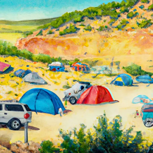
The campground offers amenities such as picnic tables, fire pits, and vault toilets. It is a first-come, first-serve campground, so visitors should plan accordingly. There are a total of 14 campsites available, and visitors should note that the area is quite popular during the summer months.
One interesting fact about the area is that it was named after a gate that was once used to control access to the Poudre Canyon. Today, the gate is still standing as a reminder of the area's history.
The best time of year to visit the Gate Camping Area is during the summer months. Average temperatures in July and August are in the mid-70s during the day and drop to the mid-40s at night. Visitors should be prepared for afternoon thunderstorms during the summer months as well. Overall, the Gate Camping Area is a beautiful spot for nature lovers and outdoor enthusiasts alike.
What's on-site at The Gate
Key facilities Snoflo tracks for this campground. Confirm with the operator before booking -- amenities can change seasonally.
Plan your trip down to the hour
Same weather feed Snoflo's iOS app uses -- updated continuously from NOAA / yr.no.
Next 5 days, hour by hour
Temperature line with weather symbols on top, snow + rain accumulation as columns, humidity as a dotted line.
5-day forecast table
Every 3 hours, broken out across temperature, snow, rain, humidity, and wind. Each cell is colour-coded relative to the column min/max so trends jump out at a glance.
| Time | Condition | Temp (°F) | Snow (in) | Rain (in) | Humidity (%) | Wind (mps) | Wind dir |
|---|---|---|---|---|---|---|---|
| Loading detailed forecast… | |||||||
15-day temperature & precipitation
Daily temperatures, snow, and rain projected over the next two weeks. Hover any point for the full breakdown.
Other campgrounds in the area
Snoflo-tracked campsites within driving distance of The Gate, with reservations status.
| Campground | Reservations | Toilets | View |
|---|---|---|---|
| The Gate Rec. Site | ✗ | ✗ | → |
| Red Bridge | ✗ | ✓ | → |
| Red Bridge Campground | ✗ | ✗ | → |
| Big Blue | ✗ | ✓ | → |
| Big Blue Campground - Gunnison Rd | ✓ | ✗ | → |
Nearby streamflow
USGS streamgauges within reach of The Gate -- pulled live from the National Water Information System.
| Streamgauge | Discharge | View |
|---|---|---|
| Lake Fork At Gateview | 86 cfs | → |
| Cimarron River Near Cimarron | 71 cfs | → |
| Lake Fork Blw Lake San Cristobal Nr Lake City | 40 cfs | → |
| Cimarron River Bl Squaw Creek | 14 cfs | → |
| North Clear Creek Bl Continental Reservoir | 6 cfs | → |
| Tomichi Creek At Gunnison | 20 cfs | → |
Nearby snow depths
NRCS SNOTEL stations within reach of The Gate -- relevant when planning a shoulder-season or alpine trip.
| SNOTEL station | Snowpack | 24h Snowfall | View |
|---|---|---|---|
| Slumgullion | 0.0 in | 0.0 in | → |
| Nohrsc Slumgullion | 1.0 in | 0.0 in | → |
| Gunnison 3wsw | 0.0 in | 0.0 in | → |
| Cimarron 8nw Ham | 0.0 in | 0.0 in | → |
| Gunnison Coop | 0.0 in | 0.0 in | → |
| Wager Gulch | 0.0 in | 0.0 in | → |
Plan a longer trip
The closest parks, lakes, boat launches, and paddle runs so a camping night can grow into a full weekend.
Parks
- Curecanti National Recreation Area
- Wilderness Powderhorn
- Black Canyon Of The Gunnison National Park
- Wilderness West Elk
- Wilderness Uncompahgre
- Ridgway State Park
Boat launches
- Devil's Creek Bridge Boat Ramp
- Us 50 Sapinero
- Dillon Pinnacles Trail Gunnison County
- Us 50 Gunnison County
- Silver Thread Scenic Byway Gunnison County
Fishing spots
- Silver Jack Fisherman Access
- Silver Jack Reservoir
- Beaver Lake Day Use Area/ Fishing Site
- Blue Mesa Reservoir
- Morrow Point Reservoir
- Lake San Cristobal
Points of interest
Paddle runs
- Curecanti National Recreation Area Boundary To High Water Line Of Blue Mesa Reservoir
- Curecanti National Recreation Area Boundary To High Water Line Of Morrow Point Reservoir
- The Southern Boundary Of The Black Canyon Gunnison National Monument To The Painted Wall
Camping essentials & Leave No Trace
- Pack it in, pack it out
- Take all trash, food scraps, and gear back with you to keep campsites clean and protect wildlife.
- Respect wildlife
- Observe animals from a distance, store food securely, and never feed wildlife to maintain natural behavior and safety.
- Know before you go
- Check weather, fire restrictions, trail conditions, and permit requirements to ensure a safe and well-planned trip.
- Minimize campfire impact
- Use established fire rings, keep fires small, fully extinguish them, or opt for a camp stove when fires are restricted.
- Leave what you find
- Preserve natural and cultural features by avoiding removal of plants, rocks, artifacts, or other elements of the environment.
Set push alerts in the Snoflo app
Save The Gate as a favorite, set a custom threshold (precipitation, snowpack, freezing temperatures), and the iOS app will push the moment conditions cross.
About The Gate
Can I make reservations at The Gate?
This campground does not appear to accept reservations -- it's typically first-come, first-served. Arrive early on summer weekends.
How fresh is the weather data on this page?
The hourly forecast updates throughout the day from the NOAA / yr.no public feeds. Streamflow data is pulled live from USGS streamgauges and snowpack from the NRCS SNOTEL network.
What's the best time of year to visit?
Use the 15-day temperature & precipitation outlook on this page to plan -- pick a window with comfortable temperatures and low precipitation. For longer trips, the 5-day hourly meteogram shows snow + rain accumulation hour-by-hour.
How do I get to The Gate?
Tap Directions in the hero above to open driving directions in Google Maps, or Open in map to center the Snoflo interactive map on the campground.
Can I get alerts when conditions change?
Yes -- alerts are managed through the Snoflo iOS app. Favorite this campground, set a threshold (temperature, snowpack, precipitation), and you'll get a push the moment it crosses.
Other campgrounds near here
Snoflo-tracked campgrounds within driving distance of The Gate.