Cayo Costa Sp Tent Camping Campground
Community Reviews
Been here? Share the conditions.
Reviews, ratings & photos are added in the free Snoflo iOS app — rate a spot, tag the conditions, and your visit is verified by location. Add or manage your reviews from the app.
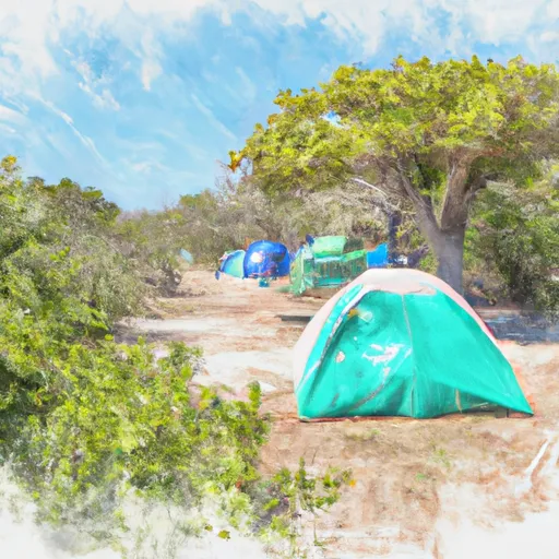
Cayo Costa Sp Tent Camping
What's on-site at Cayo Costa Sp Tent Camping
Key facilities Snoflo tracks for this campground. Confirm with the operator before booking -- amenities can change seasonally.
Plan your trip down to the hour
Same weather feed Snoflo's iOS app uses -- updated continuously from NOAA / yr.no.
Next 5 days, hour by hour
Temperature line with weather symbols on top, snow + rain accumulation as columns, humidity as a dotted line.
5-day forecast table
Every 3 hours, broken out across temperature, snow, rain, humidity, and wind. Each cell is colour-coded relative to the column min/max so trends jump out at a glance.
| Time | Condition | Temp (°F) | Snow (in) | Rain (in) | Humidity (%) | Wind (mps) | Wind dir |
|---|---|---|---|---|---|---|---|
| Loading detailed forecast… | |||||||
15-day temperature & precipitation
Daily temperatures, snow, and rain projected over the next two weeks. Hover any point for the full breakdown.
Other campgrounds in the area
Snoflo-tracked campsites within driving distance of Cayo Costa Sp Tent Camping, with reservations status.
| Campground | Reservations | Toilets | View |
|---|---|---|---|
| Tropical Waters Rv Park | ✗ | ✗ | → |
| Myakka River Motorcoach Resort | ✗ | ✗ | → |
| Flying A Group Camp | ✗ | ✗ | → |
| Gulf Air Mhp | ✗ | ✗ | → |
| Gulf Waters Rv Resort | ✗ | ✗ | → |
Nearby streamflow
USGS streamgauges within reach of Cayo Costa Sp Tent Camping -- pulled live from the National Water Information System.
| Streamgauge | Discharge | View |
|---|---|---|
| Horseshoe Canal At Cape Coral | 11 cfs | → |
| Hermosa Canal At Cape Coral | 47 cfs | → |
| Shadroe Canal At Cape Coral | 2 cfs | → |
| Aries Canal At Cape Coral | 60 cfs | → |
| Courtney Canal At Cape Coral | 12 cfs | → |
| San Carlos Canal At Cape Coral | 0 cfs | → |
Plan a longer trip
The closest parks, lakes, boat launches, and paddle runs so a camping night can grow into a full weekend.
Parks
- Gasparilla Island State Park
- Aquatic Preserve Cape Haze
- Island Bay National Wildlife Refuge
- Smokehouse Bay Preserve
- Phillips Community Park
- Don Pedro Island State Park
Boat launches
- The Innlet On The Bayou Resort
- Bocilla Island Seaport And Fishing Pier
- Pineland Marina, Boat Ramp, Kayak Launch And Ships Store
- Lavender's Landing / Bokeelia Public Boat Ramp
- Uncle Henry's Marina
- Eldred's Marina Commercial Ramp
Fishing spots
Points of interest
- Boca Grande Lighthouse
- Gasparilla Island Lighthouse
- Captiva Cruises
- Matlacha Bridge
- Cape Coral Historical Society Museum
- Gulf Coast Model Train Room
Paddle runs
- A Point Approximately 1/2 Mile South Of Sr 771 At El Jobean To The River's Mouth In The Vicinity Of Hog Island
- A Point Just Upriver Of The Us 41 Highway Crossing To The Sarasota/Charlotte County Line
- Approximately River Mile 18 To A Point Just Upriver Of The Us 41 Highway Crossing
- Approximately At River Mile 23 Where Riverfront Residential Development Begins To The Vicinity Of Snook Haven Fish Camp At Approximately River Mile 18
- The Southern Boundary Of The Myakka River State Park To Ends Approximately At River Mile 23 Where Riverfront Residential Development Begins
- Begins Downstream Of The State Road 72 Bridge To The Southern Boundary Of Myakka River State Park
Camping essentials & Leave No Trace
- Pack it in, pack it out
- Take all trash, food scraps, and gear back with you to keep campsites clean and protect wildlife.
- Respect wildlife
- Observe animals from a distance, store food securely, and never feed wildlife to maintain natural behavior and safety.
- Know before you go
- Check weather, fire restrictions, trail conditions, and permit requirements to ensure a safe and well-planned trip.
- Minimize campfire impact
- Use established fire rings, keep fires small, fully extinguish them, or opt for a camp stove when fires are restricted.
- Leave what you find
- Preserve natural and cultural features by avoiding removal of plants, rocks, artifacts, or other elements of the environment.
Set push alerts in the Snoflo app
Save Cayo Costa Sp Tent Camping as a favorite, set a custom threshold (precipitation, snowpack, freezing temperatures), and the iOS app will push the moment conditions cross.
About Cayo Costa Sp Tent Camping
Can I make reservations at Cayo Costa Sp Tent Camping?
This campground does not appear to accept reservations -- it's typically first-come, first-served. Arrive early on summer weekends.
How fresh is the weather data on this page?
The hourly forecast updates throughout the day from the NOAA / yr.no public feeds. Streamflow data is pulled live from USGS streamgauges and snowpack from the NRCS SNOTEL network.
What's the best time of year to visit?
Use the 15-day temperature & precipitation outlook on this page to plan -- pick a window with comfortable temperatures and low precipitation. For longer trips, the 5-day hourly meteogram shows snow + rain accumulation hour-by-hour.
How do I get to Cayo Costa Sp Tent Camping?
Tap Directions in the hero above to open driving directions in Google Maps, or Open in map to center the Snoflo interactive map on the campground.
Can I get alerts when conditions change?
Yes -- alerts are managed through the Snoflo iOS app. Favorite this campground, set a threshold (temperature, snowpack, precipitation), and you'll get a push the moment it crosses.
Other campgrounds near here
Snoflo-tracked campgrounds within driving distance of Cayo Costa Sp Tent Camping.