Backcountry Campsite #2 Campground
Community Reviews
Been here? Share the conditions.
Reviews, ratings & photos are added in the free Snoflo iOS app — rate a spot, tag the conditions, and your visit is verified by location. Add or manage your reviews from the app.
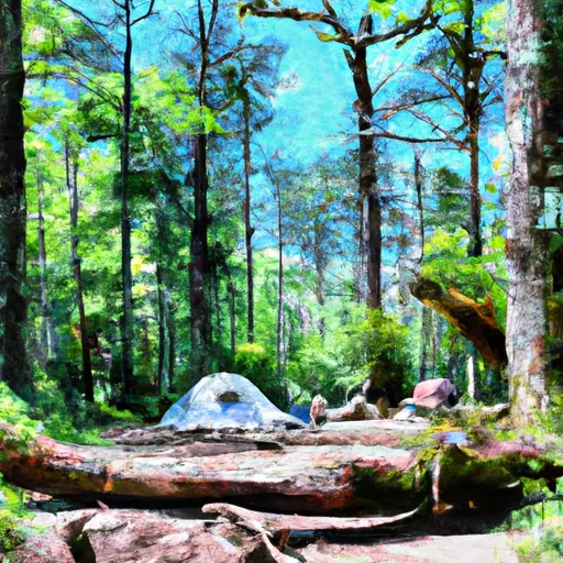
Backcountry Campsite #2
Reservations are not accepted for Backcountry Campsite #2, making it a first-come, first-served camping area. It is advisable to arrive early, especially during peak seasons, as the site has limited capacity. The best time to visit this camping area is during the spring and fall months when the weather is mild and the natural surroundings are at their most vibrant. However, it is important to note that Georgia's weather can be unpredictable, so it is recommended to check the forecast before heading out.
While camping at Backcountry Campsite #2, campers can enjoy hiking, birdwatching, and stargazing. The area is known for its beautiful trails, offering opportunities to explore the surrounding wilderness. However, it is crucial to be aware of potential wildlife encounters and to properly store food to prevent attracting animals. Additionally, campers should be cautious of rough terrain and bring appropriate footwear and gear for their safety. By being well-prepared and respectful of the natural environment, visitors can have a fulfilling and memorable camping experience at Backcountry Campsite #2 in Georgia.
What's on-site at Backcountry Campsite #2
Key facilities Snoflo tracks for this campground. Confirm with the operator before booking -- amenities can change seasonally.
Plan your trip down to the hour
Same weather feed Snoflo's iOS app uses -- updated continuously from NOAA / yr.no.
Next 5 days, hour by hour
Temperature line with weather symbols on top, snow + rain accumulation as columns, humidity as a dotted line.
5-day forecast table
Every 3 hours, broken out across temperature, snow, rain, humidity, and wind. Each cell is colour-coded relative to the column min/max so trends jump out at a glance.
| Time | Condition | Temp (°F) | Snow (in) | Rain (in) | Humidity (%) | Wind (mps) | Wind dir |
|---|---|---|---|---|---|---|---|
| Loading detailed forecast… | |||||||
15-day temperature & precipitation
Daily temperatures, snow, and rain projected over the next two weeks. Hover any point for the full breakdown.
Other campgrounds in the area
Snoflo-tracked campsites within driving distance of Backcountry Campsite #2, with reservations status.
| Campground | Reservations | Toilets | View |
|---|---|---|---|
| Fort Mountain State Park | ✓ | ✗ | → |
| Backcountry Campsite 3 | ✗ | ✗ | → |
| Backcountry Campsite 4 | ✗ | ✗ | → |
| Mulberry Gap Mountain Bike Getaway | ✗ | ✗ | → |
| Ball Field Dispersed Camping Area | ✗ | ✗ | → |
Nearby streamflow
USGS streamgauges within reach of Backcountry Campsite #2 -- pulled live from the National Water Information System.
| Streamgauge | Discharge | View |
|---|---|---|
| Holly Creek Near Chatsworth | 403 cfs | → |
| Mill Creek Near Crandall | 9 cfs | → |
| Conasauga River Near Eton | 133 cfs | → |
| Coosawattee River At Carters | 390 cfs | → |
| Coosawattee River Near Ellijay | 315 cfs | → |
| Conasauga River At Tilton | 298 cfs | → |
Plan a longer trip
The closest parks, lakes, boat launches, and paddle runs so a camping night can grow into a full weekend.
Parks
- Fort Mountain State Park
- Chatsworth Park
- Preserve Holly Creek
- Chief Vann House Historic Site
- Dalton Civic Park
- Al Rollins Baseball Complex
Boat launches
- Lake Conasauga Murray County
- Ridgeway
- Coosawattee-Carters Lake Wildlife Management Area
- Gilmer County
- Cove Road Murray County
Fishing spots
Points of interest
- Chief Vann House State Historic Site
- Chief Vann House
- Red Apple Barn
- Engelheim Vineyards Tasting Room
- Battle Of Resaca
- New Echota State Historic Site
Paddle runs
- Source In Cohutta Wilderness To Nf Boundary North Of Murray's Lake
- Southern Boundary Cohutta Wilderness Near Peter Cove To Northern Boundary Cohutta Wilderness Near Alaculsy
- Northern Boundary Cohutta Wilderness To Confluence With Conasauga River
- Nf Boundary To Taylor's Creek In Cherokee Nf (Tn)
- Taylors Creek (Rm 74.5) To Nf Boundary (Rm 70.0)
- Apalachia Powerhouse (Rm 53.5) To Us411 Bridge (Rm 43.0)
Camping essentials & Leave No Trace
- Pack it in, pack it out
- Take all trash, food scraps, and gear back with you to keep campsites clean and protect wildlife.
- Respect wildlife
- Observe animals from a distance, store food securely, and never feed wildlife to maintain natural behavior and safety.
- Know before you go
- Check weather, fire restrictions, trail conditions, and permit requirements to ensure a safe and well-planned trip.
- Minimize campfire impact
- Use established fire rings, keep fires small, fully extinguish them, or opt for a camp stove when fires are restricted.
- Leave what you find
- Preserve natural and cultural features by avoiding removal of plants, rocks, artifacts, or other elements of the environment.
Set push alerts in the Snoflo app
Save Backcountry Campsite #2 as a favorite, set a custom threshold (precipitation, snowpack, freezing temperatures), and the iOS app will push the moment conditions cross.
About Backcountry Campsite #2
Can I make reservations at Backcountry Campsite #2?
This campground does not appear to accept reservations -- it's typically first-come, first-served. Arrive early on summer weekends.
How fresh is the weather data on this page?
The hourly forecast updates throughout the day from the NOAA / yr.no public feeds. Streamflow data is pulled live from USGS streamgauges and snowpack from the NRCS SNOTEL network.
What's the best time of year to visit?
Use the 15-day temperature & precipitation outlook on this page to plan -- pick a window with comfortable temperatures and low precipitation. For longer trips, the 5-day hourly meteogram shows snow + rain accumulation hour-by-hour.
How do I get to Backcountry Campsite #2?
Tap Directions in the hero above to open driving directions in Google Maps, or Open in map to center the Snoflo interactive map on the campground.
Can I get alerts when conditions change?
Yes -- alerts are managed through the Snoflo iOS app. Favorite this campground, set a threshold (temperature, snowpack, precipitation), and you'll get a push the moment it crosses.
Other campgrounds near here
Snoflo-tracked campgrounds within driving distance of Backcountry Campsite #2.