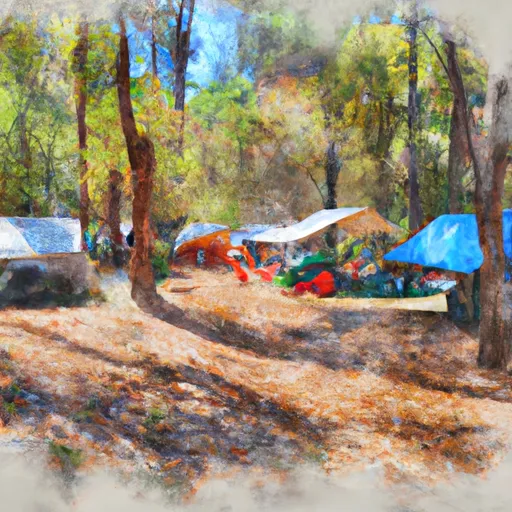
Walk-In 4 campground
Community Reviews
Been here? Share the conditions.
Reviews, ratings & photos are added in the free Snoflo iOS app — rate a spot, tag the conditions, and your visit is verified by location. Add or manage your reviews from the app.
Walk-In 4
Reservations are not accepted at this campground, making it a first-come, first-served location. Therefore, campers are advised to arrive early to secure a spot. The campground is quite popular, especially during peak seasons, so it is advisable to plan accordingly.
The best time to visit Walk-In 4 camping area is during the spring or fall, when the weather is typically mild. Summers tend to be hot and humid, while winters can be chilly. During these seasons, campers can enjoy pleasant temperatures and avoid potential crowds. However, it's always recommended to check the weather forecast before planning a trip.
While visiting Walk-In 4, campers should be cautious of wildlife in the area. It is advisable to store food securely to prevent attracting animals. Additionally, campers are encouraged to bring insect repellent to protect themselves from mosquitoes and ticks. Overall, Walk-In 4 camping area in Georgia offers a peaceful and well-equipped camping experience for nature enthusiasts.
What's on-site at Walk-In 4
Key facilities Snoflo tracks for this campground. Confirm with the operator before booking -- amenities can change seasonally.
Plan your trip down to the hour
Same weather feed Snoflo's iOS app uses -- updated continuously from NOAA / yr.no.
Next 5 days, hour by hour
Temperature line with weather symbols on top, snow + rain accumulation as columns, humidity as a dotted line.
5-day forecast table
Every 3 hours, broken out across temperature, snow, rain, humidity, and wind. Each cell is colour-coded relative to the column min/max so trends jump out at a glance.
| Time | Condition | Temp (°F) | Snow (in) | Rain (in) | Humidity (%) | Wind (mps) | Wind dir |
|---|---|---|---|---|---|---|---|
| Loading detailed forecast… | |||||||
15-day temperature & precipitation
Daily temperatures, snow, and rain projected over the next two weeks. Hover any point for the full breakdown.
Nearby streamflow
USGS streamgauges within reach of Walk-In 4 -- pulled live from the National Water Information System.
| Streamgauge | Discharge | View |
|---|---|---|
| Lookout Creek Near New England | 42 cfs | → |
| South Chickamauga Creek Near Chickamauga | 155 cfs | → |
| Sequatchie River Near Whitwell | 156 cfs | → |
| Chattooga River At Summerville | 100 cfs | → |
| Mill Creek At Dalton | 24 cfs | → |
| North Chickamauga Cr At Mile Straight | 0 cfs | → |
Nearby snow depths
NRCS SNOTEL stations within reach of Walk-In 4 -- relevant when planning a shoulder-season or alpine trip.
| SNOTEL station | Snowpack | 24h Snowfall | View |
|---|---|---|---|
| Woodville 8.0 Nne | 0.0 in | 0.0 in | → |
Plan a longer trip
The closest parks, lakes, boat launches, and paddle runs so a camping night can grow into a full weekend.
Parks
- Cloudland Canyon State Park
- Walker County Greenspace
- Lookout Mountain Battlefield And Point Park
- Prentice Cooper State Forest
- Natural Area Zahnd
- The Common And Mountain Maze
Boat launches
- Macedonia Road Marion County
- U.S. 41 18039, Chattanooga
- Mapleview Road, South Pittsburg
- Long Island
- Bridgeport
- Anchor Inn Bait & Tackle
Fishing spots
Points of interest
- Chickamauga Coal And Iron Company Coke Ovens
- Dyer House Site
- Snodgrass House
- Poe Cabin Site
- Chickamauga And Chattanooga National Military Park
- Lookout Mountain Battlefield Visitor Center
Paddle runs
- Desoto Falls In Desoto State Park To Confluence With Little River
- River Miles 8 Near Ga Sate Line To Confluence With Little River
- Confluence With East And West Branches To Al 37 Bridge
- Al 35 Bridge To Ends One Mile Upstream From Al 273 Bridge
- Begins One Mile Upstream From Al 273 Bridge To Lake Weiss
Camping essentials & Leave No Trace
- Pack it in, pack it out
- Take all trash, food scraps, and gear back with you to keep campsites clean and protect wildlife.
- Respect wildlife
- Observe animals from a distance, store food securely, and never feed wildlife to maintain natural behavior and safety.
- Know before you go
- Check weather, fire restrictions, trail conditions, and permit requirements to ensure a safe and well-planned trip.
- Minimize campfire impact
- Use established fire rings, keep fires small, fully extinguish them, or opt for a camp stove when fires are restricted.
- Leave what you find
- Preserve natural and cultural features by avoiding removal of plants, rocks, artifacts, or other elements of the environment.
Set push alerts in the Snoflo app
Save Walk-In 4 as a favorite, set a custom threshold (precipitation, snowpack, freezing temperatures), and the iOS app will push the moment conditions cross.
About Walk-In 4
Can I make reservations at Walk-In 4?
This campground does not appear to accept reservations -- it's typically first-come, first-served. Arrive early on summer weekends.
How fresh is the weather data on this page?
The hourly forecast updates throughout the day from the NOAA / yr.no public feeds. Streamflow data is pulled live from USGS streamgauges and snowpack from the NRCS SNOTEL network.
What's the best time of year to visit?
Use the 15-day temperature & precipitation outlook on this page to plan -- pick a window with comfortable temperatures and low precipitation. For longer trips, the 5-day hourly meteogram shows snow + rain accumulation hour-by-hour.
How do I get to Walk-In 4?
Tap Directions in the hero above to open driving directions in Google Maps, or Open in map to center the Snoflo interactive map on the campground.
Can I get alerts when conditions change?
Yes -- alerts are managed through the Snoflo iOS app. Favorite this campground, set a threshold (temperature, snowpack, precipitation), and you'll get a push the moment it crosses.