Farragut State Park Campground
Community Reviews
Been here? Share the conditions.
Reviews, ratings & photos are added in the free Snoflo iOS app — rate a spot, tag the conditions, and your visit is verified by location. Add or manage your reviews from the app.
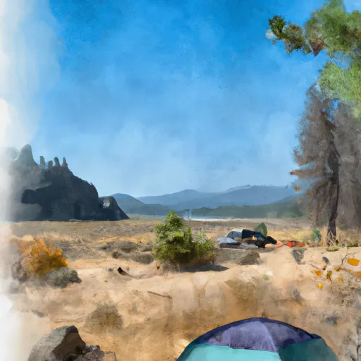
Farragut State Park
What's on-site at Farragut State Park
Key facilities Snoflo tracks for this campground. Confirm with the operator before booking -- amenities can change seasonally.
Plan your trip down to the hour
Same weather feed Snoflo's iOS app uses -- updated continuously from NOAA / yr.no.
Next 5 days, hour by hour
Temperature line with weather symbols on top, snow + rain accumulation as columns, humidity as a dotted line.
5-day forecast table
Every 3 hours, broken out across temperature, snow, rain, humidity, and wind. Each cell is colour-coded relative to the column min/max so trends jump out at a glance.
| Time | Condition | Temp (°F) | Snow (in) | Rain (in) | Humidity (%) | Wind (mps) | Wind dir |
|---|---|---|---|---|---|---|---|
| Loading detailed forecast… | |||||||
15-day temperature & precipitation
Daily temperatures, snow, and rain projected over the next two weeks. Hover any point for the full breakdown.
Other campgrounds in the area
Snoflo-tracked campsites within driving distance of Farragut State Park, with reservations status.
| Campground | Reservations | Toilets | View |
|---|---|---|---|
| Whitetail Campground | ✗ | ✗ | → |
| Snowberry Campground | ✗ | ✗ | → |
| Waldron Campground | ✗ | ✗ | → |
| Hill Campground | ✗ | ✗ | → |
| Hill Camground | ✗ | ✗ | → |
Nearby streamflow
USGS streamgauges within reach of Farragut State Park -- pulled live from the National Water Information System.
| Streamgauge | Discharge | View |
|---|---|---|
| Lightning Creek At Clark Fork Id | 17 cfs | → |
| Spokane River Blw Blackwell Nr Coeur D Alene Id | 1,420 cfs | → |
| Clark Fork River Below Cabinet Gorge Dam Id | 4,420 cfs | → |
| Priest River Nr Priest River Id | 276 cfs | → |
| Pend Oreille River At Newport Wa | 13,300 cfs | → |
| Spokane River Nr Post Falls Id | 700 cfs | → |
Nearby snow depths
NRCS SNOTEL stations within reach of Farragut State Park -- relevant when planning a shoulder-season or alpine trip.
| SNOTEL station | Snowpack | 24h Snowfall | View |
|---|---|---|---|
| Athol 1.5 Ene | 0.0 in | 0.0 in | → |
| Nohrsc Mosquito Ridge | 0.0 in | 0.0 in | → |
| Mosquito Ridge | 0.0 in | 0.0 in | → |
| Coeur D'Alene | 0.0 in | 0.0 in | → |
| Ragged Mountain | 0.0 in | 0.0 in | → |
| Ragged Mountain | 0.0 in | 0.0 in | → |
Plan a longer trip
The closest parks, lakes, boat launches, and paddle runs so a camping night can grow into a full weekend.
Parks
- Farragut State Park Visitor Center
- Round Lake State Park
- Croffoot Park And Sports Complex
- Honeysuckle Beach Park
- Finukane Park
- Canfield Sports Complex
Boat launches
Points of interest
Paddle runs
- Coeur D"Alene River, Sec. 8, T49n, R2e To Honey Mountain, Sec. 32, T53n, R1w
- Cataldo Mission To Coeur D'Alene Lake
- Confluence North Fork Coeur D'Alene River To Cataldo Mission
- Boundary Proposed Addition Cabinet Mtns Wilderness, Sec. To Cabinet Gorge Reservoir
- Forest Boundary, Sec. 34, T59n, R2w To Harrison Lake, Sec. 31, T62n, R2w
- Cabinet Mtns Wilderness Boundary, Sec. 3, T27n, R32w To Bull River, Sec. 12, T27n, R33w
Camping essentials & Leave No Trace
- Pack it in, pack it out
- Take all trash, food scraps, and gear back with you to keep campsites clean and protect wildlife.
- Respect wildlife
- Observe animals from a distance, store food securely, and never feed wildlife to maintain natural behavior and safety.
- Know before you go
- Check weather, fire restrictions, trail conditions, and permit requirements to ensure a safe and well-planned trip.
- Minimize campfire impact
- Use established fire rings, keep fires small, fully extinguish them, or opt for a camp stove when fires are restricted.
- Leave what you find
- Preserve natural and cultural features by avoiding removal of plants, rocks, artifacts, or other elements of the environment.
Set push alerts in the Snoflo app
Save Farragut State Park as a favorite, set a custom threshold (precipitation, snowpack, freezing temperatures), and the iOS app will push the moment conditions cross.
About Farragut State Park
Can I make reservations at Farragut State Park?
Yes -- this campground accepts reservations. Snoflo recommends booking early for peak season; check the operator (Recreation.gov / state park system / private operator) for the booking window and cancellation policy.
How fresh is the weather data on this page?
The hourly forecast updates throughout the day from the NOAA / yr.no public feeds. Streamflow data is pulled live from USGS streamgauges and snowpack from the NRCS SNOTEL network.
What's the best time of year to visit?
Use the 15-day temperature & precipitation outlook on this page to plan -- pick a window with comfortable temperatures and low precipitation. For longer trips, the 5-day hourly meteogram shows snow + rain accumulation hour-by-hour.
How do I get to Farragut State Park?
Tap Directions in the hero above to open driving directions in Google Maps, or Open in map to center the Snoflo interactive map on the campground.
Can I get alerts when conditions change?
Yes -- alerts are managed through the Snoflo iOS app. Favorite this campground, set a threshold (temperature, snowpack, precipitation), and you'll get a push the moment it crosses.
Other campgrounds near here
Snoflo-tracked campgrounds within driving distance of Farragut State Park.