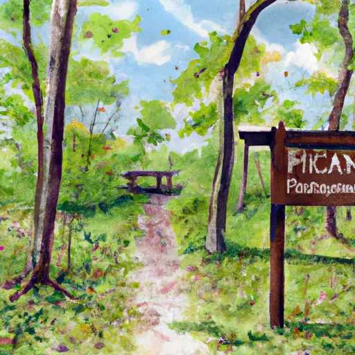
Paynatha Trail Head - Usfs Campground
Community Reviews
Been here? Share the conditions.
Reviews, ratings & photos are added in the free Snoflo iOS app — rate a spot, tag the conditions, and your visit is verified by location. Add or manage your reviews from the app.
Paynatha Trail Head - Usfs
Reservations are not accepted at Paynatha Trail Head, making it a first-come, first-served camping area. It is recommended to arrive early, especially during peak seasons, to secure a campsite. The best time to visit this campground is during the spring and fall seasons when the weather is pleasant, and the surrounding foliage offers breathtaking views. However, it is essential to note that the campground can become crowded during weekends and holidays, so planning ahead is advisable.
While enjoying your camping experience, keep in mind a few specific items of interest and things to be careful for. Paynatha Trail Head is situated in a wooded area, so be cautious of wildlife encounters and ensure proper food storage to avoid attracting animals. Additionally, campers should be mindful of fire safety and adhere to any posted regulations to prevent wildfires. Finally, it is recommended to bring insect repellent to protect against mosquitoes and other bugs that may be present in the area. With its natural beauty and amenities, Paynatha Trail Head is an ideal camping destination for nature enthusiasts seeking a tranquil outdoor experience in Illinois.
What's on-site at Paynatha Trail Head - Usfs
Key facilities Snoflo tracks for this campground. Confirm with the operator before booking -- amenities can change seasonally.
Plan your trip down to the hour
Same weather feed Snoflo's iOS app uses -- updated continuously from NOAA / yr.no.
Next 5 days, hour by hour
Temperature line with weather symbols on top, snow + rain accumulation as columns, humidity as a dotted line.
5-day forecast table
Every 3 hours, broken out across temperature, snow, rain, humidity, and wind. Each cell is colour-coded relative to the column min/max so trends jump out at a glance.
| Time | Condition | Temp (°F) | Snow (in) | Rain (in) | Humidity (%) | Wind (mps) | Wind dir |
|---|---|---|---|---|---|---|---|
| Loading detailed forecast… | |||||||
15-day temperature & precipitation
Daily temperatures, snow, and rain projected over the next two weeks. Hover any point for the full breakdown.
Other campgrounds in the area
Snoflo-tracked campsites within driving distance of Paynatha Trail Head - Usfs, with reservations status.
| Campground | Reservations | Toilets | View |
|---|---|---|---|
| Tombigbee National Forest - Davis Lake Campground | ✗ | ✗ | → |
| Witch Dance Bike Only Camping | ✗ | ✗ | → |
| Witch Dance Bicycle-Only Campground, At Milepost 234 | ✗ | ✗ | → |
| Tupelo Bicycle Only Campground | ✗ | ✗ | → |
| Natchez Trace Np - Tupelo Bicycle Cg | ✗ | ✓ | → |
Nearby streamflow
USGS streamgauges within reach of Paynatha Trail Head - Usfs -- pulled live from the National Water Information System.
| Streamgauge | Discharge | View |
|---|---|---|
| Town Creek Nr Nettleton | 110 cfs | → |
| Tombigbee River Nr Amory | 3,420 cfs | → |
| Town Creek At Eason Boulevard At Tupelo | 10 cfs | → |
| Skuna River At Bruce | 25 cfs | → |
| Tombigbee River At Bigbee | 401 cfs | → |
| Tombigbee River At Aberdeen Lock And Dam | 2,490 cfs | → |
Plan a longer trip
The closest parks, lakes, boat launches, and paddle runs so a camping night can grow into a full weekend.
Parks
- Trace State Park
- Tombigbee State Park
- Natchez Trace Parkway
- Holly Springs National Forest
- State Conservation Area Upper Sar
- Barton Ferry Recreation Area
Camping essentials & Leave No Trace
- Pack it in, pack it out
- Take all trash, food scraps, and gear back with you to keep campsites clean and protect wildlife.
- Respect wildlife
- Observe animals from a distance, store food securely, and never feed wildlife to maintain natural behavior and safety.
- Know before you go
- Check weather, fire restrictions, trail conditions, and permit requirements to ensure a safe and well-planned trip.
- Minimize campfire impact
- Use established fire rings, keep fires small, fully extinguish them, or opt for a camp stove when fires are restricted.
- Leave what you find
- Preserve natural and cultural features by avoiding removal of plants, rocks, artifacts, or other elements of the environment.
Set push alerts in the Snoflo app
Save Paynatha Trail Head - Usfs as a favorite, set a custom threshold (precipitation, snowpack, freezing temperatures), and the iOS app will push the moment conditions cross.
About Paynatha Trail Head - Usfs
Can I make reservations at Paynatha Trail Head - Usfs?
This campground does not appear to accept reservations -- it's typically first-come, first-served. Arrive early on summer weekends.
How fresh is the weather data on this page?
The hourly forecast updates throughout the day from the NOAA / yr.no public feeds. Streamflow data is pulled live from USGS streamgauges and snowpack from the NRCS SNOTEL network.
What's the best time of year to visit?
Use the 15-day temperature & precipitation outlook on this page to plan -- pick a window with comfortable temperatures and low precipitation. For longer trips, the 5-day hourly meteogram shows snow + rain accumulation hour-by-hour.
How do I get to Paynatha Trail Head - Usfs?
Tap Directions in the hero above to open driving directions in Google Maps, or Open in map to center the Snoflo interactive map on the campground.
Can I get alerts when conditions change?
Yes -- alerts are managed through the Snoflo iOS app. Favorite this campground, set a threshold (temperature, snowpack, precipitation), and you'll get a push the moment it crosses.
Other campgrounds near here
Snoflo-tracked campgrounds within driving distance of Paynatha Trail Head - Usfs.