Stannard Town Campground campground
Community Reviews
Been here? Share the conditions.
Reviews, ratings & photos are added in the free Snoflo iOS app — rate a spot, tag the conditions, and your visit is verified by location. Add or manage your reviews from the app.
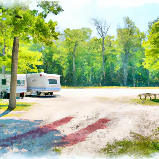
Stannard Town Campground
Reservations are accepted at Stannard Town Campground, allowing campers to plan their stay in advance. It is advisable to make reservations, especially during peak seasons, to secure a spot in this popular camping destination.
The best time to visit this campground is during the summer months when the weather is mild and perfect for outdoor activities. Campers can enjoy hiking, fishing, and wildlife watching in the area. However, it is important to be cautious of ticks during the warmer months and take necessary precautions such as wearing insect repellent and checking for ticks regularly.
In summary, Stannard Town Campground in Michigan offers various amenities, accepts reservations, and is best enjoyed during the summer months. Campers can expect a delightful experience surrounded by nature, with opportunities for hiking and other outdoor activities. Just remember to be mindful of ticks and take appropriate measures to avoid any inconvenience.
What's on-site at Stannard Town Campground
Key facilities Snoflo tracks for this campground. Confirm with the operator before booking -- amenities can change seasonally.
Plan your trip down to the hour
Same weather feed Snoflo's iOS app uses -- updated continuously from NOAA / yr.no.
Next 5 days, hour by hour
Temperature line with weather symbols on top, snow + rain accumulation as columns, humidity as a dotted line.
5-day forecast table
Every 3 hours, broken out across temperature, snow, rain, humidity, and wind. Each cell is colour-coded relative to the column min/max so trends jump out at a glance.
| Time | Condition | Temp (°F) | Snow (in) | Rain (in) | Humidity (%) | Wind (mps) | Wind dir |
|---|---|---|---|---|---|---|---|
| Loading detailed forecast… | |||||||
15-day temperature & precipitation
Daily temperatures, snow, and rain projected over the next two weeks. Hover any point for the full breakdown.
Other campgrounds in the area
Snoflo-tracked campsites within driving distance of Stannard Town Campground, with reservations status.
| Campground | Reservations | Toilets | View |
|---|---|---|---|
| Bond Falls Flowage | ✗ | ✓ | → |
| Robbins Pond Campground | ✗ | ✗ | → |
| Sparrow Rapids | ✗ | ✗ | → |
| Sparrow Rapids Campground | ✗ | ✗ | → |
| Bob Lake Campground | ✗ | ✗ | → |
Nearby streamflow
USGS streamgauges within reach of Stannard Town Campground -- pulled live from the National Water Information System.
| Streamgauge | Discharge | View |
|---|---|---|
| Bond Falls Canal Near Paulding | 91 cfs | → |
| Ontonagon River Near Rockland | 584 cfs | → |
| Middle Branch Ontonagon River Near Paulding | 108 cfs | → |
| West Branch Ontonagon River Near Bergland | 52 cfs | → |
| Cisco Branch Ontonagon R At Cisco Lake Outlet | 18 cfs | → |
| Sturgeon River Near Alston | 166 cfs | → |
Nearby snow depths
NRCS SNOTEL stations within reach of Stannard Town Campground -- relevant when planning a shoulder-season or alpine trip.
| SNOTEL station | Snowpack | 24h Snowfall | View |
|---|---|---|---|
| Paulding | 0.0 in | 0.0 in | → |
| Nohrsc Ontonagon 1.8 Ese | 0.0 in | 0.0 in | → |
| Watersmeet 12wsw | 0.0 in | 0.0 in | → |
| Watton 2wsw | 0.0 in | 0.0 in | → |
| Land O Lakes | 0.0 in | 0.0 in | → |
| Land O' Lakes 11.7 W | 0.0 in | 0.0 in | → |
Plan a longer trip
The closest parks, lakes, boat launches, and paddle runs so a camping night can grow into a full weekend.
Parks
- Lake Gogebic State Park
- Reimers Island
- Wilderness Sturgeon River Gorge
- Wilderness Sylvania
- National Wild And Scenic River Paint, Michigan
- Porcupine Mountains Wilderness State Park
Boat launches
- Steusser Lake
- Fs 5350 Interior Township
- Us 45 Haight Township
- Fs 5086-N Haight Township
- County Line Lake
- Bob Lake Road Laird Township
Fishing spots
- Steusser Lake
- Rockland Pond
- West Bay Lake
- Prickett Reservoir
- Lake Roland (Twin Lakes)
- Lake Gerald (Twin Lakes)
Points of interest
- Agate Falls
- Bond Falls Watefalls
- Sandstone Falls
- Old Victoria Historic Townsite
- Paulding Light
- Childhood Cottage Museum
Paddle runs
- South Branch,Confluence Of Cisco Branch And Tenmile Creek To Confluence With West Branch
- West Branch, Mi State Highway 28 To Cascade Falls
- From Wagner Lake In Sec 13, T49n, R31w To Eastern Boundary Of The Ottawa Nf In Sec 12, T48n, R35@
- West Branch Net River, From Its Source In Sec 35, T48n, R34w To Confluence With Mainstem Net River In Sec 24, T46n, R34w
- Net River Mainstem, Confluence With East/West Branches To Confluence With The Mainstem Paint River
- East Branch Net River, From Its Source In Sec 8, T47n, R32w To Confluence With Mainstem Net River In Sec 24, T46n, R34w
Camping essentials & Leave No Trace
- Pack it in, pack it out
- Take all trash, food scraps, and gear back with you to keep campsites clean and protect wildlife.
- Respect wildlife
- Observe animals from a distance, store food securely, and never feed wildlife to maintain natural behavior and safety.
- Know before you go
- Check weather, fire restrictions, trail conditions, and permit requirements to ensure a safe and well-planned trip.
- Minimize campfire impact
- Use established fire rings, keep fires small, fully extinguish them, or opt for a camp stove when fires are restricted.
- Leave what you find
- Preserve natural and cultural features by avoiding removal of plants, rocks, artifacts, or other elements of the environment.
Set push alerts in the Snoflo app
Save Stannard Town Campground as a favorite, set a custom threshold (precipitation, snowpack, freezing temperatures), and the iOS app will push the moment conditions cross.
About Stannard Town Campground
Can I make reservations at Stannard Town Campground?
This campground does not appear to accept reservations -- it's typically first-come, first-served. Arrive early on summer weekends.
How fresh is the weather data on this page?
The hourly forecast updates throughout the day from the NOAA / yr.no public feeds. Streamflow data is pulled live from USGS streamgauges and snowpack from the NRCS SNOTEL network.
What's the best time of year to visit?
Use the 15-day temperature & precipitation outlook on this page to plan -- pick a window with comfortable temperatures and low precipitation. For longer trips, the 5-day hourly meteogram shows snow + rain accumulation hour-by-hour.
How do I get to Stannard Town Campground?
Tap Directions in the hero above to open driving directions in Google Maps, or Open in map to center the Snoflo interactive map on the campground.
Can I get alerts when conditions change?
Yes -- alerts are managed through the Snoflo iOS app. Favorite this campground, set a threshold (temperature, snowpack, precipitation), and you'll get a push the moment it crosses.
Other campgrounds near here
Snoflo-tracked campgrounds within driving distance of Stannard Town Campground.