Sugar River Forest Preserve - Riverfront campground
Community Reviews
Been here? Share the conditions.
Reviews, ratings & photos are added in the free Snoflo iOS app — rate a spot, tag the conditions, and your visit is verified by location. Add or manage your reviews from the app.
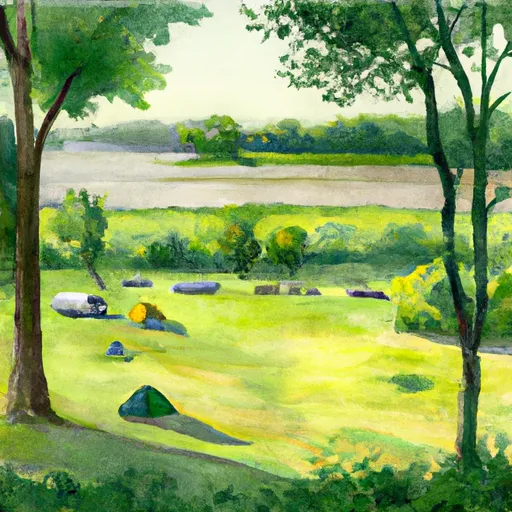
Sugar River Forest Preserve - Riverfront
Reservations are accepted at Sugar River Forest Preserve, allowing campers to secure their preferred camping spot in advance. It is advisable to make reservations, especially during peak seasons, to ensure availability. The best time of year to visit the campground is during the spring and fall seasons when the weather is pleasant, and the surrounding foliage is vibrant. Summer can also be a popular time, but it may become crowded due to the peak camping season.
There are a few specific items of interest to explore within the camping area. The Sugar River offers excellent opportunities for fishing, with a variety of species including trout and bass. The preserve also boasts scenic hiking trails where visitors can immerse themselves in the beauty of the surrounding nature. It is important to be cautious while camping at Sugar River Forest Preserve and to adhere to any safety guidelines provided by the park. This includes being aware of potential wildlife encounters and taking necessary precautions to prevent any incidents.
What's on-site at Sugar River Forest Preserve - Riverfront
Key facilities Snoflo tracks for this campground. Confirm with the operator before booking -- amenities can change seasonally.
Plan your trip down to the hour
Same weather feed Snoflo's iOS app uses -- updated continuously from NOAA / yr.no.
Next 5 days, hour by hour
Temperature line with weather symbols on top, snow + rain accumulation as columns, humidity as a dotted line.
5-day forecast table
Every 3 hours, broken out across temperature, snow, rain, humidity, and wind. Each cell is colour-coded relative to the column min/max so trends jump out at a glance.
| Time | Condition | Temp (°F) | Snow (in) | Rain (in) | Humidity (%) | Wind (mps) | Wind dir |
|---|---|---|---|---|---|---|---|
| Loading detailed forecast… | |||||||
15-day temperature & precipitation
Daily temperatures, snow, and rain projected over the next two weeks. Hover any point for the full breakdown.
Other campgrounds in the area
Snoflo-tracked campsites within driving distance of Sugar River Forest Preserve - Riverfront, with reservations status.
| Campground | Reservations | Toilets | View |
|---|---|---|---|
| Sugar River Forest Preserve - Pine Tree | ✗ | ✗ | → |
| Rivers Edge Campground | ✗ | ✗ | → |
| Hononegah Forest Preserve Campground | ✓ | ✗ | → |
| Orpr Camp | ✗ | ✗ | → |
| E.T. Seton | ✗ | ✗ | → |
Nearby streamflow
USGS streamgauges within reach of Sugar River Forest Preserve - Riverfront -- pulled live from the National Water Information System.
| Streamgauge | Discharge | View |
|---|---|---|
| Pecatonica River Nr Shirland | 1,910 cfs | → |
| Rock River At Rockton | 4,000 cfs | → |
| Sugar River Near Brodhead | 265 cfs | → |
| Rock River At Afton | 1,510 cfs | → |
| Pecatonica River At Freeport | 1,060 cfs | → |
| Kishwaukee River Near Perryville | 804 cfs | → |
Nearby snow depths
NRCS SNOTEL stations within reach of Sugar River Forest Preserve - Riverfront -- relevant when planning a shoulder-season or alpine trip.
| SNOTEL station | Snowpack | 24h Snowfall | View |
|---|---|---|---|
| Beloit | 0.0 in | 0.0 in | → |
| Brodhead | 0.0 in | 0.0 in | → |
| Rock River | 14.0 in | 0.0 in | → |
| Roscoe 1.6 Ese | 0.0 in | 0.0 in | → |
| New Millford 3.3 W | 0.0 in | 0.0 in | → |
| Pecatonica River | 0.0 in | 0.0 in | → |
Plan a longer trip
The closest parks, lakes, boat launches, and paddle runs so a camping night can grow into a full weekend.
Parks
- Nature Preserve Colored Sands Bluff
- Sugar River Forest Preserve
- Avon Bottoms Wildlife Area
- Nature Preserve Sugar River Alder
- Beckman Mill Park
- Trask Bridge Forest Preserve
Camping essentials & Leave No Trace
- Pack it in, pack it out
- Take all trash, food scraps, and gear back with you to keep campsites clean and protect wildlife.
- Respect wildlife
- Observe animals from a distance, store food securely, and never feed wildlife to maintain natural behavior and safety.
- Know before you go
- Check weather, fire restrictions, trail conditions, and permit requirements to ensure a safe and well-planned trip.
- Minimize campfire impact
- Use established fire rings, keep fires small, fully extinguish them, or opt for a camp stove when fires are restricted.
- Leave what you find
- Preserve natural and cultural features by avoiding removal of plants, rocks, artifacts, or other elements of the environment.
Set push alerts in the Snoflo app
Save Sugar River Forest Preserve - Riverfront as a favorite, set a custom threshold (precipitation, snowpack, freezing temperatures), and the iOS app will push the moment conditions cross.
About Sugar River Forest Preserve - Riverfront
Can I make reservations at Sugar River Forest Preserve - Riverfront?
This campground does not appear to accept reservations -- it's typically first-come, first-served. Arrive early on summer weekends.
How fresh is the weather data on this page?
The hourly forecast updates throughout the day from the NOAA / yr.no public feeds. Streamflow data is pulled live from USGS streamgauges and snowpack from the NRCS SNOTEL network.
What's the best time of year to visit?
Use the 15-day temperature & precipitation outlook on this page to plan -- pick a window with comfortable temperatures and low precipitation. For longer trips, the 5-day hourly meteogram shows snow + rain accumulation hour-by-hour.
How do I get to Sugar River Forest Preserve - Riverfront?
Tap Directions in the hero above to open driving directions in Google Maps, or Open in map to center the Snoflo interactive map on the campground.
Can I get alerts when conditions change?
Yes -- alerts are managed through the Snoflo iOS app. Favorite this campground, set a threshold (temperature, snowpack, precipitation), and you'll get a push the moment it crosses.
Other campgrounds near here
Snoflo-tracked campgrounds within driving distance of Sugar River Forest Preserve - Riverfront.