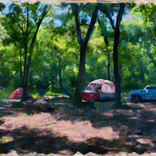
Delaney Creek Park campground
Community Reviews
Been here? Share the conditions.
Reviews, ratings & photos are added in the free Snoflo iOS app — rate a spot, tag the conditions, and your visit is verified by location. Add or manage your reviews from the app.
Delaney Creek Park
Reservations are accepted at Delaney Creek Park, allowing campers to secure their preferred campsites in advance. This is particularly beneficial during peak seasons when the campground tends to be busier. It is worth noting that the campground operates on a first-come, first-served basis for reservations, so early booking is recommended.
The best time to visit Delaney Creek Park is during the warmer months, typically from spring through fall. This is when the weather is most pleasant for outdoor activities such as hiking, fishing, and wildlife watching. The campground's proximity to Delaney Creek, which offers excellent fishing opportunities, makes it a popular destination for anglers. However, it is important to be cautious of potential wildlife encounters, particularly in wooded areas. It is advisable to properly store food and dispose of trash to minimize the risk of attracting unwanted animal visitors.
Overall, Delaney Creek Park in Indiana is an ideal camping destination, offering well-appointed campsites, essential amenities, and the opportunity to enjoy the beauty of nature.
What's on-site at Delaney Creek Park
Key facilities Snoflo tracks for this campground. Confirm with the operator before booking -- amenities can change seasonally.
Plan your trip down to the hour
Same weather feed Snoflo's iOS app uses -- updated continuously from NOAA / yr.no.
Next 5 days, hour by hour
Temperature line with weather symbols on top, snow + rain accumulation as columns, humidity as a dotted line.
5-day forecast table
Every 3 hours, broken out across temperature, snow, rain, humidity, and wind. Each cell is colour-coded relative to the column min/max so trends jump out at a glance.
| Time | Condition | Temp (°F) | Snow (in) | Rain (in) | Humidity (%) | Wind (mps) | Wind dir |
|---|---|---|---|---|---|---|---|
| Loading detailed forecast… | |||||||
15-day temperature & precipitation
Daily temperatures, snow, and rain projected over the next two weeks. Hover any point for the full breakdown.
Other campgrounds in the area
Snoflo-tracked campsites within driving distance of Delaney Creek Park, with reservations status.
| Campground | Reservations | Toilets | View |
|---|---|---|---|
| Starve Hollow State Rec Area | ✓ | ✗ | → |
| Jackson - Washington State Forest | ✗ | ✗ | → |
| Clark State Forest | ✗ | ✗ | → |
| Hardy Lake State Rec Area | ✓ | ✗ | → |
| Campground Gatehouse | ✗ | ✗ | → |
Nearby streamflow
USGS streamgauges within reach of Delaney Creek Park -- pulled live from the National Water Information System.
| Streamgauge | Discharge | View |
|---|---|---|
| West Fork Blue River At Salem | 6 cfs | → |
| East Fork White River At Seymour Ind | 1,500 cfs | → |
| East Fork White River Near Bedford | 2,280 cfs | → |
| Muscatatuck River Near Deputy | 43 cfs | → |
| Blue River At Fredericksburg | 138 cfs | → |
| Vernon Fork Muscatatuck River At Vernon | 63 cfs | → |
Nearby snow depths
NRCS SNOTEL stations within reach of Delaney Creek Park -- relevant when planning a shoulder-season or alpine trip.
| SNOTEL station | Snowpack | 24h Snowfall | View |
|---|---|---|---|
| Campbellsburg 8.4 Nne | 0.0 in | 0.0 in | → |
| Columbus Wastewater Treatment Plant | 0.0 in | 0.0 in | → |
Plan a longer trip
The closest parks, lakes, boat launches, and paddle runs so a camping night can grow into a full weekend.
Parks
- Starve Hollow State Recreation Area
- Jackson Washington State Forest
- Manaugh Park
- Austin Community Park
- Nichols-Wilson Park
- William H Graham Park
Boat launches
- County Road 775 South, Vallonia
- East Delaney Millport Road 76, Vallonia
- Sages Ferry Public Access South
- Jackson County
- North Elk Creek Road 3477-3501, Scottsburg
- Medora
Points of interest
Paddle runs
- Junction Of North/South Forks Of Lost River To State Road 337 Bridge, Approx 4 Miles Southeast Of Orleans, In
- State Road 337 Bridge To State Road 56 Bridge At Prospect, In
- State Road 56 Bridge To Forest Purchase Boundary At Roland, In
- City Limits Of English, In To Carnes Mill Site In Ne1/4ne1/4 Of Sec 13, T3s, R1w
- Carnes Mill Site To 7.65 Miles Above Confluece With Ohio River At Confluence With Turkey Creek
Camping essentials & Leave No Trace
- Pack it in, pack it out
- Take all trash, food scraps, and gear back with you to keep campsites clean and protect wildlife.
- Respect wildlife
- Observe animals from a distance, store food securely, and never feed wildlife to maintain natural behavior and safety.
- Know before you go
- Check weather, fire restrictions, trail conditions, and permit requirements to ensure a safe and well-planned trip.
- Minimize campfire impact
- Use established fire rings, keep fires small, fully extinguish them, or opt for a camp stove when fires are restricted.
- Leave what you find
- Preserve natural and cultural features by avoiding removal of plants, rocks, artifacts, or other elements of the environment.
Set push alerts in the Snoflo app
Save Delaney Creek Park as a favorite, set a custom threshold (precipitation, snowpack, freezing temperatures), and the iOS app will push the moment conditions cross.
About Delaney Creek Park
Can I make reservations at Delaney Creek Park?
This campground does not appear to accept reservations -- it's typically first-come, first-served. Arrive early on summer weekends.
How fresh is the weather data on this page?
The hourly forecast updates throughout the day from the NOAA / yr.no public feeds. Streamflow data is pulled live from USGS streamgauges and snowpack from the NRCS SNOTEL network.
What's the best time of year to visit?
Use the 15-day temperature & precipitation outlook on this page to plan -- pick a window with comfortable temperatures and low precipitation. For longer trips, the 5-day hourly meteogram shows snow + rain accumulation hour-by-hour.
How do I get to Delaney Creek Park?
Tap Directions in the hero above to open driving directions in Google Maps, or Open in map to center the Snoflo interactive map on the campground.
Can I get alerts when conditions change?
Yes -- alerts are managed through the Snoflo iOS app. Favorite this campground, set a threshold (temperature, snowpack, precipitation), and you'll get a push the moment it crosses.
Other campgrounds near here
Snoflo-tracked campgrounds within driving distance of Delaney Creek Park.