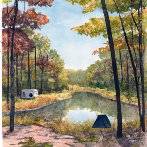
Clark State Forest Campground
Community Reviews
Been here? Share the conditions.
Reviews, ratings & photos are added in the free Snoflo iOS app — rate a spot, tag the conditions, and your visit is verified by location. Add or manage your reviews from the app.
Clark State Forest
What's on-site at Clark State Forest
Key facilities Snoflo tracks for this campground. Confirm with the operator before booking -- amenities can change seasonally.
Plan your trip down to the hour
Same weather feed Snoflo's iOS app uses -- updated continuously from NOAA / yr.no.
Next 5 days, hour by hour
Temperature line with weather symbols on top, snow + rain accumulation as columns, humidity as a dotted line.
5-day forecast table
Every 3 hours, broken out across temperature, snow, rain, humidity, and wind. Each cell is colour-coded relative to the column min/max so trends jump out at a glance.
| Time | Condition | Temp (°F) | Snow (in) | Rain (in) | Humidity (%) | Wind (mps) | Wind dir |
|---|---|---|---|---|---|---|---|
| Loading detailed forecast… | |||||||
15-day temperature & precipitation
Daily temperatures, snow, and rain projected over the next two weeks. Hover any point for the full breakdown.
Other campgrounds in the area
Snoflo-tracked campsites within driving distance of Clark State Forest, with reservations status.
| Campground | Reservations | Toilets | View |
|---|---|---|---|
| Deam Lake Campground | ✗ | ✗ | → |
| Deam Lake State Rec Area | ✓ | ✗ | → |
| Buffalo Trace Co Park | ✗ | ✓ | → |
| Delaney Creek Park | ✗ | ✗ | → |
| Charlestown State Park | ✓ | ✗ | → |
Nearby streamflow
USGS streamgauges within reach of Clark State Forest -- pulled live from the National Water Information System.
| Streamgauge | Discharge | View |
|---|---|---|
| West Fork Blue River At Salem | 5 cfs | → |
| Blue River At Fredericksburg | 124 cfs | → |
| Silver Creek Near Sellersburg | 41 cfs | → |
| Muddy Fk At Mockingbird Valley Rd At Louisville | 3 cfs | → |
| Muscatatuck River Near Deputy | 13 cfs | → |
| Little Goose Creek Near Harrods Creek | 6 cfs | → |
Nearby snow depths
NRCS SNOTEL stations within reach of Clark State Forest -- relevant when planning a shoulder-season or alpine trip.
| SNOTEL station | Snowpack | 24h Snowfall | View |
|---|---|---|---|
| Campbellsburg 8.4 Nne | 0.0 in | 0.0 in | → |
| Columbus Wastewater Treatment Plant | 0.0 in | 0.0 in | → |
Plan a longer trip
The closest parks, lakes, boat launches, and paddle runs so a camping night can grow into a full weekend.
Parks
- Deam Lake State Recreation Area
- Clark State Forest
- Nichols-Wilson Park
- William H Graham Park
- Linza Graham Park
- Speed Park
Boat launches
- North Elk Creek Road 3477-3501, Scottsburg
- Sages Ferry Public Access South
- County Road 775 South, Vallonia
- East Delaney Millport Road 76, Vallonia
- Ohio River Greenway 100-598, New Albany
- Tailwater
Points of interest
- Prather Site
- Shelby Place Historic District
- Cedar Bough Place Historic District
- Indiana Army Ammunition Plant
- Divison Street School
- New Albany Downtown Historic District
Paddle runs
- Junction Of North/South Forks Of Lost River To State Road 337 Bridge, Approx 4 Miles Southeast Of Orleans, In
- City Limits Of English, In To Carnes Mill Site In Ne1/4ne1/4 Of Sec 13, T3s, R1w
- State Road 337 Bridge To State Road 56 Bridge At Prospect, In
- Carnes Mill Site To 7.65 Miles Above Confluece With Ohio River At Confluence With Turkey Creek
- State Road 56 Bridge To Forest Purchase Boundary At Roland, In
Camping essentials & Leave No Trace
- Pack it in, pack it out
- Take all trash, food scraps, and gear back with you to keep campsites clean and protect wildlife.
- Respect wildlife
- Observe animals from a distance, store food securely, and never feed wildlife to maintain natural behavior and safety.
- Know before you go
- Check weather, fire restrictions, trail conditions, and permit requirements to ensure a safe and well-planned trip.
- Minimize campfire impact
- Use established fire rings, keep fires small, fully extinguish them, or opt for a camp stove when fires are restricted.
- Leave what you find
- Preserve natural and cultural features by avoiding removal of plants, rocks, artifacts, or other elements of the environment.
Set push alerts in the Snoflo app
Save Clark State Forest as a favorite, set a custom threshold (precipitation, snowpack, freezing temperatures), and the iOS app will push the moment conditions cross.
About Clark State Forest
Can I make reservations at Clark State Forest?
This campground does not appear to accept reservations -- it's typically first-come, first-served. Arrive early on summer weekends.
How fresh is the weather data on this page?
The hourly forecast updates throughout the day from the NOAA / yr.no public feeds. Streamflow data is pulled live from USGS streamgauges and snowpack from the NRCS SNOTEL network.
What's the best time of year to visit?
Use the 15-day temperature & precipitation outlook on this page to plan -- pick a window with comfortable temperatures and low precipitation. For longer trips, the 5-day hourly meteogram shows snow + rain accumulation hour-by-hour.
How do I get to Clark State Forest?
Tap Directions in the hero above to open driving directions in Google Maps, or Open in map to center the Snoflo interactive map on the campground.
Can I get alerts when conditions change?
Yes -- alerts are managed through the Snoflo iOS app. Favorite this campground, set a threshold (temperature, snowpack, precipitation), and you'll get a push the moment it crosses.
Other campgrounds near here
Snoflo-tracked campgrounds within driving distance of Clark State Forest.