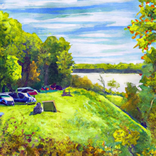
Saddle Lake Rec Area Campground
Community Reviews
Been here? Share the conditions.
Reviews, ratings & photos are added in the free Snoflo iOS app — rate a spot, tag the conditions, and your visit is verified by location. Add or manage your reviews from the app.
Saddle Lake Rec Area
The campground itself offers a number of amenities including showers, picnic tables, and fire rings. The area is first-come-first-serve, so it is recommended to arrive early to secure a spot. There are 50 campsites available.
An interesting fact about the Saddle Lake Rec Area Camping Area is that it is located on the site of a former dairy farm. The land was purchased by the government in the 1960s and turned into a recreational area.
The best time of year to visit is in the summer months when temperatures average around 80 degrees Fahrenheit. However, visitors should be aware that this is also the busiest time of year and the campground may fill up quickly.
What's on-site at Saddle Lake Rec Area
Key facilities Snoflo tracks for this campground. Confirm with the operator before booking -- amenities can change seasonally.
Plan your trip down to the hour
Same weather feed Snoflo's iOS app uses -- updated continuously from NOAA / yr.no.
Next 5 days, hour by hour
Temperature line with weather symbols on top, snow + rain accumulation as columns, humidity as a dotted line.
5-day forecast table
Every 3 hours, broken out across temperature, snow, rain, humidity, and wind. Each cell is colour-coded relative to the column min/max so trends jump out at a glance.
| Time | Condition | Temp (°F) | Snow (in) | Rain (in) | Humidity (%) | Wind (mps) | Wind dir |
|---|---|---|---|---|---|---|---|
| Loading detailed forecast… | |||||||
15-day temperature & precipitation
Daily temperatures, snow, and rain projected over the next two weeks. Hover any point for the full breakdown.
Other campgrounds in the area
Snoflo-tracked campsites within driving distance of Saddle Lake Rec Area, with reservations status.
| Campground | Reservations | Toilets | View |
|---|---|---|---|
| Dogwood Loop | ✓ | ✗ | → |
| Tipsaw | ✓ | ✗ | → |
| Primrose Loop | ✓ | ✗ | → |
| Jackpine Loop | ✓ | ✗ | → |
| Goldenrod Loop | ✓ | ✗ | → |
Nearby streamflow
USGS streamgauges within reach of Saddle Lake Rec Area -- pulled live from the National Water Information System.
| Streamgauge | Discharge | View |
|---|---|---|
| Middle Fork Anderson River At Bristow | 26 cfs | → |
| Ohio River At Cannelton Dam At Cannelton | 134,000 cfs | → |
| Blue River Near White Cloud | 245 cfs | → |
| Patoka River At Jasper | 252 cfs | → |
| Buck Creek Near New Middletown | 32 cfs | → |
| South Fork Panther Creek Near Whitesville | 12 cfs | → |
Nearby snow depths
NRCS SNOTEL stations within reach of Saddle Lake Rec Area -- relevant when planning a shoulder-season or alpine trip.
| SNOTEL station | Snowpack | 24h Snowfall | View |
|---|---|---|---|
| Huntingburg 0.4 Ssw | 0.0 in | 0.0 in | → |
| Corners | 0.0 in | 0.0 in | → |
Plan a longer trip
The closest parks, lakes, boat launches, and paddle runs so a camping night can grow into a full weekend.
Parks
- Ferdinand State Forest
- Hoosier National Forest
- Yellowbank Wildlife Management Area
- Ferdinand Municipal Park
- Lincoln State Park
- Lincoln Boyhood National Memorial
Boat launches
- Derby Community Center
- Water Street 300, Troy
- Ohio River Scenic Byway 7941, Derby
- Big Poison Creek
- Tell City
- Sr 166 8699, Perry County
Points of interest
- Huffman Mill
- Clover Lick Barrens
- Buzzard Roost Recreation Area
- Boone Creek Barrens
- Santa’S Candy Castle
- Holiday World & Splashin' Safari
Paddle runs
- Carnes Mill Site To 7.65 Miles Above Confluece With Ohio River At Confluence With Turkey Creek
- City Limits Of English, In To Carnes Mill Site In Ne1/4ne1/4 Of Sec 13, T3s, R1w
- State Road 337 Bridge To State Road 56 Bridge At Prospect, In
- State Road 56 Bridge To Forest Purchase Boundary At Roland, In
- Junction Of North/South Forks Of Lost River To State Road 337 Bridge, Approx 4 Miles Southeast Of Orleans, In
Camping essentials & Leave No Trace
- Pack it in, pack it out
- Take all trash, food scraps, and gear back with you to keep campsites clean and protect wildlife.
- Respect wildlife
- Observe animals from a distance, store food securely, and never feed wildlife to maintain natural behavior and safety.
- Know before you go
- Check weather, fire restrictions, trail conditions, and permit requirements to ensure a safe and well-planned trip.
- Minimize campfire impact
- Use established fire rings, keep fires small, fully extinguish them, or opt for a camp stove when fires are restricted.
- Leave what you find
- Preserve natural and cultural features by avoiding removal of plants, rocks, artifacts, or other elements of the environment.
Set push alerts in the Snoflo app
Save Saddle Lake Rec Area as a favorite, set a custom threshold (precipitation, snowpack, freezing temperatures), and the iOS app will push the moment conditions cross.
About Saddle Lake Rec Area
Can I make reservations at Saddle Lake Rec Area?
This campground does not appear to accept reservations -- it's typically first-come, first-served. Arrive early on summer weekends.
How fresh is the weather data on this page?
The hourly forecast updates throughout the day from the NOAA / yr.no public feeds. Streamflow data is pulled live from USGS streamgauges and snowpack from the NRCS SNOTEL network.
What's the best time of year to visit?
Use the 15-day temperature & precipitation outlook on this page to plan -- pick a window with comfortable temperatures and low precipitation. For longer trips, the 5-day hourly meteogram shows snow + rain accumulation hour-by-hour.
How do I get to Saddle Lake Rec Area?
Tap Directions in the hero above to open driving directions in Google Maps, or Open in map to center the Snoflo interactive map on the campground.
Can I get alerts when conditions change?
Yes -- alerts are managed through the Snoflo iOS app. Favorite this campground, set a threshold (temperature, snowpack, precipitation), and you'll get a push the moment it crosses.
Other campgrounds near here
Snoflo-tracked campgrounds within driving distance of Saddle Lake Rec Area.