Deer Lake - State Forest Campground
Community Reviews
Been here? Share the conditions.
Reviews, ratings & photos are added in the free Snoflo iOS app — rate a spot, tag the conditions, and your visit is verified by location. Add or manage your reviews from the app.
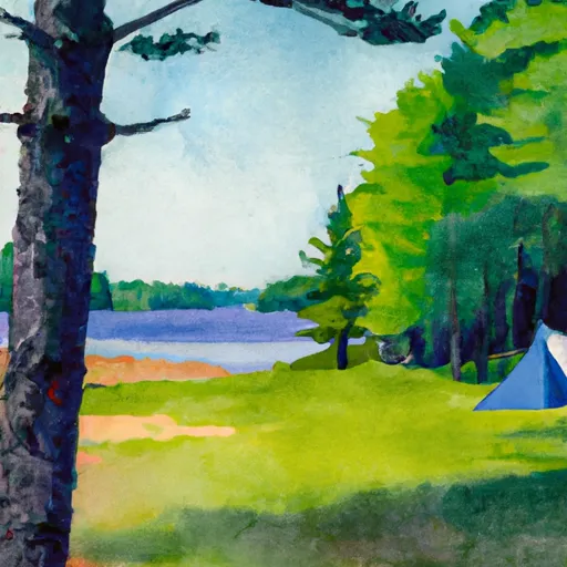
Deer Lake - State Forest
Reservations are not accepted at Deer Lake State Forest camping area, as it operates on a first-come, first-served basis. It is advisable to arrive early, especially during peak seasons, to secure a camping spot. The best time to visit this camping area is during the spring and summer months when the weather is pleasant, and the foliage is lush. Campers can engage in activities like fishing, hiking, and wildlife spotting in the surrounding area.
While exploring Deer Lake State Forest camping area, it is crucial to be cautious of wildlife encounters, such as black bears and coyotes. Campers should ensure proper food storage to prevent attracting animals to their campsite. Additionally, it is advisable to bring insect repellent, as mosquitoes and ticks can be present in the area. By being mindful of these factors and adhering to Leave No Trace principles, campers can have a memorable and enjoyable experience at Deer Lake State Forest camping area.
What's on-site at Deer Lake - State Forest
Key facilities Snoflo tracks for this campground. Confirm with the operator before booking -- amenities can change seasonally.
Plan your trip down to the hour
Same weather feed Snoflo's iOS app uses -- updated continuously from NOAA / yr.no.
Next 5 days, hour by hour
Temperature line with weather symbols on top, snow + rain accumulation as columns, humidity as a dotted line.
5-day forecast table
Every 3 hours, broken out across temperature, snow, rain, humidity, and wind. Each cell is colour-coded relative to the column min/max so trends jump out at a glance.
| Time | Condition | Temp (°F) | Snow (in) | Rain (in) | Humidity (%) | Wind (mps) | Wind dir |
|---|---|---|---|---|---|---|---|
| Loading detailed forecast… | |||||||
15-day temperature & precipitation
Daily temperatures, snow, and rain projected over the next two weeks. Hover any point for the full breakdown.
Other campgrounds in the area
Snoflo-tracked campsites within driving distance of Deer Lake - State Forest, with reservations status.
| Campground | Reservations | Toilets | View |
|---|---|---|---|
| Deer Lake State Forest Campground | ✗ | ✗ | → |
| Squaw Lake State Forest Campground | ✗ | ✗ | → |
| Lake Ellen Camp | ✗ | ✗ | → |
| King Lake State Forest Campground | ✗ | ✗ | → |
| North Horseshoe Lake State Forest Campground | ✗ | ✗ | → |
Nearby streamflow
USGS streamgauges within reach of Deer Lake - State Forest -- pulled live from the National Water Information System.
| Streamgauge | Discharge | View |
|---|---|---|
| Michigamme River Near Crystal Falls | 791 cfs | → |
| Sturgeon River Near Sidnaw | 46 cfs | → |
| Paint River Nr Alpha | 292 cfs | → |
| Iron River At County Hwy-424 At Caspian | 58 cfs | → |
| Middle Branch Escanaba River At Humboldt | 22 cfs | → |
| Brule River At Us Highway 2 Near Florence | 183 cfs | → |
Nearby snow depths
NRCS SNOTEL stations within reach of Deer Lake - State Forest -- relevant when planning a shoulder-season or alpine trip.
| SNOTEL station | Snowpack | 24h Snowfall | View |
|---|---|---|---|
| Amasa 1w | 0.0 in | 0.0 in | → |
| Michigamme 3wnw | 0.0 in | 0.0 in | → |
| Three Lakes | 0.0 in | 0.0 in | → |
| Covington | 0.0 in | 0.0 in | → |
| Watton 2wsw | 0.0 in | 0.0 in | → |
| Herman | 0.0 in | 0.0 in | → |
Plan a longer trip
The closest parks, lakes, boat launches, and paddle runs so a camping night can grow into a full weekend.
Parks
- Bewabic State Park
- Craig Lake State Park
- Van Riper State Park
- Wilderness Sturgeon River Gorge
- Mccormick Wilderness
- County Fair Park
Boat launches
- Deer Lake Road Crystal Falls Township
- Fishing Site No 1 Road Hematite Township
- Bates-Amasa Road Crystal Falls Township
- Net River Dam Road Covington Township
- Kohon Road Crystal Falls Township
- Cable Shores Drive Hematite Township
Fishing spots
Points of interest
- Amasa Historical Museum
- Crystal Falls Dam
- Crystal Falls Power Plant
- Michigamme Historical Museum
- Chicagon Mine Road
- East Genesee Street
Paddle runs
- East Branch Net River, From Its Source In Sec 8, T47n, R32w To Confluence With Mainstem Net River In Sec 24, T46n, R34w
- West Branch Net River, From Its Source In Sec 35, T48n, R34w To Confluence With Mainstem Net River In Sec 24, T46n, R34w
- Net River Mainstem, Confluence With East/West Branches To Confluence With The Mainstem Paint River
- Mainstem, Easternforest Boundary In Sec 1, T44n, R35w To City Of Crystal Falls
- From Wagner Lake In Sec 13, T49n, R31w To Eastern Boundary Of The Ottawa Nf In Sec 12, T48n, R35@
- Brule Lake In Ne1/4 Sec 15, T41n, R13e To Forest Boundary In Se1/4 Sec 31, T41n, R17e
Camping essentials & Leave No Trace
- Pack it in, pack it out
- Take all trash, food scraps, and gear back with you to keep campsites clean and protect wildlife.
- Respect wildlife
- Observe animals from a distance, store food securely, and never feed wildlife to maintain natural behavior and safety.
- Know before you go
- Check weather, fire restrictions, trail conditions, and permit requirements to ensure a safe and well-planned trip.
- Minimize campfire impact
- Use established fire rings, keep fires small, fully extinguish them, or opt for a camp stove when fires are restricted.
- Leave what you find
- Preserve natural and cultural features by avoiding removal of plants, rocks, artifacts, or other elements of the environment.
Set push alerts in the Snoflo app
Save Deer Lake - State Forest as a favorite, set a custom threshold (precipitation, snowpack, freezing temperatures), and the iOS app will push the moment conditions cross.
About Deer Lake - State Forest
Can I make reservations at Deer Lake - State Forest?
This campground does not appear to accept reservations -- it's typically first-come, first-served. Arrive early on summer weekends.
How fresh is the weather data on this page?
The hourly forecast updates throughout the day from the NOAA / yr.no public feeds. Streamflow data is pulled live from USGS streamgauges and snowpack from the NRCS SNOTEL network.
What's the best time of year to visit?
Use the 15-day temperature & precipitation outlook on this page to plan -- pick a window with comfortable temperatures and low precipitation. For longer trips, the 5-day hourly meteogram shows snow + rain accumulation hour-by-hour.
How do I get to Deer Lake - State Forest?
Tap Directions in the hero above to open driving directions in Google Maps, or Open in map to center the Snoflo interactive map on the campground.
Can I get alerts when conditions change?
Yes -- alerts are managed through the Snoflo iOS app. Favorite this campground, set a threshold (temperature, snowpack, precipitation), and you'll get a push the moment it crosses.
Other campgrounds near here
Snoflo-tracked campgrounds within driving distance of Deer Lake - State Forest.