Haymeadow Creek Campsites Campground
Community Reviews
Been here? Share the conditions.
Reviews, ratings & photos are added in the free Snoflo iOS app — rate a spot, tag the conditions, and your visit is verified by location. Add or manage your reviews from the app.
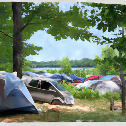
Haymeadow Creek Campsites
Reservations are accepted at Haymeadow Creek Campsites, allowing campers to secure their preferred dates in advance. This is particularly beneficial during peak seasons when the campground may get crowded. Therefore, it is recommended to make reservations to ensure availability.
The best time to visit Haymeadow Creek Campsites is during the summer months, from June to August, when the weather is mild and conducive to outdoor activities. During this time, campers can take advantage of the beautiful nearby trails for hiking, biking, and bird-watching. It is important to note that the campground is a popular destination, so arriving early or making reservations is advised.
While visiting Haymeadow Creek Campsites, campers should be cautious and aware of the local wildlife, such as bears and raccoons, and take appropriate measures to store food securely. Additionally, it is essential to follow Leave No Trace principles and respect the natural surroundings by properly disposing of trash and minimizing environmental impact.
In conclusion, Haymeadow Creek Campsites in Michigan offers a well-equipped camping experience with amenities like campsites, restrooms, and showers. Reservations are accepted, and the best time to visit is during the summer months. Campers should be mindful of wildlife and practice responsible camping to preserve the natural beauty of the area.
What's on-site at Haymeadow Creek Campsites
Key facilities Snoflo tracks for this campground. Confirm with the operator before booking -- amenities can change seasonally.
Plan your trip down to the hour
Same weather feed Snoflo's iOS app uses -- updated continuously from NOAA / yr.no.
Next 5 days, hour by hour
Temperature line with weather symbols on top, snow + rain accumulation as columns, humidity as a dotted line.
5-day forecast table
Every 3 hours, broken out across temperature, snow, rain, humidity, and wind. Each cell is colour-coded relative to the column min/max so trends jump out at a glance.
| Time | Condition | Temp (°F) | Snow (in) | Rain (in) | Humidity (%) | Wind (mps) | Wind dir |
|---|---|---|---|---|---|---|---|
| Loading detailed forecast… | |||||||
15-day temperature & precipitation
Daily temperatures, snow, and rain projected over the next two weeks. Hover any point for the full breakdown.
Other campgrounds in the area
Snoflo-tracked campsites within driving distance of Haymeadow Creek Campsites, with reservations status.
| Campground | Reservations | Toilets | View |
|---|---|---|---|
| Haymeadow Creek Campground | ✗ | ✗ | → |
| Flowing Well Campground | ✗ | ✗ | → |
| Vagabond Resort | ✗ | ✗ | → |
| Chicago Lake Campsites | ✓ | ✗ | → |
| Camp Cook Campsites | ✓ | ✗ | → |
Nearby streamflow
USGS streamgauges within reach of Haymeadow Creek Campsites -- pulled live from the National Water Information System.
| Streamgauge | Discharge | View |
|---|---|---|
| Sturgeon River Near Nahma Junction | 89 cfs | → |
| Escanaba River At Cornell | 370 cfs | → |
| Au Train River At Forest Lake | 137 cfs | → |
| Ford River Near Hyde | 79 cfs | → |
| Manistique River Near Manistique | 919 cfs | → |
| Middle Branch Escanaba River Nr Princeton | 103 cfs | → |
Nearby snow depths
NRCS SNOTEL stations within reach of Haymeadow Creek Campsites -- relevant when planning a shoulder-season or alpine trip.
| SNOTEL station | Snowpack | 24h Snowfall | View |
|---|---|---|---|
| Gladstone No. 2 | 0.0 in | 0.0 in | → |
| Garden Corners | 0.0 in | 0.0 in | → |
| Escanaba | 0.0 in | 0.0 in | → |
| Manistique 2.7 Nw | 0.0 in | 0.0 in | → |
| Skandia 3.0 Sse | 0.0 in | 0.0 in | → |
| Munising | 27.0 in | 0.0 in | → |
Plan a longer trip
The closest parks, lakes, boat launches, and paddle runs so a camping night can grow into a full weekend.
Parks
- Wilderness Big Island Lake
- Fayette State Park
- National Wild And Scenic River Indian, Michigan
- Palms Book State Park
- Hiawatha National Forest
- Wilderness Rock River Canyon
Boat launches
- Rapid River
- 35.5 Road Garden Township
- Dana Lake Road Nahma Township
- Ogontz Bay
- North Lake Shore Drive Gladstone
- Van Cleve Park
Fishing spots
Points of interest
- South 15 Road
- Flowing Well
- Nahma And Northern Railway Locomotive Number 5
- Toms Lake Cabin
- Mckeever Cabin
- King Road
Paddle runs
- West Branch From Source In Sec 26, T46n, R23 W To Junction With County Road 444
- From Sixteen Mile Lake To North Line Of Sec 26, T43n, R19w
- County Road H-58 (Aka. Adams Trail/ Munising-Van Meer-Shingleton Rd.) To Mouth At Lake Superior
- Section 17, T48n, R17w (Boundary Of Pictured Rocks National Lakeshore Lands) To Mouth At Lake Superior
Camping essentials & Leave No Trace
- Pack it in, pack it out
- Take all trash, food scraps, and gear back with you to keep campsites clean and protect wildlife.
- Respect wildlife
- Observe animals from a distance, store food securely, and never feed wildlife to maintain natural behavior and safety.
- Know before you go
- Check weather, fire restrictions, trail conditions, and permit requirements to ensure a safe and well-planned trip.
- Minimize campfire impact
- Use established fire rings, keep fires small, fully extinguish them, or opt for a camp stove when fires are restricted.
- Leave what you find
- Preserve natural and cultural features by avoiding removal of plants, rocks, artifacts, or other elements of the environment.
Set push alerts in the Snoflo app
Save Haymeadow Creek Campsites as a favorite, set a custom threshold (precipitation, snowpack, freezing temperatures), and the iOS app will push the moment conditions cross.
About Haymeadow Creek Campsites
Can I make reservations at Haymeadow Creek Campsites?
This campground does not appear to accept reservations -- it's typically first-come, first-served. Arrive early on summer weekends.
How fresh is the weather data on this page?
The hourly forecast updates throughout the day from the NOAA / yr.no public feeds. Streamflow data is pulled live from USGS streamgauges and snowpack from the NRCS SNOTEL network.
What's the best time of year to visit?
Use the 15-day temperature & precipitation outlook on this page to plan -- pick a window with comfortable temperatures and low precipitation. For longer trips, the 5-day hourly meteogram shows snow + rain accumulation hour-by-hour.
How do I get to Haymeadow Creek Campsites?
Tap Directions in the hero above to open driving directions in Google Maps, or Open in map to center the Snoflo interactive map on the campground.
Can I get alerts when conditions change?
Yes -- alerts are managed through the Snoflo iOS app. Favorite this campground, set a threshold (temperature, snowpack, precipitation), and you'll get a push the moment it crosses.
Other campgrounds near here
Snoflo-tracked campgrounds within driving distance of Haymeadow Creek Campsites.