Montauk State Park Campground
Community Reviews
Been here? Share the conditions.
Reviews, ratings & photos are added in the free Snoflo iOS app — rate a spot, tag the conditions, and your visit is verified by location. Add or manage your reviews from the app.
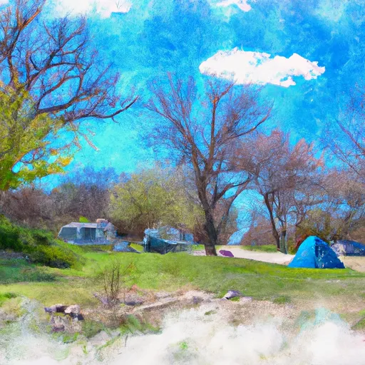
Montauk State Park
The best time of year to visit Montauk State Park is during the spring and fall seasons. Spring offers excellent fishing opportunities, as the park is known for its stocked trout streams. Fall brings beautiful foliage, making it the perfect time for hiking and exploring the park's scenic trails. Visitors should be cautious of potential heavy crowds during weekends and holidays, especially during the peak fishing season. It is advised to arrive early to secure a campsite and avoid any disappointment. Additionally, campers should be aware of the park's rules and regulations, such as fishing regulations and quiet hours, to ensure a pleasant experience for everyone.
In summary, Montauk State Park in Missouri offers a well-equipped campground with various amenities for campers. Reservations are accepted, making it convenient for visitors to plan their stay in advance. The best time to visit is during the spring and fall seasons, when fishing, hiking, and enjoying the park's natural beauty are at their peak. However, travelers should be prepared for potential crowds during popular times and adhere to the park's guidelines to ensure a safe and enjoyable camping experience.
What's on-site at Montauk State Park
Key facilities Snoflo tracks for this campground. Confirm with the operator before booking -- amenities can change seasonally.
Plan your trip down to the hour
Same weather feed Snoflo's iOS app uses -- updated continuously from NOAA / yr.no.
Next 5 days, hour by hour
Temperature line with weather symbols on top, snow + rain accumulation as columns, humidity as a dotted line.
5-day forecast table
Every 3 hours, broken out across temperature, snow, rain, humidity, and wind. Each cell is colour-coded relative to the column min/max so trends jump out at a glance.
| Time | Condition | Temp (°F) | Snow (in) | Rain (in) | Humidity (%) | Wind (mps) | Wind dir |
|---|---|---|---|---|---|---|---|
| Loading detailed forecast… | |||||||
15-day temperature & precipitation
Daily temperatures, snow, and rain projected over the next two weeks. Hover any point for the full breakdown.
Other campgrounds in the area
Snoflo-tracked campsites within driving distance of Montauk State Park, with reservations status.
| Campground | Reservations | Toilets | View |
|---|---|---|---|
| Montauk | ✗ | ✗ | → |
| Cedargrove | ✗ | ✗ | → |
| Dee Murray | ✗ | ✗ | → |
| Akers | ✓ | ✗ | → |
| Akers Ferry Campground | ✗ | ✗ | → |
Nearby streamflow
USGS streamgauges within reach of Montauk State Park -- pulled live from the National Water Information System.
| Streamgauge | Discharge | View |
|---|---|---|
| Current River Above Akers | 212 cfs | → |
| Jacks Fork At Alley Spring | 123 cfs | → |
| Big Piney River Near Big Piney | 192 cfs | → |
| Jacks Fork At Eminence | 199 cfs | → |
| Jacks Fork Near Mountain View | 101 cfs | → |
| Meramec River At Cook Station | 90 cfs | → |
Plan a longer trip
The closest parks, lakes, boat launches, and paddle runs so a camping night can grow into a full weekend.
Parks
- Montauk State Park
- Cedar Grove State Forest
- Conservation Area Cedar Grove
- Sunklands Natural Area
- Shawnee Mac Lakes Conservation Area
- Midvale Conservation Area
Boat launches
- State Highway B Shannon County
- Shawnee Mac Lakes Conservation Area
- Boiling Spring Access
- Mason Road Texas County
- Mineral Springs Access
Points of interest
- Welch Spring
- The Deer Statue
- The Gassy Pig
- Dent County Museum
- Round Spring Visitor Center
- Alley Mill
Paddle runs
- Confluence With Alley Spring (Branch) To Confluence With Current River (Does Not Include River Segment In Gap Between Parkland Units)
- Western Edge Of Ozark National Scenic Riverways To Confluence With Alley Spring (Branch)
- Missouri State Highway 17 To Fort Leonard Wood (Army Base)
- Northern Boundary Of Fort Leonard Wood To North Section Line Of Sec 31, T36n, R10w
Camping essentials & Leave No Trace
- Pack it in, pack it out
- Take all trash, food scraps, and gear back with you to keep campsites clean and protect wildlife.
- Respect wildlife
- Observe animals from a distance, store food securely, and never feed wildlife to maintain natural behavior and safety.
- Know before you go
- Check weather, fire restrictions, trail conditions, and permit requirements to ensure a safe and well-planned trip.
- Minimize campfire impact
- Use established fire rings, keep fires small, fully extinguish them, or opt for a camp stove when fires are restricted.
- Leave what you find
- Preserve natural and cultural features by avoiding removal of plants, rocks, artifacts, or other elements of the environment.
Set push alerts in the Snoflo app
Save Montauk State Park as a favorite, set a custom threshold (precipitation, snowpack, freezing temperatures), and the iOS app will push the moment conditions cross.
About Montauk State Park
Can I make reservations at Montauk State Park?
Yes -- this campground accepts reservations. Snoflo recommends booking early for peak season; check the operator (Recreation.gov / state park system / private operator) for the booking window and cancellation policy.
How fresh is the weather data on this page?
The hourly forecast updates throughout the day from the NOAA / yr.no public feeds. Streamflow data is pulled live from USGS streamgauges and snowpack from the NRCS SNOTEL network.
What's the best time of year to visit?
Use the 15-day temperature & precipitation outlook on this page to plan -- pick a window with comfortable temperatures and low precipitation. For longer trips, the 5-day hourly meteogram shows snow + rain accumulation hour-by-hour.
How do I get to Montauk State Park?
Tap Directions in the hero above to open driving directions in Google Maps, or Open in map to center the Snoflo interactive map on the campground.
Can I get alerts when conditions change?
Yes -- alerts are managed through the Snoflo iOS app. Favorite this campground, set a threshold (temperature, snowpack, precipitation), and you'll get a push the moment it crosses.
Other campgrounds near here
Snoflo-tracked campgrounds within driving distance of Montauk State Park.