Cypress Creek Landing Campground
Community Reviews
Been here? Share the conditions.
Reviews, ratings & photos are added in the free Snoflo iOS app — rate a spot, tag the conditions, and your visit is verified by location. Add or manage your reviews from the app.
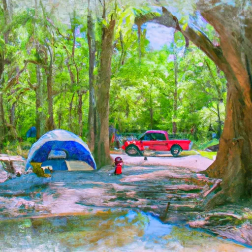
Cypress Creek Landing
Reservations are accepted at Cypress Creek Landing, ensuring campers can secure their desired camping spot in advance. It is recommended to book early, especially during peak seasons, to guarantee availability. The best time to visit this campground is during the spring and fall when the weather is more pleasant and the area is less crowded.
Campers should be cautious of certain factors while camping at Cypress Creek Landing. It is advisable to bring bug spray, as the area can have a significant mosquito population. Additionally, campers should be cautious of wildlife encounters, such as snakes and alligators, that can occasionally be found in the surrounding areas. Being mindful of these factors ensures a safe and enjoyable camping experience at Cypress Creek Landing.
What's on-site at Cypress Creek Landing
Key facilities Snoflo tracks for this campground. Confirm with the operator before booking -- amenities can change seasonally.
Plan your trip down to the hour
Same weather feed Snoflo's iOS app uses -- updated continuously from NOAA / yr.no.
Next 5 days, hour by hour
Temperature line with weather symbols on top, snow + rain accumulation as columns, humidity as a dotted line.
5-day forecast table
Every 3 hours, broken out across temperature, snow, rain, humidity, and wind. Each cell is colour-coded relative to the column min/max so trends jump out at a glance.
| Time | Condition | Temp (°F) | Snow (in) | Rain (in) | Humidity (%) | Wind (mps) | Wind dir |
|---|---|---|---|---|---|---|---|
| Loading detailed forecast… | |||||||
15-day temperature & precipitation
Daily temperatures, snow, and rain projected over the next two weeks. Hover any point for the full breakdown.
Other campgrounds in the area
Snoflo-tracked campsites within driving distance of Cypress Creek Landing, with reservations status.
| Campground | Reservations | Toilets | View |
|---|---|---|---|
| Janice Rec.Area | ✗ | ✗ | → |
| Fairley Bridge Landing | ✗ | ✗ | → |
| Moodys Landing | ✗ | ✗ | → |
| Moody's Landing - Usfs | ✗ | ✗ | → |
| Flint Creek Waterpark | ✗ | ✗ | → |
Nearby streamflow
USGS streamgauges within reach of Cypress Creek Landing -- pulled live from the National Water Information System.
| Streamgauge | Discharge | View |
|---|---|---|
| Cypress Creek Nr Janice | 21 cfs | → |
| Black Creek Nr Brooklyn | 200 cfs | → |
| Leaf River Nr Mclain | 1,810 cfs | → |
| Pascagoula River At Merrill | 3,790 cfs | → |
| Leaf River Nr New Augusta | 1,580 cfs | → |
| Red Creek At Vestry | 289 cfs | → |
Nearby snow depths
NRCS SNOTEL stations within reach of Cypress Creek Landing -- relevant when planning a shoulder-season or alpine trip.
| SNOTEL station | Snowpack | 24h Snowfall | View |
|---|---|---|---|
| Pass Christian 9.8 Nnw | 0.0 in | 0.0 in | → |
| Ocean Springs 3.3 E | 0.0 in | 0.0 in | → |
| Wilmer 3.4 Se | 0.0 in | 0.0 in | → |
Plan a longer trip
The closest parks, lakes, boat launches, and paddle runs so a camping night can grow into a full weekend.
Parks
- National Wild And Scenic River Black Creek, Mississippi
- National Conservation Area Le
- Flint Creek Water Park
- Wilderness Leaf
- Paul B. Johnson State Park
- State Conservation Area Little Bilo
Points of interest
- Wmah-Tv (Biloxi)
- Leaf River Bridge
- Mahned Bridge
- Building 6981
- Sarah Gillespie Museum
- Lucille Parker Gallery
Paddle runs
- The Confluence With Scarsborough Creek To The Confluence With The Escatawpa River
- The Jackson County Route 614 Bridge To Ends Approximately 2 River Miles From The Southern Terminus Of The Study Area
- Begins Approximately 1 River Mile Upstream From The U.S. Highway 98 Bridge To The Jackson County Route 614 Bridge
Camping essentials & Leave No Trace
- Pack it in, pack it out
- Take all trash, food scraps, and gear back with you to keep campsites clean and protect wildlife.
- Respect wildlife
- Observe animals from a distance, store food securely, and never feed wildlife to maintain natural behavior and safety.
- Know before you go
- Check weather, fire restrictions, trail conditions, and permit requirements to ensure a safe and well-planned trip.
- Minimize campfire impact
- Use established fire rings, keep fires small, fully extinguish them, or opt for a camp stove when fires are restricted.
- Leave what you find
- Preserve natural and cultural features by avoiding removal of plants, rocks, artifacts, or other elements of the environment.
Set push alerts in the Snoflo app
Save Cypress Creek Landing as a favorite, set a custom threshold (precipitation, snowpack, freezing temperatures), and the iOS app will push the moment conditions cross.
About Cypress Creek Landing
Can I make reservations at Cypress Creek Landing?
This campground does not appear to accept reservations -- it's typically first-come, first-served. Arrive early on summer weekends.
How fresh is the weather data on this page?
The hourly forecast updates throughout the day from the NOAA / yr.no public feeds. Streamflow data is pulled live from USGS streamgauges and snowpack from the NRCS SNOTEL network.
What's the best time of year to visit?
Use the 15-day temperature & precipitation outlook on this page to plan -- pick a window with comfortable temperatures and low precipitation. For longer trips, the 5-day hourly meteogram shows snow + rain accumulation hour-by-hour.
How do I get to Cypress Creek Landing?
Tap Directions in the hero above to open driving directions in Google Maps, or Open in map to center the Snoflo interactive map on the campground.
Can I get alerts when conditions change?
Yes -- alerts are managed through the Snoflo iOS app. Favorite this campground, set a threshold (temperature, snowpack, precipitation), and you'll get a push the moment it crosses.
Other campgrounds near here
Snoflo-tracked campgrounds within driving distance of Cypress Creek Landing.