Imp Lake Campground
Community Reviews
Been here? Share the conditions.
Reviews, ratings & photos are added in the free Snoflo iOS app — rate a spot, tag the conditions, and your visit is verified by location. Add or manage your reviews from the app.
Imp Lake
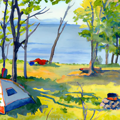
Reservations are not accepted at Imp Lake camping area, which means that campsites are available on a first-come, first-served basis. It is recommended to arrive early, especially during peak seasons, to secure a spot. The best time of year to visit this camping area is during the summer months, from June to September, when the weather is pleasant and perfect for outdoor activities such as hiking, fishing, and swimming in the lake.
While camping at Imp Lake, be cautious of wildlife, particularly bears. It is essential to properly store food and dispose of garbage in bear-proof containers to avoid attracting them. Additionally, be mindful of the rules and regulations regarding fishing and boating in the lake. Overall, Imp Lake camping area offers a serene and picturesque environment for campers to enjoy the natural beauty of Michigan's outdoors.
What's on-site at Imp Lake
Key facilities Snoflo tracks for this campground. Confirm with the operator before booking -- amenities can change seasonally.
Plan your trip down to the hour
Same weather feed Snoflo's iOS app uses -- updated continuously from NOAA / yr.no.
Next 5 days, hour by hour
Temperature line with weather symbols on top, snow + rain accumulation as columns, humidity as a dotted line.
5-day forecast table
Every 3 hours, broken out across temperature, snow, rain, humidity, and wind. Each cell is colour-coded relative to the column min/max so trends jump out at a glance.
| Time | Condition | Temp (°F) | Snow (in) | Rain (in) | Humidity (%) | Wind (mps) | Wind dir |
|---|---|---|---|---|---|---|---|
| Loading detailed forecast… | |||||||
15-day temperature & precipitation
Daily temperatures, snow, and rain projected over the next two weeks. Hover any point for the full breakdown.
Other campgrounds in the area
Snoflo-tracked campsites within driving distance of Imp Lake, with reservations status.
| Campground | Reservations | Toilets | View |
|---|---|---|---|
| Imp Lake Campground | ✗ | ✗ | → |
| Marion Lake 2 | ✗ | ✗ | → |
| Marion Lake Campground | ✗ | ✗ | → |
| Marion Lake 1 | ✗ | ✗ | → |
| Burned Dam Campground | ✗ | ✗ | → |
Nearby streamflow
USGS streamgauges within reach of Imp Lake -- pulled live from the National Water Information System.
| Streamgauge | Discharge | View |
|---|---|---|
| Middle Branch Ontonagon River Near Paulding | 102 cfs | → |
| Bond Falls Canal Near Paulding | 91 cfs | → |
| Cisco Branch Ontonagon R At Cisco Lake Outlet | 1 cfs | → |
| Iron River At County Hwy-424 At Caspian | 58 cfs | → |
| Muskellunge Ck-Muskellunge L Otl-Nr Eagle River | 2 cfs | → |
| Muskellunge Creek Near St. Germain | 9 cfs | → |
Nearby snow depths
NRCS SNOTEL stations within reach of Imp Lake -- relevant when planning a shoulder-season or alpine trip.
| SNOTEL station | Snowpack | 24h Snowfall | View |
|---|---|---|---|
| Lac Vieux Desert | 0.0 in | 0.0 in | → |
| Paulding | 0.0 in | 0.0 in | → |
| Watersmeet 12wsw | 0.0 in | 0.0 in | → |
| Land O Lakes | 0.0 in | 0.0 in | → |
| Land O' Lakes 11.7 W | 0.0 in | 0.0 in | → |
| Eagle River-4 E | 0.0 in | 0.0 in | → |
Plan a longer trip
The closest parks, lakes, boat launches, and paddle runs so a camping night can grow into a full weekend.
Parks
- National Wild And Scenic River Paint, Michigan
- Reimers Island
- Wilderness Sylvania
- Wilderness Blackjack Springs
- Ottawa National Forest
- State Forest Northern Highland
Boat launches
- Imp Lake
- Taylor Lake
- Marion Lake Campground
- Dinner Lake Boating Access Site Watersmeet Township
- Marion Lake
- East Grass Lake Road Watersmeet Township
Fishing spots
Points of interest
- Northern Waters Museum
- Paulding Light
- Phelps Historical Museum
- Bond Falls Watefalls
- Agate Falls
- Kartway
Paddle runs
- North Branch--Butternut Lake To Confluence With Main Branch
- Net River Mainstem, Confluence With East/West Branches To Confluence With The Mainstem Paint River
- Private Bridge To Highway 55
- Forest Road 2174 To Private Bridge
- Main Branch--Headwaters To Forest Road 2174
- Highway 55 To Forest Road 2169
Camping essentials & Leave No Trace
- Pack it in, pack it out
- Take all trash, food scraps, and gear back with you to keep campsites clean and protect wildlife.
- Respect wildlife
- Observe animals from a distance, store food securely, and never feed wildlife to maintain natural behavior and safety.
- Know before you go
- Check weather, fire restrictions, trail conditions, and permit requirements to ensure a safe and well-planned trip.
- Minimize campfire impact
- Use established fire rings, keep fires small, fully extinguish them, or opt for a camp stove when fires are restricted.
- Leave what you find
- Preserve natural and cultural features by avoiding removal of plants, rocks, artifacts, or other elements of the environment.
Set push alerts in the Snoflo app
Save Imp Lake as a favorite, set a custom threshold (precipitation, snowpack, freezing temperatures), and the iOS app will push the moment conditions cross.
About Imp Lake
Can I make reservations at Imp Lake?
This campground does not appear to accept reservations -- it's typically first-come, first-served. Arrive early on summer weekends.
How fresh is the weather data on this page?
The hourly forecast updates throughout the day from the NOAA / yr.no public feeds. Streamflow data is pulled live from USGS streamgauges and snowpack from the NRCS SNOTEL network.
What's the best time of year to visit?
Use the 15-day temperature & precipitation outlook on this page to plan -- pick a window with comfortable temperatures and low precipitation. For longer trips, the 5-day hourly meteogram shows snow + rain accumulation hour-by-hour.
How do I get to Imp Lake?
Tap Directions in the hero above to open driving directions in Google Maps, or Open in map to center the Snoflo interactive map on the campground.
Can I get alerts when conditions change?
Yes -- alerts are managed through the Snoflo iOS app. Favorite this campground, set a threshold (temperature, snowpack, precipitation), and you'll get a push the moment it crosses.
Other campgrounds near here
Snoflo-tracked campgrounds within driving distance of Imp Lake.