Trail Of Tears State Forest Campground
Community Reviews
Been here? Share the conditions.
Reviews, ratings & photos are added in the free Snoflo iOS app — rate a spot, tag the conditions, and your visit is verified by location. Add or manage your reviews from the app.
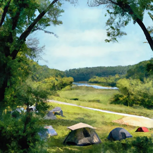
Trail Of Tears State Forest
An interesting fact about the Trail of Tears State Forest Camping Area is that it is named after the Trail of Tears, which was the forced relocation of Native Americans from their ancestral lands in the Southeastern United States to Indian Territory in present-day Oklahoma. The best time of year to visit is during the fall when the leaves change colors and the temperatures are mild, averaging around 60°F during the day and 40°F at night. However, the campground is open year-round and offers a beautiful winter camping experience. Overall, Trail of Tears State Forest Camping Area is a must-visit for anyone looking for a peaceful and scenic camping experience in Southern Illinois.
What's on-site at Trail Of Tears State Forest
Key facilities Snoflo tracks for this campground. Confirm with the operator before booking -- amenities can change seasonally.
Plan your trip down to the hour
Same weather feed Snoflo's iOS app uses -- updated continuously from NOAA / yr.no.
Next 5 days, hour by hour
Temperature line with weather symbols on top, snow + rain accumulation as columns, humidity as a dotted line.
5-day forecast table
Every 3 hours, broken out across temperature, snow, rain, humidity, and wind. Each cell is colour-coded relative to the column min/max so trends jump out at a glance.
| Time | Condition | Temp (°F) | Snow (in) | Rain (in) | Humidity (%) | Wind (mps) | Wind dir |
|---|---|---|---|---|---|---|---|
| Loading detailed forecast… | |||||||
15-day temperature & precipitation
Daily temperatures, snow, and rain projected over the next two weeks. Hover any point for the full breakdown.
Other campgrounds in the area
Snoflo-tracked campsites within driving distance of Trail Of Tears State Forest, with reservations status.
| Campground | Reservations | Toilets | View |
|---|---|---|---|
| Pine Hills | ✗ | ✗ | → |
| Pine Hills Campground | ✗ | ✓ | → |
| Trail Of Tears State Park | ✓ | ✗ | → |
| Horse Campground | ✗ | ✗ | → |
| Youth Campground | ✗ | ✗ | → |
Nearby streamflow
USGS streamgauges within reach of Trail Of Tears State Forest -- pulled live from the National Water Information System.
| Streamgauge | Discharge | View |
|---|---|---|
| Big Muddy River At Rte 127 At Murphysboro | 318 cfs | → |
| Mississippi River At Thebes | 161,000 cfs | → |
| Cache River At Forman | 84 cfs | → |
| Crab Orchard Creek Near Marion | 1 cfs | → |
| Big Muddy River At Plumfield | 95 cfs | → |
| South Fork Saline Creek Near Perryville | 37 cfs | → |
Nearby snow depths
NRCS SNOTEL stations within reach of Trail Of Tears State Forest -- relevant when planning a shoulder-season or alpine trip.
| SNOTEL station | Snowpack | 24h Snowfall | View |
|---|---|---|---|
| De Soto 0.3 Ese | 0.0 in | 0.0 in | → |
| New Burnside 1.8 Ene | 0.0 in | 0.0 in | → |
| Chester | 0.0 in | 0.0 in | → |
| Kaskaskia River Navigation Lock | 0.0 in | 0.0 in | → |
Plan a longer trip
The closest parks, lakes, boat launches, and paddle runs so a camping night can grow into a full weekend.
Parks
- Nature Preserve Ozark Hills
- Trail Of Tears State Forest
- Wilderness Bald Knob
- Wilderness Clear Springs
- Mcclure Shale Glade Nature Preserve
- Natural Area Vancill Hollow
Boat launches
- Clear Creek Levee Road Union County
- Cedar Lake
- Cape Girardeau County
- Front Street 677, Grand Tower
- Dongola City Reservoir
- Cedar Creek Boat Ramp
Points of interest
- Bald Knob Cross Of Peace
- Alto Clay Works
- Cobden Museum
- Larue-Pine Hills-Otter Pond Research Natural Area
- Pomona Natural Bridge
- Bill Emerson Memorial Bridge
Paddle runs
- 1 Mile West Of Alto Pass, Il To 1/2 Mile South Of Confluence With Clear Creek, West Of Trail Of Tears State Forest
- 1/2 Mile Downstream Of Confluence With Kinkaid Creek To Confluence With Mississippi River, Approx 4 Miles South Of Grand Tower, Il
- 1 Minle Southwest Of Delwood, Il (Sec. 18, T11s, R13e) To Reesville, 1/4 Mile South Of The Confluence With Sugar Creek
Camping essentials & Leave No Trace
- Pack it in, pack it out
- Take all trash, food scraps, and gear back with you to keep campsites clean and protect wildlife.
- Respect wildlife
- Observe animals from a distance, store food securely, and never feed wildlife to maintain natural behavior and safety.
- Know before you go
- Check weather, fire restrictions, trail conditions, and permit requirements to ensure a safe and well-planned trip.
- Minimize campfire impact
- Use established fire rings, keep fires small, fully extinguish them, or opt for a camp stove when fires are restricted.
- Leave what you find
- Preserve natural and cultural features by avoiding removal of plants, rocks, artifacts, or other elements of the environment.
Set push alerts in the Snoflo app
Save Trail Of Tears State Forest as a favorite, set a custom threshold (precipitation, snowpack, freezing temperatures), and the iOS app will push the moment conditions cross.
About Trail Of Tears State Forest
Can I make reservations at Trail Of Tears State Forest?
Yes -- this campground accepts reservations. Snoflo recommends booking early for peak season; check the operator (Recreation.gov / state park system / private operator) for the booking window and cancellation policy.
How fresh is the weather data on this page?
The hourly forecast updates throughout the day from the NOAA / yr.no public feeds. Streamflow data is pulled live from USGS streamgauges and snowpack from the NRCS SNOTEL network.
What's the best time of year to visit?
Use the 15-day temperature & precipitation outlook on this page to plan -- pick a window with comfortable temperatures and low precipitation. For longer trips, the 5-day hourly meteogram shows snow + rain accumulation hour-by-hour.
How do I get to Trail Of Tears State Forest?
Tap Directions in the hero above to open driving directions in Google Maps, or Open in map to center the Snoflo interactive map on the campground.
Can I get alerts when conditions change?
Yes -- alerts are managed through the Snoflo iOS app. Favorite this campground, set a threshold (temperature, snowpack, precipitation), and you'll get a push the moment it crosses.
Other campgrounds near here
Snoflo-tracked campgrounds within driving distance of Trail Of Tears State Forest.