Bryant Creek Campground
Community Reviews
Been here? Share the conditions.
Reviews, ratings & photos are added in the free Snoflo iOS app — rate a spot, tag the conditions, and your visit is verified by location. Add or manage your reviews from the app.
Bryant Creek
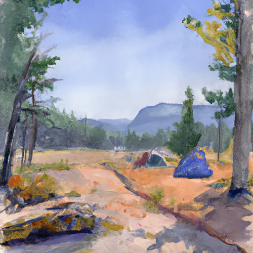
The campground itself offers a variety of amenities, including picnic tables, fire rings, and vault toilets. There are 24 campsites available, and reservations are recommended during peak season. Visitors should note that the campground does not have potable water, so they will need to bring their own or treat water from Bryant Creek.
Interesting facts about the area include the fact that the Big Hole River, which runs through the area, is home to one of the last remaining populations of native westslope cutthroat trout in the country. The river is also a popular destination for fly fishing and offers visitors a chance to catch rainbow and brown trout as well.
The best time of year to visit Bryant Creek Campground is during the summer months when temperatures are warm and the days are long. Average temperatures during July and August range from the mid-60s to low 80s during the day and drop into the 40s at night.
Sources:
- USDA Forest Service: https://www.fs.usda.gov/recarea/bdnf/recarea/?recid=5640
- Visit Montana: https://www.visitmt.com/places-to-go/central-montana/bryant-creek-campground.html
- Montana Fish, Wildlife & Parks: https://fwp.mt.gov/fish/management/westslope-cutthroat-trout-management/big-hole-river-westslope-cutthroat-trout-restoration-project
What's on-site at Bryant Creek
Key facilities Snoflo tracks for this campground. Confirm with the operator before booking -- amenities can change seasonally.
Plan your trip down to the hour
Same weather feed Snoflo's iOS app uses -- updated continuously from NOAA / yr.no.
Next 5 days, hour by hour
Temperature line with weather symbols on top, snow + rain accumulation as columns, humidity as a dotted line.
5-day forecast table
Every 3 hours, broken out across temperature, snow, rain, humidity, and wind. Each cell is colour-coded relative to the column min/max so trends jump out at a glance.
| Time | Condition | Temp (°F) | Snow (in) | Rain (in) | Humidity (%) | Wind (mps) | Wind dir |
|---|---|---|---|---|---|---|---|
| Loading detailed forecast… | |||||||
15-day temperature & precipitation
Daily temperatures, snow, and rain projected over the next two weeks. Hover any point for the full breakdown.
Other campgrounds in the area
Snoflo-tracked campsites within driving distance of Bryant Creek, with reservations status.
| Campground | Reservations | Toilets | View |
|---|---|---|---|
| East Bank | ✗ | ✗ | → |
| Dickie Bridge | ✗ | ✗ | → |
| Fishtrap Creek - Foolhen Mt - Fas | ✗ | ✗ | → |
| Seymour Creek Campground | ✗ | ✗ | → |
| Seymour Creek | ✗ | ✓ | → |
Nearby streamflow
USGS streamgauges within reach of Bryant Creek -- pulled live from the National Water Information System.
| Streamgauge | Discharge | View |
|---|---|---|
| Big Hole River Near Wise River Mt | 112 cfs | → |
| Big Hole River Bl Mudd Cr Nr Wisdom Mt | 343 cfs | → |
| Big Hole River At Maiden Rock Nr Divide Mt | 684 cfs | → |
| Warm Springs Creek Near Anaconda Mt | 87 cfs | → |
| Willow Creek At Opportunity | 7 cfs | → |
| Mill Creek At Opportunity | 8 cfs | → |
Nearby snow depths
NRCS SNOTEL stations within reach of Bryant Creek -- relevant when planning a shoulder-season or alpine trip.
| SNOTEL station | Snowpack | 24h Snowfall | View |
|---|---|---|---|
| Calvert Creek | 4.0 in | 0.0 in | → |
| Calvert Creek | 0.0 in | 0.0 in | → |
| Nohrsc Barker Lakes | 0.0 in | 0.0 in | → |
| Barker Lakes | 0.0 in | 0.0 in | → |
| Anaconda | 0.0 in | 0.0 in | → |
| Anaconda 7.4 Nw | 0.0 in | 0.0 in | → |
Plan a longer trip
The closest parks, lakes, boat launches, and paddle runs so a camping night can grow into a full weekend.
Parks
- Anaconda Smoke Stack State Park
- Wilderness Anaconda Pintler
- Lost Creek State Park
- Stodden Park
- Father Sheehan Park
- Big Hole National Battlefield
Boat launches
- East Bank Boat Ramp
- Dickie Bridge Boat Ramp
- Fishtrap Creek
- Sawlog Creek
- Jerry Creek Bridge Boat Ramp
- George Grant Memorial
Fishing spots
- Black Lion Lake
- Baldy Lake
- Comers Point Fishing Access
- Sunnyside Fishing Access
- Badger Bay Fishing Access
- Red Bridge Fishing Access
Camping essentials & Leave No Trace
- Pack it in, pack it out
- Take all trash, food scraps, and gear back with you to keep campsites clean and protect wildlife.
- Respect wildlife
- Observe animals from a distance, store food securely, and never feed wildlife to maintain natural behavior and safety.
- Know before you go
- Check weather, fire restrictions, trail conditions, and permit requirements to ensure a safe and well-planned trip.
- Minimize campfire impact
- Use established fire rings, keep fires small, fully extinguish them, or opt for a camp stove when fires are restricted.
- Leave what you find
- Preserve natural and cultural features by avoiding removal of plants, rocks, artifacts, or other elements of the environment.
Set push alerts in the Snoflo app
Save Bryant Creek as a favorite, set a custom threshold (precipitation, snowpack, freezing temperatures), and the iOS app will push the moment conditions cross.
About Bryant Creek
Can I make reservations at Bryant Creek?
This campground does not appear to accept reservations -- it's typically first-come, first-served. Arrive early on summer weekends.
How fresh is the weather data on this page?
The hourly forecast updates throughout the day from the NOAA / yr.no public feeds. Streamflow data is pulled live from USGS streamgauges and snowpack from the NRCS SNOTEL network.
What's the best time of year to visit?
Use the 15-day temperature & precipitation outlook on this page to plan -- pick a window with comfortable temperatures and low precipitation. For longer trips, the 5-day hourly meteogram shows snow + rain accumulation hour-by-hour.
How do I get to Bryant Creek?
Tap Directions in the hero above to open driving directions in Google Maps, or Open in map to center the Snoflo interactive map on the campground.
Can I get alerts when conditions change?
Yes -- alerts are managed through the Snoflo iOS app. Favorite this campground, set a threshold (temperature, snowpack, precipitation), and you'll get a push the moment it crosses.
Other campgrounds near here
Snoflo-tracked campgrounds within driving distance of Bryant Creek.