Hunter Peak Campground Campground
Community Reviews
Been here? Share the conditions.
Reviews, ratings & photos are added in the free Snoflo iOS app — rate a spot, tag the conditions, and your visit is verified by location. Add or manage your reviews from the app.
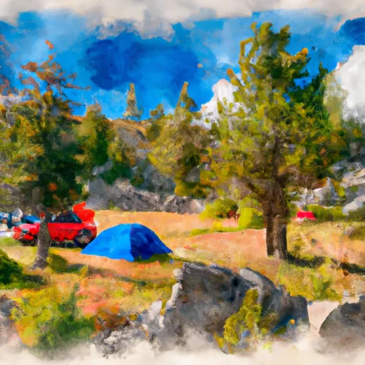
Hunter Peak Campground
The campground offers numerous amenities, including picnic tables, fire rings, and vault toilets. These amenities ensure campers have access to basic necessities while enjoying the beauty of the surrounding nature. Additionally, the campground provides potable water, allowing campers to easily stay hydrated during their stay. It is important to note that there are no electrical hookups available at this campground.
Reservations are not accepted at Hunter Peak Campground, making it a first-come, first-served camping area. Therefore, it is recommended to arrive early to secure a spot, especially during peak seasons. The best time to visit the campground is during the summer months, from June to September, when the weather is pleasant and favorable for outdoor activities.
While camping at Hunter Peak Campground, visitors have the opportunity to explore the natural wonders of Montana. The campground is located near various hiking trails, offering breathtaking views of the surrounding landscapes. However, it is essential to be cautious of wildlife, as the area is home to bears and other wild animals. Campers are advised to properly store food and dispose of waste to avoid attracting wildlife.
In conclusion, Hunter Peak Campground in Montana provides a serene and enjoyable camping experience. With its basic amenities, first-come, first-served policy, and stunning natural surroundings, it is an ideal destination for outdoor enthusiasts.
What's on-site at Hunter Peak Campground
Key facilities Snoflo tracks for this campground. Confirm with the operator before booking -- amenities can change seasonally.
Plan your trip down to the hour
Same weather feed Snoflo's iOS app uses -- updated continuously from NOAA / yr.no.
Next 5 days, hour by hour
Temperature line with weather symbols on top, snow + rain accumulation as columns, humidity as a dotted line.
5-day forecast table
Every 3 hours, broken out across temperature, snow, rain, humidity, and wind. Each cell is colour-coded relative to the column min/max so trends jump out at a glance.
| Time | Condition | Temp (°F) | Snow (in) | Rain (in) | Humidity (%) | Wind (mps) | Wind dir |
|---|---|---|---|---|---|---|---|
| Loading detailed forecast… | |||||||
15-day temperature & precipitation
Daily temperatures, snow, and rain projected over the next two weeks. Hover any point for the full breakdown.
Other campgrounds in the area
Snoflo-tracked campsites within driving distance of Hunter Peak Campground, with reservations status.
| Campground | Reservations | Toilets | View |
|---|---|---|---|
| Hunter Peak | ✓ | ✓ | → |
| Lily Lake Camping Area | ✓ | ✗ | → |
| Beartooth Lake Campground | ✓ | ✗ | → |
| Crazy Creek Campground (Usfs) | ✗ | ✗ | → |
| Fox Creek Campground - Closed | ✓ | ✗ | → |
Nearby streamflow
USGS streamgauges within reach of Hunter Peak Campground -- pulled live from the National Water Information System.
| Streamgauge | Discharge | View |
|---|---|---|
| Soda Butte Cr At Park Bndry At Silver Gate | 68 cfs | → |
| Rock Creek Near Red Lodge Mt | 440 cfs | → |
| West Rosebud Creek Near Roscoe Mt | 457 cfs | → |
| Clarks Fork Yellowstone River Nr Belfry Mt | 1,500 cfs | → |
| North Fork Shoshone River At Wapiti | 1,050 cfs | → |
| Lamar River Nr Tower Falls Ranger Station Ynp | 498 cfs | → |
Nearby snow depths
NRCS SNOTEL stations within reach of Hunter Peak Campground -- relevant when planning a shoulder-season or alpine trip.
| SNOTEL station | Snowpack | 24h Snowfall | View |
|---|---|---|---|
| Wolverine | 0.0 in | 0.0 in | → |
| Nohrsc Wolverine Snotel | 0.0 in | 0.0 in | → |
| Nohrsc Beartooth Lake Snotel | 0.0 in | 0.0 in | → |
| Beartooth Lake | 0.0 in | 0.0 in | → |
| Parker Peak | 0.0 in | 0.0 in | → |
| Nohrsc Parker Peak Snotel | 0.0 in | 0.0 in | → |
Plan a longer trip
The closest parks, lakes, boat launches, and paddle runs so a camping night can grow into a full weekend.
Parks
- Wilderness Absaroka-Beartooth
- Custer National Forest
- North Absaroka Wilderness
- Buffalo Bill State Park
Boat launches
- Beartooth Highway Wyoming
- Beartooth High Lakes Trail Wyoming
- Clarks Fork Boat Launch
- Hogan Reservoir Boat Launch
- Luce Reservoir Boat Launch
Fishing spots
Points of interest
- Clay Butte Lookout
- Woody Creek Cabin
- Cooke City Museum
- Clarks Fork Canyon Scenic Viewpoint
- Mount Zimmer Yurt
- Northeast Entrance Station
Paddle runs
- Absaroka-Beartooth Wilderness Boundary To Headwaters, Sec. 20, T9s, R17e
- Chief Joseph Cg, Sec. 28, T9s, R15e To Montana State Line, Sec. 34, T9s, R15e
- The Headwaters To The Confluence With Soda Butte Creek
- Clarks Fork Of The Yellowstone
- Absaroka-Beartooth Wilderness Boundary To Headwaters, Sec. 10, T9s, R17e
- Confluence Rock Creek, Sec. 34, T8s, R19e To Absaroka-Beartooth Wilderness Boundary
Camping essentials & Leave No Trace
- Pack it in, pack it out
- Take all trash, food scraps, and gear back with you to keep campsites clean and protect wildlife.
- Respect wildlife
- Observe animals from a distance, store food securely, and never feed wildlife to maintain natural behavior and safety.
- Know before you go
- Check weather, fire restrictions, trail conditions, and permit requirements to ensure a safe and well-planned trip.
- Minimize campfire impact
- Use established fire rings, keep fires small, fully extinguish them, or opt for a camp stove when fires are restricted.
- Leave what you find
- Preserve natural and cultural features by avoiding removal of plants, rocks, artifacts, or other elements of the environment.
Set push alerts in the Snoflo app
Save Hunter Peak Campground as a favorite, set a custom threshold (precipitation, snowpack, freezing temperatures), and the iOS app will push the moment conditions cross.
About Hunter Peak Campground
Can I make reservations at Hunter Peak Campground?
Yes -- this campground accepts reservations. Snoflo recommends booking early for peak season; check the operator (Recreation.gov / state park system / private operator) for the booking window and cancellation policy.
How fresh is the weather data on this page?
The hourly forecast updates throughout the day from the NOAA / yr.no public feeds. Streamflow data is pulled live from USGS streamgauges and snowpack from the NRCS SNOTEL network.
What's the best time of year to visit?
Use the 15-day temperature & precipitation outlook on this page to plan -- pick a window with comfortable temperatures and low precipitation. For longer trips, the 5-day hourly meteogram shows snow + rain accumulation hour-by-hour.
How do I get to Hunter Peak Campground?
Tap Directions in the hero above to open driving directions in Google Maps, or Open in map to center the Snoflo interactive map on the campground.
Can I get alerts when conditions change?
Yes -- alerts are managed through the Snoflo iOS app. Favorite this campground, set a threshold (temperature, snowpack, precipitation), and you'll get a push the moment it crosses.
Other campgrounds near here
Snoflo-tracked campgrounds within driving distance of Hunter Peak Campground.